TopoQuest Logo
Do you find TopoQuest useful?
Help keep TopoQuest running and adding new maps/features by donating!
Bitcoin:  19c7KJd3qBynnjoSw5npx9KScwjBe4ifkT
Litecoin:  LXs6TkuXGGXo1vDsWCkWVdjQX94eUKd6ui
Home View Maps Find Maps Find Places Resources & Links


Santa Claus, Indiana Topographic Map

USGS Map Title: Santa Claus, IN
USGS Map MRC: 38086A8
DRG (GeoTIFF) Download: o38086a8.tif


Neighboring USGS Topographic Map Quads:


  Holland, IN  
38087B1
 

  Dale, IN  
38086B8
 

  Saint Meinrad, IN  
38086B7
 

  Chrisney, IN  
38087A1
 

  Santa Claus, IN  
38086A8
 

  Fulda, IN  
38086A7
 

  Rockport, IN  
37087H1
 

  Lewisport, KY  
37086H8
 

  Tell City, IN  
37086H7


Map MRC Location:

N39°
W87°
N39°
W86°
H8 H7 H6 H5 H4 H3 H2 H1
G8 G7 G6 G5 G4 G3 G2 G1
F8 F7 F6 F5 F4 F3 F2 F1
E8 E7 E6 E5 E4 E3 E2 E1
D8 D7 D6 D5 D4 D3 D2 D1
C8 C7 C6 C5 C4 C3 C2 C1
B8 B7 B6 B5 B4 B3 B2 B1
A8 A7 A6 A5 A4 A3 A2 A1
N38°
W87°
N38°
W86°

Santa Claus, IN USGS 1:24K Topographic Map Preview:
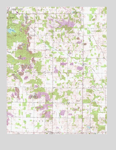
Santa Claus, IN USGS Topographic Map
Click on map above to begin viewing in our Map Viewer.

This topographic map contains these locations and features:
Feature Name Type Latitude Longitude GNIS ID View Map
BuffalovillePopulated PlaceN38.0976°W86.9653°431777View Map
Buffaloville CemeteryCemeteryN38.1045°W86.9656°431778View Map
Cedar Crest LakeReservoirN38.0065°W86.8976°432270View Map
Christmas LakeReservoirN38.1085°W86.9252°446754View Map
Christmas Lake DamDamN38.1056°W86.9169°448910View Map
Clay CityPopulated PlaceN38.0826°W86.9517°432584View Map
Clay-Huff Elementary SchoolSchoolN38.0464°W86.8958°432593View Map
Collins ChapelChurchN38.0020°W86.8905°432792View Map
Foertsch AirportAirportN38.0371°W86.9066°2677056View Map
KennedyPopulated PlaceN38.0814°W86.9225°437242View Map
Lake HollyReservoirN38.1056°W86.9445°448544View Map
Lake Holly DamDamN38.1047°W86.9428°448543View Map
Lake LincolnReservoirN38.1017°W86.9946°437946View Map
LamarPopulated PlaceN38.0692°W86.9055°437569View Map
LiberalPopulated PlaceN38.0459°W86.9430°437815View Map
Lincoln Boyhood National MemorialParkN38.1182°W86.9966°446882View Map
Lincoln Cabin SiteParkN38.1195°W86.9964°437905View Map
Lincoln CityPopulated PlaceN38.1212°W86.9986°437907View Map
Lincoln State ParkParkN38.1042°W86.9964°437944View Map
Little Pigeon ChurchChurchN38.0656°W86.9964°438111View Map
Meeks CemeteryCemeteryN38.0170°W86.9550°438964View Map
Mount Zion ChurchChurchN38.0992°W86.9119°439748View Map
Nancy Hanks Lincoln State MemorialParkN38.1142°W86.9958°439934View Map
New Hope ChurchChurchN38.0017°W86.9342°440064View Map
NewtonvillePopulated PlaceN38.0020°W86.9433°440151View Map
Noel LakeReservoirN38.1125°W86.9451°451803View Map
Noel Lake DamDamN38.1124°W86.9425°448610View Map
Santa ClausPopulated PlaceN38.1201°W86.9142°449729View Map
Santa Claus Volunteer Fire DepartmentBuildingN38.1217°W86.9229°2626335View Map
Santa FePopulated PlaceN38.1126°W86.9094°443022View Map
Tableman CemeteryCemeteryN38.0603°W86.9533°444536View Map
Town of Santa ClausCivilN38.1168°W86.9293°2396905View Map
Township of ClayCivilN38.0747°W86.9612°453219View Map
Union ChapelChurchN38.0309°W86.9236°445078View Map

Note: Coordinates in the location and feature list above are referenced to NAD83 datum.


Copyright (C) 2008-2024 Ryan Niemi / Sunset Dynamics ... All Rights Reserved