TopoQuest Logo
Do you find TopoQuest useful?
Help keep TopoQuest running and adding new maps/features by donating!
Bitcoin:  19c7KJd3qBynnjoSw5npx9KScwjBe4ifkT
Litecoin:  LXs6TkuXGGXo1vDsWCkWVdjQX94eUKd6ui
Home View Maps Find Maps Find Places Resources & Links


Chrisney, Indiana Topographic Map

USGS Map Title: Chrisney, IN
USGS Map MRC: 38087A1
DRG (GeoTIFF) Download: o38087a1.tif


Neighboring USGS Topographic Map Quads:


  Folsomville, IN  
38087B2
 

  Holland, IN  
38087B1
 

  Dale, IN  
38086B8
 

  De Gonia Springs, IN  
38087A2
 

  Chrisney, IN  
38087A1
 

  Santa Claus, IN  
38086A8
 

  Richland City, IN  
37087H2
 

  Rockport, IN  
37087H1
 

  Lewisport, KY  
37086H8


Map MRC Location:

N39°
W88°
N39°
W87°
H8 H7 H6 H5 H4 H3 H2 H1
G8 G7 G6 G5 G4 G3 G2 G1
F8 F7 F6 F5 F4 F3 F2 F1
E8 E7 E6 E5 E4 E3 E2 E1
D8 D7 D6 D5 D4 D3 D2 D1
C8 C7 C6 C5 C4 C3 C2 C1
B8 B7 B6 B5 B4 B3 B2 B1
A8 A7 A6 A5 A4 A3 A2 A1
N38°
W88°
N38°
W87°

Chrisney, IN USGS 1:24K Topographic Map Preview:
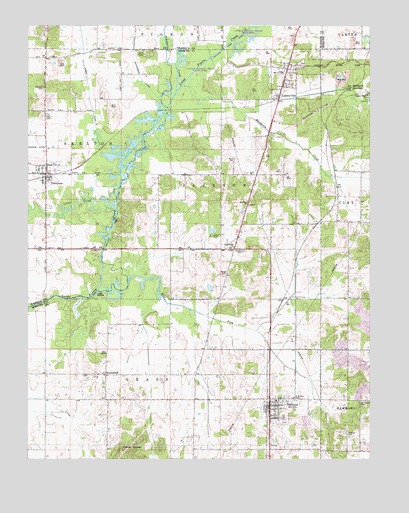
Chrisney, IN USGS Topographic Map
Click on map above to begin viewing in our Map Viewer.

This topographic map contains these locations and features:
Feature Name Type Latitude Longitude GNIS ID View Map
Beasley CemeteryCemeteryN38.0073°W87.0080°430656View Map
Bender CemeteryCemeteryN38.0603°W87.0467°430798View Map
BloomfieldPopulated PlaceN38.0245°W87.0964°431199View Map
Buckhorn CreekStreamN38.1073°W87.0692°431748View Map
ChrisneyPopulated PlaceN38.0148°W87.0364°432490View Map
Chrisney DitchCanalN38.0414°W87.0597°432491View Map
Chrisney Elementary SchoolSchoolN38.0170°W87.0347°447109View Map
Chrisney LakeReservoirN38.0107°W87.0235°447277View Map
Chrisney Lake DamDamN38.0134°W87.0250°447278View Map
Chrisney Town MarshalBuildingN38.0157°W87.0359°2758438View Map
Chrisney Volunteer Fire DepartmentBuildingN38.0158°W87.0355°2625982View Map
Clark CemeteryCemeteryN38.1170°W87.0825°432550View Map
Coles CreekStreamN38.0723°W87.0928°432757View Map
East Fork Little Pigeon CreekStreamN38.0487°W87.0994°449488View Map
Friendship ChurchChurchN38.0612°W87.0497°434862View Map
Garrison CemeteryCemeteryN38.1073°W87.1192°434974View Map
GentryvillePopulated PlaceN38.1042°W87.0331°435016View Map
Hesson CemeteryCemeteryN38.0650°W87.0564°436072View Map
High BanksCliffN38.0470°W87.0989°436136View Map
Hutchinson DitchCanalN38.1101°W87.0839°436661View Map
Jackson Township Volunteer Fire Department GentryvilleBuildingN38.1137°W87.0358°2626588View Map
KerchevalPopulated PlaceN38.0895°W87.0139°446753View Map
Little Pigeon CreekStreamN38.1059°W87.0706°438112View Map
Mount Moriah CemeteryCemeteryN38.0159°W87.0036°439602View Map
Mount Olive ChurchChurchN38.0742°W87.0447°439617View Map
PigeonPopulated PlaceN38.1001°W87.0667°446752View Map
Pigeon Creek ChurchChurchN38.1048°W87.0008°441116View Map
Polk CemeteryCemeteryN38.0989°W87.1183°441407View Map
Polkberry DitchCanalN38.1148°W87.0742°441411View Map
Rockport JunctionPopulated PlaceN38.1073°W87.0067°442225View Map
Saint Martins CemeteryCemeteryN38.0173°W87.0278°442682View Map
Skelton - Owen Fire TerritoryBuildingN38.0829°W87.1180°2625802View Map
Spencer CountyCivilN38.0141°W87.0077°450388View Map
Stark CemeteryCemeteryN38.0864°W87.0494°444075View Map
TennysonPopulated PlaceN38.0823°W87.1183°444641View Map
Tennyson Town MarshalBuildingN38.0828°W87.1179°2758187View Map
Town of ChrisneyCivilN38.0097°W87.0316°2396644View Map
Town of GentryvilleCivilN38.1091°W87.0315°2396957View Map
Town of TennysonCivilN38.0817°W87.1188°2397694View Map
Township of GrassCivilN38.0024°W87.0942°453338View Map
Township of JacksonCivilN38.0754°W87.0508°453467View Map
Wallace Fork DitchCanalN38.1006°W87.0747°445393View Map
Wires DitchCanalN38.1051°W87.1025°446202View Map
Wright CemeteryCemeteryN38.0531°W87.0533°446338View Map

Note: Coordinates in the location and feature list above are referenced to NAD83 datum.


Copyright (C) 2008-2024 Ryan Niemi / Sunset Dynamics ... All Rights Reserved