TopoQuest Logo
Do you find TopoQuest useful?
Help keep TopoQuest running and adding new maps/features by donating!
Bitcoin:  19c7KJd3qBynnjoSw5npx9KScwjBe4ifkT
Litecoin:  LXs6TkuXGGXo1vDsWCkWVdjQX94eUKd6ui
Home View Maps Find Maps Find Places Resources & Links


Sarahsville, Ohio Topographic Map

USGS Map Title: Sarahsville, OH
USGS Map MRC: 39081G4
DRG (GeoTIFF) Download: o39081g4.tif


Neighboring USGS Topographic Map Quads:


  Byesville, OH  
39081H5
 

  Senecaville, OH  
39081H4
 

  Quaker City, OH  
39081H3
 

  Caldwell North, OH  
39081G5
 

  Sarahsville, OH  
39081G4
 

  Summerfield, OH  
39081G3
 

  Caldwell South, OH  
39081F5
 

  Macksburg, OH  
39081F4
 

  Stafford, OH  
39081F3


Map MRC Location:

N40°
W82°
N40°
W81°
H8 H7 H6 H5 H4 H3 H2 H1
G8 G7 G6 G5 G4 G3 G2 G1
F8 F7 F6 F5 F4 F3 F2 F1
E8 E7 E6 E5 E4 E3 E2 E1
D8 D7 D6 D5 D4 D3 D2 D1
C8 C7 C6 C5 C4 C3 C2 C1
B8 B7 B6 B5 B4 B3 B2 B1
A8 A7 A6 A5 A4 A3 A2 A1
N39°
W82°
N39°
W81°

Sarahsville, OH USGS 1:24K Topographic Map Preview:
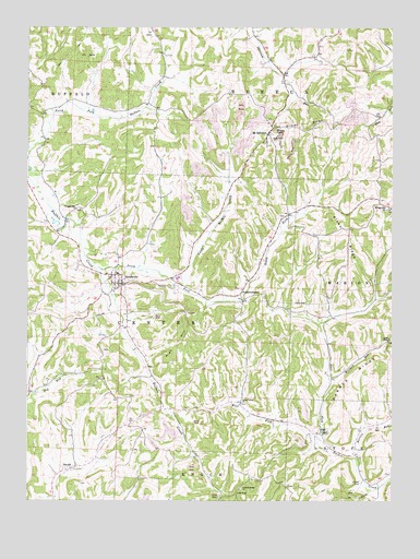
Sarahsville, OH USGS Topographic Map
Click on map above to begin viewing in our Map Viewer.

This topographic map contains these locations and features:
Feature Name Type Latitude Longitude GNIS ID View Map
Aiken RidgeRidgeN39.8212°W81.3918°1037333View Map
Aiken School (historical)SchoolN39.8223°W81.3890°1050968View Map
Allens ChapelChurchN39.7926°W81.3757°1060819View Map
Allens Chapel CemeteryCemeteryN39.7921°W81.3767°1963666View Map
Archer CemeteryCemeteryN39.7548°W81.3857°1037470View Map
Archer School (historical)SchoolN39.7598°W81.3857°1050965View Map
Archers Ridge CemeteryCemeteryN39.7534°W81.4268°1963667View Map
Archers Ridge ChurchChurchN39.7531°W81.4273°1060828View Map
Baggs School (historical)SchoolN39.7834°W81.4882°1050958View Map
Barnes RidgeRidgeN39.7834°W81.3879°1075306View Map
Barnes RunStreamN39.7615°W81.3873°1075308View Map
Beatty KnobSummitN39.8476°W81.4157°1048501View Map
Center (historical)Populated PlaceN39.7854°W81.4587°1065544View Map
DuvallPopulated PlaceN39.7587°W81.4851°1064569View Map
East UnionPopulated PlaceN39.7679°W81.4007°1064591View Map
East Union CemeteryCemeteryN39.7690°W81.3973°1963675View Map
FredericksdalePopulated PlaceN39.8031°W81.4268°1064679View Map
Fredericksdale Post Office (historical)Post OfficeN39.8029°W81.4262°2041182View Map
Green Valley ChurchChurchN39.7759°W81.4268°1041114View Map
Groves RidgeRidgeN39.8473°W81.4057°1041202View Map
High HillSummitN39.7917°W81.4473°1048836View Map
Lemon School (historical)SchoolN39.7667°W81.4615°1050956View Map
Little Buffalo CreekStreamN39.8062°W81.4479°1065804View Map
Low GapGapN39.7520°W81.4285°1042802View Map
McGarry School (historical)SchoolN39.8215°W81.4598°1050960View Map
Mount EphraimPopulated PlaceN39.8473°W81.4179°1065068View Map
Mount Ephraim Post Office (historical)Post OfficeN39.8473°W81.4185°2041274View Map
Mount Ephraim Station (historical)LocaleN39.8259°W81.4107°1050967View Map
Mount Ephriam Methodist ChurchChurchN39.8490°W81.4154°1963687View Map
Noble CountyCivilN39.7660°W81.4556°1074073View Map
Old Mount Ephriam CemeteryCemeteryN39.8492°W81.4154°1963691View Map
Pleasant Hill CemeteryCemeteryN39.8270°W81.4832°1963695View Map
Pleasant Hill ChurchChurchN39.8267°W81.4840°1044554View Map
Reeds School (historical)SchoolN39.8320°W81.4307°1050964View Map
Riches Church (historical)ChurchN39.8531°W81.4671°1050961View Map
Riches School (historical)SchoolN39.8523°W81.4579°1050962View Map
SarahsvillePopulated PlaceN39.8073°W81.4679°1065288View Map
Sarahsville Post OfficePost OfficeN39.8070°W81.4679°2041510View Map
Shenandoah Elementary SchoolSchoolN39.8101°W81.4693°1050959View Map
Shenandoah High SchoolSchoolN39.8087°W81.4485°1050963View Map
South Fork Buffalo CreekStreamN39.8112°W81.4765°1046461View Map
Stones School (historical)SchoolN39.7998°W81.4082°1050966View Map
Township of CenterCivilN39.7961°W81.4599°1086742View Map
Township of SenecaCivilN39.8643°W81.4077°1086750View Map
Upper Opossum School (historical)SchoolN39.8706°W81.4193°1071058View Map
Village of SarahsvilleCivilN39.8075°W81.4694°2399183View Map
Vorhies (historical)Populated PlaceN39.7959°W81.4660°1050957View Map
West Fork East Fork Duck CreekStreamN39.7662°W81.4010°1047752View Map
Wolfpen RunStreamN39.7820°W81.3962°1077226View Map

Note: Coordinates in the location and feature list above are referenced to NAD83 datum.


Copyright (C) 2008-2024 Ryan Niemi / Sunset Dynamics ... All Rights Reserved