TopoQuest Logo
Do you find TopoQuest useful?
Help keep TopoQuest running and adding new maps/features by donating!
Bitcoin:  19c7KJd3qBynnjoSw5npx9KScwjBe4ifkT
Litecoin:  LXs6TkuXGGXo1vDsWCkWVdjQX94eUKd6ui
Home View Maps Find Maps Find Places Resources & Links


Birdwell Lake, Texas Topographic Map

USGS Map Title: Birdwell Lake, TX
USGS Map MRC: 30094G3
DRG (GeoTIFF) Download: o30094g3.tif


Neighboring USGS Topographic Map Quads:


  Colmesneil, TX  
30094H4
 

  Boggy Lake, TX  
30094H3
 

  Pace Hill, TX  
30094H2
 

  Woodville, TX  
30094G4
 

  Birdwell Lake, TX  
30094G3
 

  Town Bluff, TX  
30094G2
 

  Hillister, TX  
30094F4
 

  Kirkpatrick Lake, TX  
30094F3
 

  Spurger, TX  
30094F2


Map MRC Location:

N31°
W95°
N31°
W94°
H8 H7 H6 H5 H4 H3 H2 H1
G8 G7 G6 G5 G4 G3 G2 G1
F8 F7 F6 F5 F4 F3 F2 F1
E8 E7 E6 E5 E4 E3 E2 E1
D8 D7 D6 D5 D4 D3 D2 D1
C8 C7 C6 C5 C4 C3 C2 C1
B8 B7 B6 B5 B4 B3 B2 B1
A8 A7 A6 A5 A4 A3 A2 A1
N30°
W95°
N30°
W94°

Birdwell Lake, TX USGS 1:24K Topographic Map Preview:
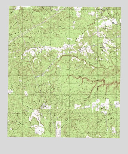
Birdwell Lake, TX USGS Topographic Map
Click on map above to begin viewing in our Map Viewer.

This topographic map contains these locations and features:
Feature Name Type Latitude Longitude GNIS ID View Map
Allison LakeReservoirN30.7535°W94.3169°1861679View Map
Allison Lake DamDamN30.7535°W94.3169°1861678View Map
Antioch ChurchChurchN30.7813°W94.2744°1351196View Map
Birdwell LakeLakeN30.7800°W94.3361°1352237View Map
Birdwell LakeReservoirN30.7769°W94.3369°1861681View Map
Birdwell Lake DamDamN30.7769°W94.3369°1861680View Map
Boar BranchStreamN30.8705°W94.3283°1352529View Map
Brush CreekStreamN30.7691°W94.3408°1353016View Map
Buzzard CreekStreamN30.8358°W94.3319°1353444View Map
Clear Fork CreekStreamN30.8716°W94.3077°1373134View Map
Dogwood TrailTrailN30.8035°W94.3633°2032788View Map
Double Bridge BranchStreamN30.7927°W94.2827°1356171View Map
Drunkards BranchStreamN30.7549°W94.3341°1356271View Map
Dry CreekStreamN30.8544°W94.2896°1356300View Map
Ebenezer ChurchChurchN30.8674°W94.2827°1356783View Map
EmillePopulated PlaceN30.8435°W94.2627°2035017View Map
Hooker BranchStreamN30.8708°W94.3266°1359523View Map
Hopewell CemeteryCemeteryN30.8185°W94.2958°1359541View Map
Hopewell ChurchChurchN30.8246°W94.3224°1359549View Map
Little Wolf CreekStreamN30.8596°W94.2591°1361510View Map
Moss Hill ChurchChurchN30.8044°W94.3624°1363200View Map
New Shady Grove ChurchChurchN30.8133°W94.3330°1363777View Map
Ratcliff BranchStreamN30.8013°W94.2613°1366020View Map
Red BranchStreamN30.8063°W94.2921°1366127View Map
Reids BranchStreamN30.7744°W94.3458°1366333View Map
Steep Hollow BranchStreamN30.8019°W94.2669°1369159View Map
Still BranchStreamN30.8044°W94.2769°1369202View Map
Tompkins Mill CreekStreamN30.8633°W94.2627°1370006View Map
Victory Baptist ChurchChurchN30.7755°W94.3527°2024382View Map
Wash Hole BranchStreamN30.7749°W94.2610°1370871View Map
White Oak BranchStreamN30.8166°W94.2657°1371388View Map

Note: Coordinates in the location and feature list above are referenced to NAD83 datum.


Copyright (C) 2008-2025 Ryan Niemi / Sunset Dynamics ... All Rights Reserved