TopoQuest Logo
Do you find TopoQuest useful?
Help keep TopoQuest running and adding new maps/features by donating!
Bitcoin:  19c7KJd3qBynnjoSw5npx9KScwjBe4ifkT
Litecoin:  LXs6TkuXGGXo1vDsWCkWVdjQX94eUKd6ui
Home View Maps Find Maps Find Places Resources & Links


Lone Star, Texas Topographic Map

USGS Map Title: Lone Star, TX
USGS Map MRC: 32094H6
DRG (GeoTIFF) Download: o32094h6.tif


Neighboring USGS Topographic Map Quads:


  Cason, TX  
33094A7
 

  Daingerfield, TX  
33094A6
 

  Sardis, TX  
33094A5
 

  Lafayette, TX  
32094H7
 

  Lone Star, TX  
32094H6
 

  Avinger, TX  
32094H5
 

  Coffeeville, TX  
32094G7
 

  Ore City, TX  
32094G6
 

  Lassater, TX  
32094G5


Map MRC Location:

N33°
W95°
N33°
W94°
H8 H7 H6 H5 H4 H3 H2 H1
G8 G7 G6 G5 G4 G3 G2 G1
F8 F7 F6 F5 F4 F3 F2 F1
E8 E7 E6 E5 E4 E3 E2 E1
D8 D7 D6 D5 D4 D3 D2 D1
C8 C7 C6 C5 C4 C3 C2 C1
B8 B7 B6 B5 B4 B3 B2 B1
A8 A7 A6 A5 A4 A3 A2 A1
N32°
W95°
N32°
W94°

Lone Star, TX USGS 1:24K Topographic Map Preview:
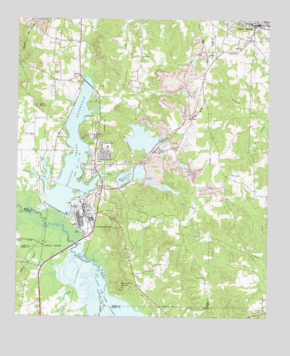
Lone Star, TX USGS Topographic Map
Click on map above to begin viewing in our Map Viewer.

This topographic map contains these locations and features:
Feature Name Type Latitude Longitude GNIS ID View Map
Barnes CreekStreamN32.9343°W94.7085°1330056View Map
Barnes Creek ReservoirReservoirN32.9336°W94.6966°1330057View Map
Black Mountain MineMineN32.9998°W94.7416°1330771View Map
Black MountainsRangeN32.9987°W94.7497°1372610View Map
BondLocaleN32.9587°W94.6635°1331035View Map
Brutons CreekStreamN32.9135°W94.7272°1331462View Map
Buzzard Roost MountainSummitN32.8874°W94.6980°1331778View Map
Cheatham CemeteryCemeteryN32.9490°W94.6330°1332701View Map
City of Hughes SpringsCivilN32.9987°W94.6311°2410803View Map
City of Lone StarCivilN32.9393°W94.7090°2410863View Map
Clark CemeteryCemeteryN32.9776°W94.7294°1332886View Map
Ellison Creek DamDamN32.9185°W94.7252°1862142View Map
Ellison Creek ReservoirReservoirN32.9406°W94.7228°1335335View Map
Fowler MountainSummitN32.9637°W94.7399°1336130View Map
Gramfield ChurchChurchN32.8915°W94.6560°1336796View Map
Harris ChapelChurchN32.9349°W94.6427°1337386View Map
Hospital in the PinesHospitalN32.9660°W94.7108°1338145View Map
Hughes SpringsPopulated PlaceN32.9985°W94.6308°1338249View Map
Hughes Springs City HallBuildingN32.9979°W94.6256°2753718View Map
Hughes Springs Fire StationBuildingN32.9973°W94.6266°2655255View Map
Hughes Springs Police DepartmentBuildingN32.9979°W94.6256°2751155View Map
Hughes Springs Post OfficePost OfficeN32.9994°W94.6317°2731972View Map
Hughes Springs Volunteer Ambulance ServiceBuildingN32.9971°W94.6255°2720980View Map
Iron Bluff CemeteryCemeteryN32.9385°W94.7105°1338496View Map
JenkinsPopulated PlaceN32.9762°W94.7185°1378496View Map
Jenkins Volunteer Fire DepartmentBuildingN32.9755°W94.7196°2655538View Map
Jones CreekStreamN32.8821°W94.7147°1338854View Map
LamanPopulated PlaceN32.9851°W94.6546°1378554View Map
Little CreekStreamN32.9124°W94.7363°1340069View Map
Livity ChurchChurchN32.9885°W94.6391°1340268View Map
Lone StarPopulated PlaceN32.9440°W94.7072°1340390View Map
Lone Star City HallBuildingN32.9391°W94.7134°2754028View Map
Lone Star ParkParkN32.9049°W94.7105°2028569View Map
Lone Star Police DepartmentBuildingN32.9391°W94.7134°2751204View Map
Lone Star Post OfficePost OfficeN32.9453°W94.7104°2731309View Map
Lone Star Steel Company Airport (historical)AirportN32.9248°W94.7377°1387101View Map
Lone Star Volunteer Fire Department / Emergency Medical ServiceBuildingN32.9387°W94.7136°2655177View Map
Mount Pilgrim ChurchChurchN32.8776°W94.6271°1342089View Map
New Jerusalem ChurchChurchN32.9843°W94.6877°1342489View Map
Peacock CreekStreamN32.9646°W94.7044°1343724View Map
Roberts BranchStreamN32.9062°W94.7338°1345311View Map
South Union CemeteryCemeteryN32.9737°W94.6941°1347541View Map
South Union CreekStreamN32.9624°W94.7113°1347542View Map
Upper Barnes Creek DamDamN32.9335°W94.6858°1349115View Map

Note: Coordinates in the location and feature list above are referenced to NAD83 datum.


Copyright (C) 2008-2024 Ryan Niemi / Sunset Dynamics ... All Rights Reserved