TopoQuest Logo
Do you find TopoQuest useful?
Help keep TopoQuest running and adding new maps/features by donating!
Bitcoin:  19c7KJd3qBynnjoSw5npx9KScwjBe4ifkT
Litecoin:  LXs6TkuXGGXo1vDsWCkWVdjQX94eUKd6ui
Home View Maps Find Maps Find Places Resources & Links


Schell Mountain, California Topographic Map

USGS Map Title: Schell Mountain, CA
USGS Map MRC: 40122G5
DRG (GeoTIFF) Download: o40122g5.tif


Neighboring USGS Topographic Map Quads:


  Trinity Center, CA  
40122H6
 

  Damnation Peak, CA  
40122H5
 

  Lamoine, CA  
40122H4
 

  Papoose Creek, CA  
40122G6
 

  Schell Mountain, CA  
40122G5
 

  Bohemotash Mountain, CA  
40122G4
 

  French Gulch, CA  
40122F6
 

  Whiskeytown, CA  
40122F5
 

  Shasta Dam, CA  
40122F4


Map MRC Location:

N41°
W123°
N41°
W122°
H8 H7 H6 H5 H4 H3 H2 H1
G8 G7 G6 G5 G4 G3 G2 G1
F8 F7 F6 F5 F4 F3 F2 F1
E8 E7 E6 E5 E4 E3 E2 E1
D8 D7 D6 D5 D4 D3 D2 D1
C8 C7 C6 C5 C4 C3 C2 C1
B8 B7 B6 B5 B4 B3 B2 B1
A8 A7 A6 A5 A4 A3 A2 A1
N40°
W123°
N40°
W122°

Schell Mountain, CA USGS 1:24K Topographic Map Preview:
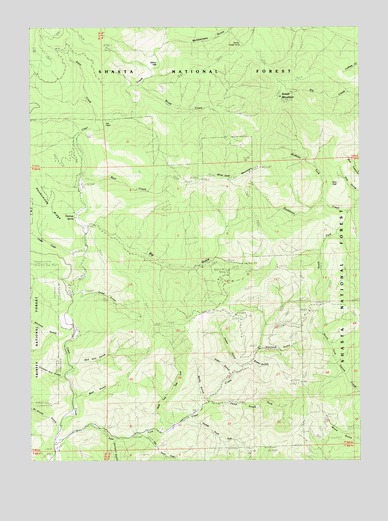
Schell Mountain, CA USGS Topographic Map
Click on map above to begin viewing in our Map Viewer.

This topographic map contains these locations and features:
Feature Name Type Latitude Longitude GNIS ID View Map
Al Smith GulchValleyN40.7604°W122.6136°253653View Map
Alder GulchValleyN40.7749°W122.5506°218102View Map
Baker GulchValleyN40.7785°W122.5422°218547View Map
Baker MineMineN40.7771°W122.5347°218550View Map
Bear CreekStreamN40.8310°W122.6061°218816View Map
Bear GulchValleyN40.7688°W122.6089°218847View Map
Big GulchValleyN40.8182°W122.6034°219194View Map
Brush CreekStreamN40.8582°W122.5847°219927View Map
Canyon Hill GulchValleyN40.7743°W122.6142°220562View Map
Cedar GulchValleyN40.7776°W122.5464°220782View Map
Cedar GulchValleyN40.7901°W122.5881°220783View Map
Cosy DellValleyN40.7885°W122.6111°221616View Map
Dodge CreekStreamN40.8093°W122.6111°222448View Map
Doe FlatFlatN40.8268°W122.5103°222458View Map
First South Fork East Fork Clear CreekStreamN40.7574°W122.5850°223523View Map
Gilroy FlatFlatN40.8649°W122.5770°224182View Map
Hackney SpringSpringN40.8200°W122.6092°1661806View Map
Hall CabinLocaleN40.8474°W122.5967°224801View Map
Honeymoon RidgeRidgeN40.8296°W122.6245°225520View Map
Modesto ForkStreamN40.8249°W122.5150°228891View Map
North Fork East Fork Clear CreekStreamN40.7576°W122.5767°229636View Map
Rattlesnake GulchValleyN40.8701°W122.5734°234540View Map
Red Hill GulchValleyN40.7776°W122.6097°231336View Map
Schell MountainSummitN40.8551°W122.5303°232646View Map
Schultz Sheep CampLocaleN40.8674°W122.5470°232701View Map
Second South Fork East Fork Clear CreekStreamN40.7615°W122.5672°232777View Map
Shirttail GulchValleyN40.7557°W122.5950°234694View Map
Slate CreekStreamN40.8457°W122.5992°234710View Map
South Fork Backbone CreekStreamN40.8213°W122.5053°234965View Map
Stottard GulchValleyN40.7821°W122.5383°235557View Map
Third South Fork East Fork Clear CreekStreamN40.7665°W122.5578°236245View Map
Walts GulchValleyN40.7671°W122.5595°237220View Map
Whitney CreekStreamN40.7865°W122.6097°1683017View Map
Whitney GulchValleyN40.7857°W122.6145°237713View Map
Wild Cow MountainSummitN40.8324°W122.5595°237750View Map

Note: Coordinates in the location and feature list above are referenced to NAD83 datum.


Copyright (C) 2008-2025 Ryan Niemi / Sunset Dynamics ... All Rights Reserved