TopoQuest Logo
Do you find TopoQuest useful?
Help keep TopoQuest running and adding new maps/features by donating!
Bitcoin:  19c7KJd3qBynnjoSw5npx9KScwjBe4ifkT
Litecoin:  LXs6TkuXGGXo1vDsWCkWVdjQX94eUKd6ui
Home View Maps Find Maps Find Places Resources & Links


Bohemotash Mountain, California Topographic Map

USGS Map Title: Bohemotash Mountain, CA
USGS Map MRC: 40122G4
DRG (GeoTIFF) Download: o40122g4.tif


Neighboring USGS Topographic Map Quads:


  Damnation Peak, CA  
40122H5
 

  Lamoine, CA  
40122H4
 

  Hanland Peak, CA  
40122H3
 

  Schell Mountain, CA  
40122G5
 

  Bohemotash Mountain, CA  
40122G4
 

  O'Brien, CA  
40122G3
 

  Whiskeytown, CA  
40122F5
 

  Shasta Dam, CA  
40122F4
 

  Project City, CA  
40122F3


Map MRC Location:

N41°
W123°
N41°
W122°
H8 H7 H6 H5 H4 H3 H2 H1
G8 G7 G6 G5 G4 G3 G2 G1
F8 F7 F6 F5 F4 F3 F2 F1
E8 E7 E6 E5 E4 E3 E2 E1
D8 D7 D6 D5 D4 D3 D2 D1
C8 C7 C6 C5 C4 C3 C2 C1
B8 B7 B6 B5 B4 B3 B2 B1
A8 A7 A6 A5 A4 A3 A2 A1
N40°
W123°
N40°
W122°

Bohemotash Mountain, CA USGS 1:24K Topographic Map Preview:
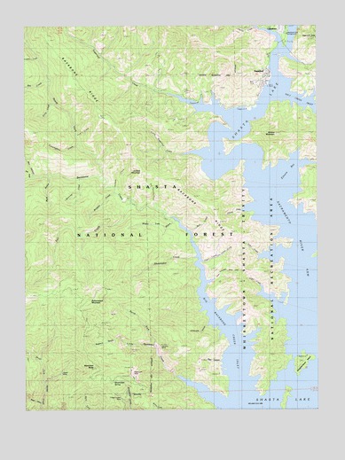
Bohemotash Mountain, CA USGS Topographic Map
Click on map above to begin viewing in our Map Viewer.

This topographic map contains these locations and features:
Feature Name Type Latitude Longitude GNIS ID View Map
Adler CreekStreamN40.7876°W122.3995°266362View Map
Alder CreekStreamN40.7999°W122.3997°266370View Map
Backbone CreekStreamN40.8124°W122.4386°266396View Map
Backbone RidgeRidgeN40.8251°W122.4411°233450View Map
Beartrap CreekStreamN40.8249°W122.4775°266433View Map
Beehive CampgroundLocaleN40.8474°W122.4064°276962View Map
Big Backbone Creek InletStreamN40.7543°W122.4095°266397View Map
Big CreekStreamN40.8571°W122.4900°266446View Map
Bohemotash MountainSummitN40.7843°W122.4753°266475View Map
Box CanyonValleyN40.8263°W122.4970°266483View Map
Buck GulchValleyN40.8254°W122.4908°266493View Map
Bull CreekStreamN40.8079°W122.4306°266508View Map
Charlie CreekStreamN40.8682°W122.3908°266553View Map
Clipper MineMineN40.7613°W122.4856°266582View Map
Cunningham CreekStreamN40.8363°W122.4778°266614View Map
Dark CanyonValleyN40.7651°W122.4172°266620View Map
Doe GulchValleyN40.8254°W122.4995°266650View Map
Elmore (historical)Populated PlaceN40.8101°W122.3950°1682477View Map
Elmore BayBayN40.8304°W122.3864°266690View Map
Elmore CreekStreamN40.8160°W122.4039°266691View Map
Elmore MountainSummitN40.8399°W122.3931°266692View Map
Fall CreekStreamN40.8179°W122.4558°266697View Map
Friday-Louden MineMineN40.7535°W122.4597°266734View Map
Golinsky MineMineN40.7701°W122.4428°266760View Map
Gooseneck Cove CampgroundLocaleN40.8260°W122.4242°266761View Map
Haycock PeakSummitN40.8710°W122.3756°266796View Map
Jackass CreekStreamN40.8226°W122.4620°266853View Map
Jackass MountainSummitN40.8274°W122.4508°266854View Map
Lakeshore CampgroundLocaleN40.8682°W122.3936°266893View Map
Lakeshore East CampgroundLocaleN40.8718°W122.3892°276965View Map
Lakeshore Fire Control StationLocaleN40.8693°W122.3897°276960View Map
Lick CreekStreamN40.8432°W122.4711°266908View Map
Limerock GulchValleyN40.7779°W122.4220°266912View Map
Little Backbone CreekStreamN40.7529°W122.4200°266916View Map
Little Sugarloaf CreekStreamN40.8332°W122.4239°266928View Map
Lockhart CreekStreamN40.8649°W122.4950°266933View Map
Lower Limestone Valley CreekStreamN40.7913°W122.4228°266951View Map
Mabel (historical)Populated PlaceN40.8060°W122.3845°1682500View Map
Mammoth ButteSummitN40.7632°W122.4717°266962View Map
Mammoth MineMineN40.7618°W122.4556°266963View Map
Morley (historical)Populated PlaceN40.7768°W122.3811°1682502View Map
North Fork Backbone CreekStreamN40.8263°W122.4686°267067View Map
North Fork Little Backbone CreekStreamN40.7707°W122.4450°267074View Map
Oak Opening CreekStreamN40.8160°W122.4478°267091View Map
Old Man CampgroundLocaleN40.8501°W122.4292°267093View Map
Polly CreekStreamN40.8504°W122.4883°267139View Map
Ringeye CreekStreamN40.8210°W122.4620°267181View Map
Sacramento River ArmBayN40.7988°W122.3817°267201View Map
Salt CreekStreamN40.8526°W122.3947°267205View Map
Salt Creek Point CampgroundLocaleN40.8485°W122.3945°267207View Map
Sawmill GulchValleyN40.7740°W122.4600°267213View Map
Shake Tree GulchValleyN40.8118°W122.4364°267226View Map
Shoemaker GulchStreamN40.7999°W122.4275°267241View Map
Shoemaker SpringSpringN40.7595°W122.4632°267242View Map
Slaughterhouse IslandIslandN40.7654°W122.3825°267261View Map
Slaughterhouse Island CampgroundLocaleN40.7674°W122.3811°276954View Map
SugarloafPopulated PlaceN40.8582°W122.3970°1659898View Map
Sugarloaf CreekStreamN40.8446°W122.4103°267870View Map
Sutro MineMineN40.7818°W122.4636°1675860View Map
Tasadi ResortLocaleN40.8651°W122.3970°276961View Map
Upper Limestone Valley CreekStreamN40.7985°W122.4253°268623View Map
Wood GulchValleyN40.7521°W122.4947°269282View Map

Note: Coordinates in the location and feature list above are referenced to NAD83 datum.


Copyright (C) 2008-2025 Ryan Niemi / Sunset Dynamics ... All Rights Reserved