TopoQuest Logo
Do you find TopoQuest useful?
Help keep TopoQuest running and adding new maps/features by donating!
Bitcoin:  19c7KJd3qBynnjoSw5npx9KScwjBe4ifkT
Litecoin:  LXs6TkuXGGXo1vDsWCkWVdjQX94eUKd6ui
Home View Maps Find Maps Find Places Resources & Links


Scio, Oregon Topographic Map

USGS Map Title: Scio, OR
USGS Map MRC: 44122F7
DRG (GeoTIFF) Download: o44122f7.tif


Neighboring USGS Topographic Map Quads:


  Turner, OR  
44122G8
 

  Stayton, OR  
44122G7
 

  Stout Mountain, OR  
44122G6
 

  Crabtree, OR  
44122F8
 

  Scio, OR  
44122F7
 

  Jordan, OR  
44122F6
 

  Lebanon, OR  
44122E8
 

  Onehorse Slough, OR  
44122E7
 

  Lacomb, OR  
44122E6


Map MRC Location:

N45°
W123°
N45°
W122°
H8 H7 H6 H5 H4 H3 H2 H1
G8 G7 G6 G5 G4 G3 G2 G1
F8 F7 F6 F5 F4 F3 F2 F1
E8 E7 E6 E5 E4 E3 E2 E1
D8 D7 D6 D5 D4 D3 D2 D1
C8 C7 C6 C5 C4 C3 C2 C1
B8 B7 B6 B5 B4 B3 B2 B1
A8 A7 A6 A5 A4 A3 A2 A1
N44°
W123°
N44°
W122°

Scio, OR USGS 1:24K Topographic Map Preview:
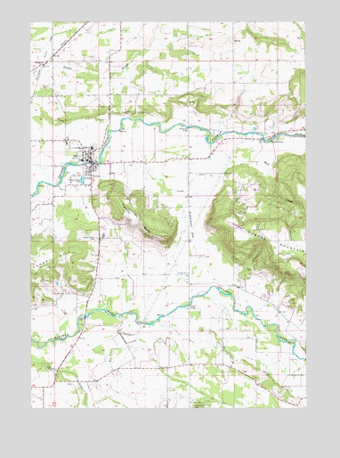
Scio, OR USGS Topographic Map
Click on map above to begin viewing in our Map Viewer.

This topographic map contains these locations and features:
Feature Name Type Latitude Longitude GNIS ID View Map
Ballins Mill (historical)LocaleN44.6887°W122.7540°1162679View Map
Centennial Elementary SchoolSchoolN44.7051°W122.8535°1162173View Map
City of ScioCivilN44.7046°W122.8509°2411840View Map
Dotyville (historical)Populated PlaceN44.6540°W122.8054°1158667View Map
Dotyville Post Office (historical)Post OfficeN44.6540°W122.8054°1165174View Map
Evergreen Church of God in Christ Mennonite ChurchChurchN44.6955°W122.8492°2508176View Map
Franklin ButteSummitN44.6857°W122.8301°1120951View Map
Franklin Butte CemeteryCemeteryN44.6796°W122.8465°1120952View Map
Gaines CemeteryCemeteryN44.6373°W122.7706°1130592View Map
Gourley DairyLocaleN44.6578°W122.7706°2663779View Map
Inspiration AirportAirportN44.6251°W122.7538°2645986View Map
Jacks HeliportAirportN44.6398°W122.8278°2699485View Map
Leffler GradeSlopeN44.7207°W122.8401°1162680View Map
Linn County Sheriff's Office Scio SubstationBuildingN44.7049°W122.8498°2737830View Map
Mill CreekStreamN44.7101°W122.7954°1163144View Map
Miller CemeteryCemeteryN44.7290°W122.8670°1124185View Map
Oregon Connections AcademySchoolN44.7050°W122.8486°2466075View Map
Peters DitchCanalN44.6968°W122.8156°1125317View Map
Richardson GapGapN44.6826°W122.8034°1125983View Map
Richardson Gap Grange HallBuildingN44.6685°W122.8049°1639223View Map
Rosa Post Office (historical)Post OfficeN44.6573°W122.8045°1164643View Map
Schimanek BridgeBridgeN44.7156°W122.8043°1126643View Map
ScioPopulated PlaceN44.7048°W122.8493°1126672View Map
Scio City HallBuildingN44.7050°W122.8498°2699799View Map
Scio High SchoolSchoolN44.7090°W122.8485°2466074View Map
Scio Junction (historical)LocaleN44.7351°W122.8723°1166345View Map
Scio Middle SchoolSchoolN44.7052°W122.8507°2466073View Map
Scio Municipal CourtBuildingN44.7050°W122.8498°2699800View Map
Scio Post OfficePost OfficeN44.7051°W122.8492°1165920View Map
Scio Public LibraryBuildingN44.7050°W122.8498°2699801View Map
Scio Public Works Department OfficeBuildingN44.7050°W122.8498°2699802View Map
Scio Rural Fire Protection District Station 90BuildingN44.7004°W122.8490°2576886View Map
Scio Rural Fire Protection District Station 91BuildingN44.7033°W122.8469°2576642View Map
Scio Sewage Treatment FacilityLocaleN44.6998°W122.8539°2697058View Map
Scio-Lacomb DivisionCivilN44.6459°W122.8662°1938114View Map
ShelburnPopulated PlaceN44.7360°W122.8706°1166711View Map
Shelburn Post Office (historical)Post OfficeN44.7360°W122.8706°1165937View Map
Shindler BridgeBridgeN44.7120°W122.7701°1638934View Map
The Green Trees Ranch AirportAirportN44.6842°W122.7843°1131725View Map
Tolstoj Sokol LodgeLocaleN44.6604°W122.8040°1638858View Map
Trollinger (historical)LocaleN44.7482°W122.8529°1166415View Map

Note: Coordinates in the location and feature list above are referenced to NAD83 datum.


Copyright (C) 2008-2025 Ryan Niemi / Sunset Dynamics ... All Rights Reserved