TopoQuest Logo
Do you find TopoQuest useful?
Help keep TopoQuest running and adding new maps/features by donating!
Bitcoin:  19c7KJd3qBynnjoSw5npx9KScwjBe4ifkT
Litecoin:  LXs6TkuXGGXo1vDsWCkWVdjQX94eUKd6ui
Home View Maps Find Maps Find Places Resources & Links


Turner, Oregon Topographic Map

USGS Map Title: Turner, OR
USGS Map MRC: 44122G8
DRG (GeoTIFF) Download: o44122g8.tif


Neighboring USGS Topographic Map Quads:


  Salem West, OR  
44123H1
 

  Salem East, OR  
44122H8
 

  Stayton NE, OR  
44122H7
 

  Sidney, OR  
44123G1
 

  Turner, OR  
44122G8
 

  Stayton, OR  
44122G7
 

  Albany, OR  
44123F1
 

  Crabtree, OR  
44122F8
 

  Scio, OR  
44122F7


Map MRC Location:

N45°
W123°
N45°
W122°
H8 H7 H6 H5 H4 H3 H2 H1
G8 G7 G6 G5 G4 G3 G2 G1
F8 F7 F6 F5 F4 F3 F2 F1
E8 E7 E6 E5 E4 E3 E2 E1
D8 D7 D6 D5 D4 D3 D2 D1
C8 C7 C6 C5 C4 C3 C2 C1
B8 B7 B6 B5 B4 B3 B2 B1
A8 A7 A6 A5 A4 A3 A2 A1
N44°
W123°
N44°
W122°

Turner, OR USGS 1:24K Topographic Map Preview:
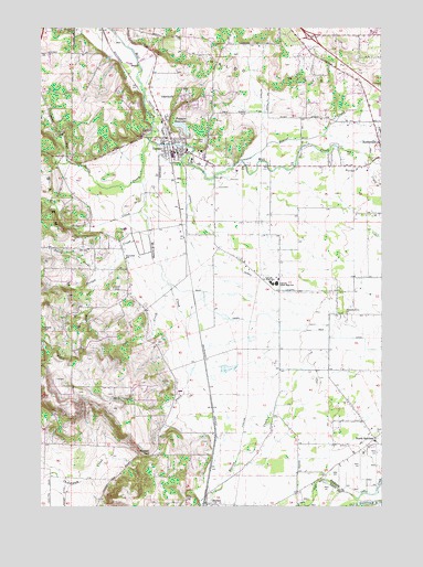
Turner, OR USGS Topographic Map
Click on map above to begin viewing in our Map Viewer.

This topographic map contains these locations and features:
Feature Name Type Latitude Longitude GNIS ID View Map
Aldersgate Conference CenterBuildingN44.8429°W122.9434°2699100View Map
Ames AirportAirportN44.7712°W122.9708°2770593View Map
Aumsville Elementary SchoolSchoolN44.8481°W122.8762°1163492View Map
Aumsville Public Works DepartmentBuildingN44.8404°W122.8791°2699133View Map
Battle CreekStreamN44.8348°W122.9645°1117317View Map
Beaver CreekStreamN44.8404°W122.9276°1162835View Map
Cascade Junior High SchoolSchoolN44.8081°W122.9165°1162880View Map
Cascade Senior High SchoolSchoolN44.8082°W122.9146°1162881View Map
City of TurnerCivilN44.8489°W122.9518°2412115View Map
Cloverdale Elementary SchoolSchoolN44.8144°W122.9699°1162906View Map
Cook CreekStreamN44.8082°W122.9545°1162914View Map
Crandall (historical)LocaleN44.8596°W122.9659°1166387View Map
Flying E AirportAirportN44.8456°W122.8991°1163633View Map
Franzen DamDamN44.8485°W122.9479°1133544View Map
Franzen ReservoirReservoirN44.8496°W122.9496°1120957View Map
Herron CemeteryCemeteryN44.8716°W122.9661°1160997View Map
Hunsaker CemeteryCemeteryN44.7826°W122.9529°1160998View Map
Independent Order of Odd Fellows CemeteryCemeteryN44.8067°W122.9744°1163652View Map
Jefferson DivisionCivilN44.7758°W122.9881°1938032View Map
Main CanalCanalN44.7937°W122.8820°1166675View Map
Marion Census Designated PlaceCensusN44.7512°W122.9277°2408180View Map
Marion DitchCanalN44.7626°W122.8976°1123760View Map
Marion Friends CemeteryCemeteryN44.7521°W122.9484°1163124View Map
McDonald PondLakeN44.8443°W122.9665°1130293View Map
McKinney CreekStreamN44.8454°W122.9615°1123996View Map
North Fork Norton CreekStreamN44.8126°W122.9754°1163177View Map
North SantiamLocaleN44.7676°W122.8787°1166688View Map
North Santiam School (historical)SchoolN44.7669°W122.8786°1638718View Map
Norton CreekStreamN44.8260°W122.9684°1124851View Map
Parrish GapGapN44.7635°W122.9604°1125198View Map
Penitentiary Annex CemeteryCemeteryN44.8742°W122.9648°1163491View Map
Perrin LateralCanalN44.8098°W122.9234°1125308View Map
Pleasant Grove CemeteryCemeteryN44.8002°W122.8901°1163580View Map
Pleasant Grove ChurchChurchN44.8001°W122.8890°1125470View Map
Porter Boone ParkParkN44.8410°W122.8801°1638717View Map
Porter CreekStreamN44.8432°W122.8920°1125573View Map
Rodgers CreekStreamN44.8268°W122.9648°1126256View Map
Salem Water Treatment PlantLocaleN44.8464°W122.9469°2697156View Map
Seclusia ReservoirReservoirN44.7777°W122.9712°1130294View Map
Shaw CreekStreamN44.8560°W122.8798°1163265View Map
South Fork Norton CreekStreamN44.8082°W122.9823°1163282View Map
Stayton Rural Fire Protection District Marion StationBuildingN44.7503°W122.9398°2576626View Map
TurnerPopulated PlaceN44.8432°W122.9529°1136845View Map
Turner Christian ChurchChurchN44.8400°W122.9419°2508218View Map
Turner City HallBuildingN44.8496°W122.9548°2699894View Map
Turner Elementary SchoolSchoolN44.8429°W122.9475°1162111View Map
Turner Fire DepartmentBuildingN44.8451°W122.9536°2576472View Map
Turner Municipal CourtBuildingN44.8496°W122.9548°2699895View Map
Turner Police DepartmentBuildingN44.8496°W122.9550°2737728View Map
Turner Post OfficePost OfficeN44.8503°W122.9551°1166072View Map
Turner Public Works Department OfficeBuildingN44.8497°W122.9544°2699896View Map
Twin Oaks CemeteryCemeteryN44.8454°W122.9415°1128357View Map
West Stayton School (historical)SchoolN44.7887°W122.8754°1638714View Map

Note: Coordinates in the location and feature list above are referenced to NAD83 datum.


Copyright (C) 2008-2025 Ryan Niemi / Sunset Dynamics ... All Rights Reserved