TopoQuest Logo
Do you find TopoQuest useful?
Help keep TopoQuest running and adding new maps/features by donating!
Bitcoin:  19c7KJd3qBynnjoSw5npx9KScwjBe4ifkT
Litecoin:  LXs6TkuXGGXo1vDsWCkWVdjQX94eUKd6ui
Home View Maps Find Maps Find Places Resources & Links


Martensdale, Iowa Topographic Map

USGS Map Title: Martensdale, IA
USGS Map MRC: 41093C6
DRG (GeoTIFF) Download: o41093c6.tif


Neighboring USGS Topographic Map Quads:


  Cumming, IA  
41093D7
 

  Norwalk, IA  
41093D6
 

  Scotch Ridge, IA  
41093D5
 

  Saint Charles, IA  
41093C7
 

  Martensdale, IA  
41093C6
 

  Indianola, IA  
41093C5
 

  Truro, IA  
41093B7
 

  New Virginia, IA  
41093B6
 

  Medora, IA  
41093B5


Map MRC Location:

N42°
W94°
N42°
W93°
H8 H7 H6 H5 H4 H3 H2 H1
G8 G7 G6 G5 G4 G3 G2 G1
F8 F7 F6 F5 F4 F3 F2 F1
E8 E7 E6 E5 E4 E3 E2 E1
D8 D7 D6 D5 D4 D3 D2 D1
C8 C7 C6 C5 C4 C3 C2 C1
B8 B7 B6 B5 B4 B3 B2 B1
A8 A7 A6 A5 A4 A3 A2 A1
N41°
W94°
N41°
W93°

Martensdale, IA USGS 1:24K Topographic Map Preview:
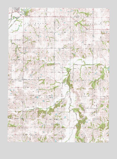
Martensdale, IA USGS Topographic Map
Click on map above to begin viewing in our Map Viewer.

This topographic map contains these locations and features:
Feature Name Type Latitude Longitude GNIS ID View Map
Center ChapelChurchN41.3561°W93.6530°455277View Map
Church of ChristChurchN41.3667°W93.7238°1823035View Map
City of MartensdaleCivilN41.3738°W93.7386°2395028View Map
City of Saint MarysCivilN41.3077°W93.7339°2396506View Map
Clanton CreekStreamN41.3661°W93.7352°455420View Map
Davis SchoolSchoolN41.3144°W93.6674°455812View Map
Immaculate Conception ChurchChurchN41.3094°W93.7316°1970011View Map
Lake GeorgeReservoirN41.2917°W93.7136°1823032View Map
LatimerLocaleN41.2708°W93.6549°466029View Map
Latimer Post Office (historical)Post OfficeN41.2778°W93.6641°1969884View Map
Mahaska County Hospital HeliportAirportN41.3005°W93.6299°466907View Map
MartensdalePopulated PlaceN41.3730°W93.7358°458826View Map
Martensdale City HallBuildingN41.3730°W93.7358°1970044View Map
Martensdale Community ChurchChurchN41.3730°W93.7358°1970045View Map
Martensdale Fire and Rescue DepartmentBuildingN41.3735°W93.7400°2577226View Map
Martensdale Post OfficePost OfficeN41.3730°W93.7358°1970047View Map
Medford Post Office (historical)Post OfficeN41.2505°W93.6544°1969876View Map
Oswego Post Office (historical)Post OfficeN41.3439°W93.6919°1969877View Map
Painter CreekStreamN41.2925°W93.6769°459993View Map
Pleasant Hill ChurchChurchN41.2919°W93.6347°460261View Map
Reddish SchoolSchoolN41.3522°W93.6922°460565View Map
Saint MarysPopulated PlaceN41.3080°W93.7297°461154View Map
Saint Marys (historical)LocaleN41.3080°W93.7297°1970009View Map
Saint Marys CemeteryCemeteryN41.3114°W93.7319°1970010View Map
Saint Marys Fire DepartmentBuildingN41.3076°W93.7311°1970008View Map
Saint Marys Post OfficePost OfficeN41.3080°W93.7297°1970007View Map
Saint Marys School - MartensdaleSchoolN41.3083°W93.7305°1970012View Map
Saint Pauls Lutheran ChurchChurchN41.3730°W93.7358°1970046View Map
Sants BranchStreamN41.3205°W93.6494°465497View Map
Too Short AirportAirportN41.2933°W93.6488°2677124View Map
Township of JacksonCivilN41.2934°W93.7316°468117View Map
Turkey CreekStreamN41.2642°W93.6677°462361View Map
Wallace CemeteryCemeteryN41.3417°W93.7466°1823033View Map
Warren CemeteryCemeteryN41.3500°W93.6669°1970090View Map
Warren County HomeBuildingN41.3403°W93.6594°463300View Map
West Saint MarysPopulated PlaceN41.3080°W93.7397°464799View Map
White Oak Point Post Office (historical)Post OfficeN41.2917°W93.6669°1969872View Map
White Oak SchoolSchoolN41.2744°W93.6544°462993View Map
Whitman SchoolSchoolN41.3514°W93.6436°463010View Map
WickPopulated PlaceN41.3447°W93.7388°463023View Map
Wick Post Office (historical)Post OfficeN41.3447°W93.7388°1969885View Map

Note: Coordinates in the location and feature list above are referenced to NAD83 datum.


Copyright (C) 2008-2024 Ryan Niemi / Sunset Dynamics ... All Rights Reserved