TopoQuest Logo
Do you find TopoQuest useful?
Help keep TopoQuest running and adding new maps/features by donating!
Bitcoin:  19c7KJd3qBynnjoSw5npx9KScwjBe4ifkT
Litecoin:  LXs6TkuXGGXo1vDsWCkWVdjQX94eUKd6ui
Home View Maps Find Maps Find Places Resources & Links


Bismarck, Illinois Topographic Map

USGS Map Title: Bismarck, IL
USGS Map MRC: 40087C5
DRG (GeoTIFF) Download: o40087c5.tif


Neighboring USGS Topographic Map Quads:


  Hoopeston, IL  
40087D6
 

  Ambia, IN  
40087D5
 

  Tab, IN  
40087D4
 

  Henning, IL  
40087C6
 

  Bismarck, IL  
40087C5
 

  West Lebanon, IN  
40087C4
 

  Danville NW, IL  
40087B6
 

  Danville NE, IL  
40087B5
 

  Covington, IN  
40087B4


Map MRC Location:

N41°
W88°
N41°
W87°
H8 H7 H6 H5 H4 H3 H2 H1
G8 G7 G6 G5 G4 G3 G2 G1
F8 F7 F6 F5 F4 F3 F2 F1
E8 E7 E6 E5 E4 E3 E2 E1
D8 D7 D6 D5 D4 D3 D2 D1
C8 C7 C6 C5 C4 C3 C2 C1
B8 B7 B6 B5 B4 B3 B2 B1
A8 A7 A6 A5 A4 A3 A2 A1
N40°
W88°
N40°
W87°

Bismarck, IL USGS 1:24K Topographic Map Preview:
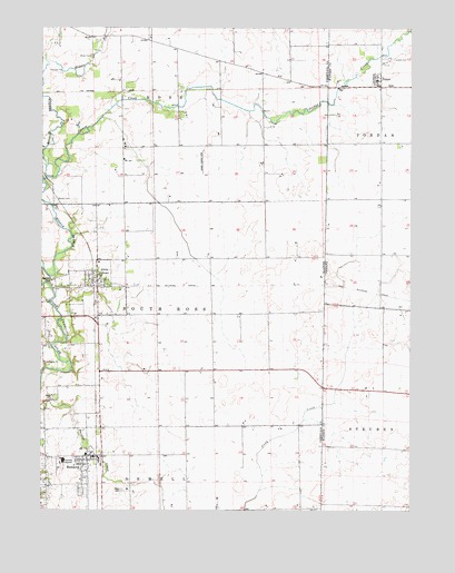
Bismarck, IL USGS Topographic Map
Click on map above to begin viewing in our Map Viewer.

This topographic map contains these locations and features:
Feature Name Type Latitude Longitude GNIS ID View Map
AlvinPopulated PlaceN40.3084°W87.6084°403476View Map
Alvin Post OfficePost OfficeN40.3089°W87.6063°2788244View Map
Barlow ParkPopulated PlaceN40.3095°W87.6231°422431View Map
Bethel CemeteryCemeteryN40.3304°W87.6206°404277View Map
Bethel School (historical)SchoolN40.3314°W87.6209°1764436View Map
BismarckPopulated PlaceN40.2639°W87.6081°424535View Map
Bismarck Community AmbulanceBuildingN40.2637°W87.6076°2673951View Map
Bismarck Community Fire Protection DistrictBuildingN40.3095°W87.6059°2682526View Map
Bismarck Community Fire Protection DistrictBuildingN40.2638°W87.6073°2682078View Map
Bismarck Elemenatary SchoolSchoolN40.2645°W87.6097°1823594View Map
Bismarck Post OfficePost OfficeN40.2639°W87.6077°1823595View Map
Bismarck United Methodist ChurchChurchN40.2620°W87.6086°1967388View Map
Bismarck-Henning High SchoolSchoolN40.2628°W87.6175°1764491View Map
Brown School (historical)SchoolN40.2720°W87.5756°1764441View Map
Cottage Grove School (historical)SchoolN40.2825°W87.6103°1764448View Map
Dale School (historical)SchoolN40.3298°W87.5967°1764453View Map
French School (historical)SchoolN40.2723°W87.5464°1764464View Map
Green School (historical)SchoolN40.3006°W87.5484°1764471View Map
James M Adams Airport (historical)AirportN40.3389°W87.5709°427772View Map
Johannot (historical)LocaleN40.3589°W87.5878°1764479View Map
Jordan CemeteryCemeteryN40.3670°W87.5070°437111View Map
Jordan CreekStreamN40.3361°W87.6231°411241View Map
Jordan Creek of the North Fork Nature PreserveParkN40.3517°W87.6047°2013436View Map
Knowles (historical)LocaleN40.3006°W87.5859°1764481View Map
Little CreekStreamN40.3745°W87.5003°438031View Map
Miller CemeteryCemeteryN40.3675°W87.6081°413577View Map
PencePopulated PlaceN40.3611°W87.5114°440987View Map
Pleasant Hill School (historical)SchoolN40.3650°W87.5561°1764496View Map
Pleasant View School (historical)SchoolN40.3725°W87.5981°1764499View Map
Rose CemeteryCemeteryN40.2551°W87.5975°416935View Map
Sumner School (historical)SchoolN40.3220°W87.5497°1764512View Map
ThomasPopulated PlaceN40.3086°W87.5297°1764514View Map
Village of AlvanCivilN40.3070°W87.6069°2397950View Map
Village of BismarckCivilN40.2594°W87.6113°2398128View Map

Note: Coordinates in the location and feature list above are referenced to NAD83 datum.


Copyright (C) 2008-2025 Ryan Niemi / Sunset Dynamics ... All Rights Reserved