TopoQuest Logo
Do you find TopoQuest useful?
Help keep TopoQuest running and adding new maps/features by donating!
Bitcoin:  19c7KJd3qBynnjoSw5npx9KScwjBe4ifkT
Litecoin:  LXs6TkuXGGXo1vDsWCkWVdjQX94eUKd6ui
Home View Maps Find Maps Find Places Resources & Links


Hoopeston, Illinois Topographic Map

USGS Map Title: Hoopeston, IL
USGS Map MRC: 40087D6
DRG (GeoTIFF) Download: o40087d6.tif


Neighboring USGS Topographic Map Quads:


  Claytonville, IL  
40087E7
 

  Wellington, IL  
40087E6
 

  Stockland, IL  
40087E5
 

  East Lynn, IL  
40087D7
 

  Hoopeston, IL  
40087D6
 

  Ambia, IN  
40087D5
 

  Potomac, IL  
40087C7
 

  Henning, IL  
40087C6
 

  Bismarck, IL  
40087C5


Map MRC Location:

N41°
W88°
N41°
W87°
H8 H7 H6 H5 H4 H3 H2 H1
G8 G7 G6 G5 G4 G3 G2 G1
F8 F7 F6 F5 F4 F3 F2 F1
E8 E7 E6 E5 E4 E3 E2 E1
D8 D7 D6 D5 D4 D3 D2 D1
C8 C7 C6 C5 C4 C3 C2 C1
B8 B7 B6 B5 B4 B3 B2 B1
A8 A7 A6 A5 A4 A3 A2 A1
N40°
W88°
N40°
W87°

Hoopeston, IL USGS 1:24K Topographic Map Preview:
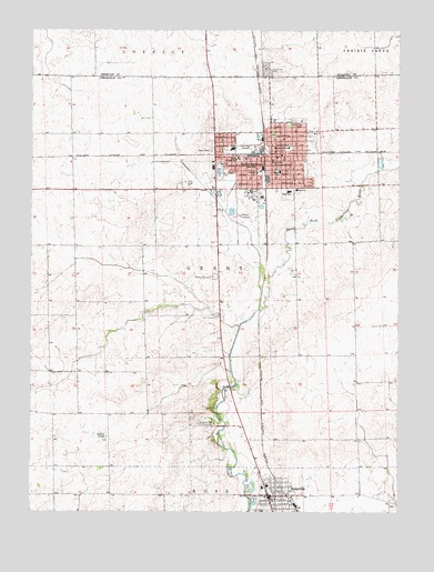
Hoopeston, IL USGS Topographic Map
Click on map above to begin viewing in our Map Viewer.

This topographic map contains these locations and features:
Feature Name Type Latitude Longitude GNIS ID View Map
Beckley Airfield (historical)AirportN40.3953°W87.7242°1764435View Map
Bristle Ridge School (historical)SchoolN40.4109°W87.7345°1764440View Map
City of HoopestonCivilN40.4608°W87.6636°2394415View Map
Cunningham School (historical)SchoolN40.4453°W87.6478°1764451View Map
Demaree School (historical)SchoolN40.4161°W87.6397°1764456View Map
Excelsior School (historical)SchoolN40.4725°W87.7367°1764458View Map
Floral Hill CemeteryCemeteryN40.4906°W87.6700°408467View Map
Frank School (historical)SchoolN40.4581°W87.7497°1764463View Map
Grant School (historical)SchoolN40.4675°W87.6320°1764470View Map
Honeywell Elementary SchoolSchoolN40.4695°W87.6625°410485View Map
HoopestonPopulated PlaceN40.4673°W87.6684°410494View Map
Hoopeston Area High SchoolSchoolN40.4581°W87.6625°1764476View Map
Hoopeston Community Ambulance ServiceBuildingN40.4671°W87.6760°2673942View Map
Hoopeston Community Memorial Hospital HeliportAirportN40.4586°W87.6595°427386View Map
Hoopeston Police DeptBuildingN40.4669°W87.6742°2759084View Map
Hoopeston Post OfficePost OfficeN40.4658°W87.6682°1764477View Map
Hoopeston Regional Health CenterHospitalN40.4586°W87.6598°1823617View Map
Hoopeston United Methodist ChurchChurchN40.4678°W87.6650°1823618View Map
Hoopeston Volunteer Fire DepartmentBuildingN40.4670°W87.6765°2681927View Map
Hoopeston Volunteer Fire DepartmentBuildingN40.4686°W87.6682°2681749View Map
Hubbard Trail Country ClubLocaleN40.3978°W87.6875°425015View Map
John Greer Elementary SchoolSchoolN40.4667°W87.6795°409476View Map
Liberty School (historical)SchoolN40.4442°W87.7122°1764483View Map
Lincoln SchoolSchoolN40.4634°W87.6722°412163View Map
Maple Elementary SchoolSchoolN40.4634°W87.6656°412964View Map
McFerren ParkParkN40.4625°W87.6861°413261View Map
Redtop CemeteryCemeteryN40.4258°W87.6869°416467View Map
Redtop School (historical)SchoolN40.4259°W87.6861°1764503View Map
RossvillePopulated PlaceN40.3792°W87.6686°424549View Map
Rossville Area Fire Protection DistrictBuildingN40.3858°W87.6716°2682545View Map
Rossville Community Ambulance ServiceBuildingN40.3791°W87.6699°2673953View Map
Rossville Police DepartmentBuildingN40.3794°W87.6681°2758911View Map
Rossville Post OfficePost OfficeN40.3783°W87.6676°2788326View Map
Rossville-Alvin Elementary SchoolSchoolN40.3814°W87.6709°1823637View Map
Rossville-Alvin High SchoolSchoolN40.3817°W87.6695°1823638View Map
Squankum School (historical)SchoolN40.3795°W87.7411°1764511View Map
Township of GrantCivilN40.4383°W87.6443°429072View Map
Union ParkParkN40.4756°W87.6625°1764515View Map
Village of RossvilleCivilN40.3815°W87.6699°2399127View Map
Waveland School (historical)SchoolN40.3939°W87.6292°1764519View Map
WHPO-FM (Hoopeston)TowerN40.4767°W87.6934°428502View Map

Note: Coordinates in the location and feature list above are referenced to NAD83 datum.


Copyright (C) 2008-2025 Ryan Niemi / Sunset Dynamics ... All Rights Reserved