TopoQuest Logo
Do you find TopoQuest useful?
Help keep TopoQuest running and adding new maps/features by donating!
Bitcoin:  19c7KJd3qBynnjoSw5npx9KScwjBe4ifkT
Litecoin:  LXs6TkuXGGXo1vDsWCkWVdjQX94eUKd6ui
Home View Maps Find Maps Find Places Resources & Links


Scott City, Missouri Topographic Map

USGS Map Title: Scott City, MO
USGS Map MRC: 37089B5
DRG (GeoTIFF) Download: o37089b5.tif


Neighboring USGS Topographic Map Quads:


  Gordonville, MO  
37089C6
 

  Cape Girardeau, MO  
37089C5
 

  McClure, IL  
37089C4
 

  Chaffee, MO  
37089B6
 

  Scott City, MO  
37089B5
 

  Thebes, IL  
37089B4
 

  Oran, MO  
37089A6
 

  Morley, MO  
37089A5
 

  Thebes SW, MO  
37089A4


Map MRC Location:

N38°
W90°
N38°
W89°
H8 H7 H6 H5 H4 H3 H2 H1
G8 G7 G6 G5 G4 G3 G2 G1
F8 F7 F6 F5 F4 F3 F2 F1
E8 E7 E6 E5 E4 E3 E2 E1
D8 D7 D6 D5 D4 D3 D2 D1
C8 C7 C6 C5 C4 C3 C2 C1
B8 B7 B6 B5 B4 B3 B2 B1
A8 A7 A6 A5 A4 A3 A2 A1
N37°
W90°
N37°
W89°

Scott City, MO USGS 1:24K Topographic Map Preview:
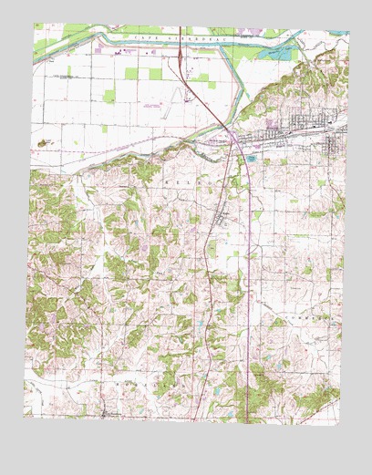
Scott City, MO USGS Topographic Map
Click on map above to begin viewing in our Map Viewer.

This topographic map contains these locations and features:
Feature Name Type Latitude Longitude GNIS ID View Map
Ancell CemeteryCemeteryN37.1684°W89.5206°713272View Map
Anton Niederkorn DamDamN37.1267°W89.5434°765516View Map
Bonhardt CemeteryCemeteryN37.2262°W89.5004°714523View Map
Cape Girardeau Regional AirportAirportN37.2259°W89.5650°758622View Map
City of Scott CityCivilN37.2243°W89.5361°2396557View Map
Clymer CemeteryCemeteryN37.1525°W89.5095°716024View Map
Debol SchoolSchoolN37.1992°W89.5862°716777View Map
Diebold Orchards Lake Section 13ReservoirN37.1783°W89.5753°765580View Map
Diebold Orchards Section 13 DamDamN37.1767°W89.5751°765579View Map
Diebold Orchards Section 14 DamDamN37.1784°W89.5801°765530View Map
Diebold Orchards Section 14 LakeReservoirN37.1784°W89.5801°765531View Map
Draper LakeReservoirN37.1350°W89.5487°765542View Map
Draper Lake DamDamN37.1351°W89.5484°765541View Map
Dutchtown DitchCanalN37.2478°W89.5820°717219View Map
East Fork Sals CreekStreamN37.1823°W89.5948°717301View Map
Eisleben ChurchChurchN37.1903°W89.5501°730399View Map
HilltopPopulated PlaceN37.2317°W89.5068°740554View Map
IllmoPopulated PlaceN37.2198°W89.5090°731590View Map
Illmo BranchStreamN37.2098°W89.5440°720075View Map
Illmo-Scott City SchoolSchoolN37.2142°W89.5487°720076View Map
KaechelsLocaleN37.2164°W89.5768°740555View Map
KelsoPopulated PlaceN37.1906°W89.5495°720525View Map
Kelso Post OfficePost OfficeN37.1909°W89.5491°2783182View Map
Little Caney CreekStreamN37.1370°W89.6243°721185View Map
Lost HillSummitN37.2120°W89.6204°721593View Map
Marquette LakesReservoirN37.2423°W89.5294°721893View Map
Massey (historical)LocaleN37.2451°W89.5193°748058View Map
Mothershead LakeReservoirN37.1378°W89.5641°765584View Map
Mothershead Lake DamDamN37.1384°W89.5651°765583View Map
Mount Zion CemeteryCemeteryN37.2139°W89.5115°722929View Map
NashPopulated PlaceN37.2381°W89.6195°741090View Map
New HamburgPopulated PlaceN37.1264°W89.5934°731624View Map
Niederkorn LakeReservoirN37.1281°W89.5430°765517View Map
Pleasant Hill Church (historical)ChurchN37.1517°W89.5098°730400View Map
Pleasant Hill School (historical)SchoolN37.1512°W89.5176°748059View Map
Ramsey BranchStreamN37.2478°W89.5534°725089View Map
Ramsey CreekStreamN37.2448°W89.5512°725093View Map
Ramsey Creek Diversion ChannelChannelN37.2262°W89.5437°725094View Map
Rockview CemeteryCemeteryN37.1989°W89.6215°725491View Map
Saint Lawrence ChurchChurchN37.1267°W89.5937°730398View Map
Sals CreekStreamN37.2137°W89.5609°725963View Map
Sals Creek Diversion ChannelChannelN37.2092°W89.5829°725964View Map
Scott CityPopulated PlaceN37.2167°W89.5245°735843View Map
Scott City Fire DepartmentBuildingN37.2194°W89.5156°2621241View Map
Scott City Police DepartmentBuildingN37.2193°W89.5160°2752261View Map
Scott City Post OfficePost OfficeN37.2151°W89.5074°2782905View Map
Shearer School (historical)SchoolN37.1542°W89.5531°748060View Map
Spradlin CemeteryCemeteryN37.1748°W89.5004°726877View Map
Township of KelsoCivilN37.1936°W89.5670°767386View Map
Village of KelsoCivilN37.1922°W89.5504°2398334View Map
West Fork Sals CreekStreamN37.1823°W89.5948°728576View Map
Westerwell CemeteryCemeteryN37.2409°W89.5129°728645View Map

Note: Coordinates in the location and feature list above are referenced to NAD83 datum.


Copyright (C) 2008-2025 Ryan Niemi / Sunset Dynamics ... All Rights Reserved