TopoQuest Logo
Do you find TopoQuest useful?
Help keep TopoQuest running and adding new maps/features by donating!
Bitcoin:  19c7KJd3qBynnjoSw5npx9KScwjBe4ifkT
Litecoin:  LXs6TkuXGGXo1vDsWCkWVdjQX94eUKd6ui
Home View Maps Find Maps Find Places Resources & Links


Gordonville, Missouri Topographic Map

USGS Map Title: Gordonville, MO
USGS Map MRC: 37089C6
DRG (GeoTIFF) Download: o37089c6.tif


Neighboring USGS Topographic Map Quads:


  Millersville, MO  
37089D7
 

  Jackson, MO  
37089D6
 

  Cape Girardeau NE, MO  
37089D5
 

  Burfordville, MO  
37089C7
 

  Gordonville, MO  
37089C6
 

  Cape Girardeau, MO  
37089C5
 

  Whitewater, MO  
37089B7
 

  Chaffee, MO  
37089B6
 

  Scott City, MO  
37089B5


Map MRC Location:

N38°
W90°
N38°
W89°
H8 H7 H6 H5 H4 H3 H2 H1
G8 G7 G6 G5 G4 G3 G2 G1
F8 F7 F6 F5 F4 F3 F2 F1
E8 E7 E6 E5 E4 E3 E2 E1
D8 D7 D6 D5 D4 D3 D2 D1
C8 C7 C6 C5 C4 C3 C2 C1
B8 B7 B6 B5 B4 B3 B2 B1
A8 A7 A6 A5 A4 A3 A2 A1
N37°
W90°
N37°
W89°

Gordonville, MO USGS 1:24K Topographic Map Preview:
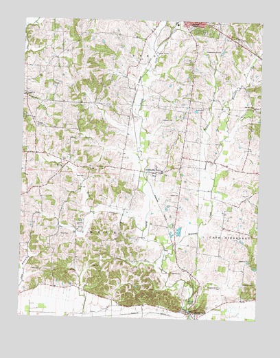
Gordonville, MO USGS Topographic Map
Click on map above to begin viewing in our Map Viewer.

This topographic map contains these locations and features:
Feature Name Type Latitude Longitude GNIS ID View Map
Abernathy School (historical)SchoolN37.2876°W89.6265°748128View Map
Beach CemeteryCemeteryN37.3134°W89.7068°713763View Map
Bethel Church (historical)ChurchN37.3420°W89.6604°730548View Map
Davis CemeteryCemeteryN37.3239°W89.6487°716708View Map
DutchtownPopulated PlaceN37.2528°W89.6598°731565View Map
Dutchtown Census Designated PlaceCensusN37.2508°W89.6557°2791524View Map
Dutchtown Post OfficePost OfficeN37.2507°W89.6575°2782778View Map
Eakon CemeteryCemeteryN37.3092°W89.7170°717238View Map
Eggimann CemeteryCemeteryN37.2692°W89.6698°717417View Map
Evangelical ChurchChurchN37.2634°W89.6456°717670View Map
Evans Lake EastReservoirN37.2567°W89.6751°765478View Map
Evans Lake East DamDamN37.2567°W89.6751°765477View Map
Evans Lake WestReservoirN37.2584°W89.6851°765476View Map
Evans Lake West DamDamN37.2584°W89.6851°765475View Map
Foster CreekStreamN37.2867°W89.6851°718119View Map
Gartung CemeteryCemeteryN37.2700°W89.7437°718364View Map
Goose CreekStreamN37.3601°W89.6798°718586View Map
GordonvillePopulated PlaceN37.3112°W89.6793°731575View Map
Gordonville Area Volunteer Fire Department Station 1BuildingN37.3113°W89.6752°2621161View Map
Gordonville Area Volunteer Fire Department Station 2BuildingN37.3059°W89.7465°2620343View Map
Gordonville Area Volunteer Fire Department Station 3BuildingN37.2525°W89.6588°2620304View Map
Gordonville Post OfficePost OfficeN37.3109°W89.6669°2783120View Map
Hager CemeteryCemeteryN37.2717°W89.7081°718969View Map
Hayden CemeteryCemeteryN37.3017°W89.6715°719254View Map
Hitt CemeteryCemeteryN37.3020°W89.6304°719639View Map
HouckPopulated PlaceN37.3009°W89.7487°739929View Map
Immanuel ChurchChurchN37.3434°W89.7490°720087View Map
Keller Spur (historical)LocaleN37.2831°W89.6704°740390View Map
Kimbeland Country ClubLocaleN37.3626°W89.6465°755249View Map
Kinder CemeteryCemeteryN37.2850°W89.7248°720596View Map
McGuire CemeteryCemeteryN37.3384°W89.6551°722123View Map
McKendrie ChapelChurchN37.3620°W89.6309°740391View Map
Needmore School (historical)SchoolN37.2826°W89.6959°748125View Map
Number 786 DamDamN37.3651°W89.6434°764779View Map
Number 804 DamDamN37.2867°W89.6651°764787View Map
Number 805 DamDamN37.2967°W89.6734°764788View Map
Oak Grove School (historical)SchoolN37.3395°W89.6290°723595View Map
Pemberton LakeReservoirN37.2717°W89.6834°763887View Map
Pemberton Lake Dam - US Survey 2283 DamDamN37.2717°W89.6834°763886View Map
Pemberton Lake Section 22ReservoirN37.2601°W89.7034°764792View Map
Pemberton Lake Section 22 DamDamN37.2601°W89.7034°764791View Map
Poplar Grove SchoolSchoolN37.3420°W89.6618°748126View Map
Randol CreekStreamN37.3089°W89.6484°725099View Map
Saint James ChurchChurchN37.3342°W89.7484°725753View Map
Sandy Ridge School (historical)SchoolN37.3484°W89.7112°748124View Map
Shady Grove CemeteryCemeteryN37.2648°W89.6259°726234View Map
Shady Grove School (historical)SchoolN37.2642°W89.6256°748129View Map
Smith CemeteryCemeteryN37.3164°W89.7265°726589View Map
Southeast LowlandsAreaN37.2503°W89.6254°754115View Map
Suedekum CemeteryCemeteryN37.2748°W89.6293°727213View Map
Summers CemeteryCemeteryN37.3337°W89.6765°727284View Map
Thompson CemeteryCemeteryN37.2900°W89.7193°727595View Map
TilsitPopulated PlaceN37.3303°W89.7420°727662View Map
Township of HubbleCivilN37.2805°W89.7257°766398View Map
Village of Dutchtown (historical)CivilN37.2508°W89.6557°2398763View Map
Village of GordonvilleCivilN37.3111°W89.6739°2398180View Map
Williams CreekStreamN37.2748°W89.6745°731668View Map
Zion ChurchChurchN37.2887°W89.6701°729238View Map
Zion ChurchChurchN37.3134°W89.7290°729239View Map
Zion United Methodist Church CemeteryCemeteryN37.3128°W89.7296°2681393View Map

Note: Coordinates in the location and feature list above are referenced to NAD83 datum.


Copyright (C) 2008-2025 Ryan Niemi / Sunset Dynamics ... All Rights Reserved