TopoQuest Logo
Do you find TopoQuest useful?
Help keep TopoQuest running and adding new maps/features by donating!
Bitcoin:  19c7KJd3qBynnjoSw5npx9KScwjBe4ifkT
Litecoin:  LXs6TkuXGGXo1vDsWCkWVdjQX94eUKd6ui
Home View Maps Find Maps Find Places Resources & Links


Scottsburg, Indiana Topographic Map

USGS Map Title: Scottsburg, IN
USGS Map MRC: 38085F7
DRG (GeoTIFF) Download: o38085f7.tif


Neighboring USGS Topographic Map Quads:


  Tampico, IN  
38085G8
 

  Crothersville, IN  
38085G7
 

  Deputy, IN  
38085G6
 

  Little York, IN  
38085F8
 

  Scottsburg, IN  
38085F7
 

  Blocher, IN  
38085F6
 

  South Boston, IN  
38085E8
 

  Henryville, IN  
38085E7
 

  Otisco, IN  
38085E6


Map MRC Location:

N39°
W86°
N39°
W85°
H8 H7 H6 H5 H4 H3 H2 H1
G8 G7 G6 G5 G4 G3 G2 G1
F8 F7 F6 F5 F4 F3 F2 F1
E8 E7 E6 E5 E4 E3 E2 E1
D8 D7 D6 D5 D4 D3 D2 D1
C8 C7 C6 C5 C4 C3 C2 C1
B8 B7 B6 B5 B4 B3 B2 B1
A8 A7 A6 A5 A4 A3 A2 A1
N38°
W86°
N38°
W85°

Scottsburg, IN USGS 1:24K Topographic Map Preview:
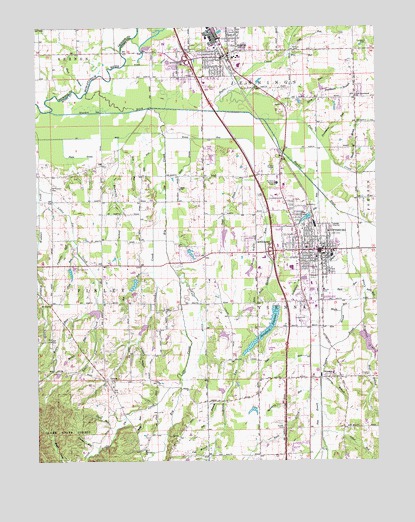
Scottsburg, IN USGS Topographic Map
Click on map above to begin viewing in our Map Viewer.

This topographic map contains these locations and features:
Feature Name Type Latitude Longitude GNIS ID View Map
Austin Elementary SchoolSchoolN38.7409°W85.8025°447123View Map
Austin Fire BaseBuildingN38.7453°W85.8085°2625599View Map
Austin High SchoolSchoolN38.7409°W85.8025°447121View Map
Austin Middle SchoolSchoolN38.7409°W85.8025°447122View Map
Austin Police DepartmentBuildingN38.7418°W85.8070°2758134View Map
Baby RunStreamN38.6389°W85.8372°430381View Map
Bee BranchStreamN38.6423°W85.8066°430702View Map
Big Ox CreekStreamN38.7312°W85.8561°431049View Map
Bird RunStreamN38.6781°W85.7561°431103View Map
Brown RunStreamN38.6631°W85.8544°431631View Map
Buzz GullyValleyN38.6889°W85.7912°431916View Map
Calf CreekStreamN38.6781°W85.8230°431959View Map
Carlisle RunStreamN38.6889°W85.8614°432133View Map
City of AustinCivilN38.7417°W85.8118°2397445View Map
City of ScottsburgCivilN38.6854°W85.7830°2396560View Map
Clark RunStreamN38.6342°W85.8461°432563View Map
Cold RunStreamN38.7445°W85.7811°432748View Map
Coonie CreekStreamN38.6998°W85.8275°432938View Map
Craig CemeteryCemeteryN38.7015°W85.7920°433078View Map
Cravens CemeteryCemeteryN38.6495°W85.7555°433095View Map
Cub BranchStreamN38.6301°W85.8102°433232View Map
David Garriott LakeReservoirN38.6612°W85.8061°447849View Map
David Garriott Lake DamDamN38.6621°W85.8076°447850View Map
Dog RunStreamN38.6798°W85.8325°450859View Map
Don Reid LakeReservoirN38.6813°W85.8623°447823View Map
Don Reid Lake DamDamN38.6817°W85.8633°447822View Map
Elm BranchStreamN38.6678°W85.7630°434116View Map
Estil RunStreamN38.6734°W85.7541°434240View Map
Everitt CemeteryCemeteryN38.6345°W85.7849°434268View Map
Finley Township Volunteer Fire DepartmentBuildingN38.6820°W85.8511°2626483View Map
Fire RunStreamN38.7420°W85.7819°434495View Map
Five BranchStreamN38.7314°W85.8602°434538View Map
Flat CreekStreamN38.7237°W85.7908°434560View Map
Forest Helton Lake DamDamN38.6701°W85.7950°447824View Map
Forest RunStreamN38.6287°W85.8530°434668View Map
Forrest Helton LakeReservoirN38.6687°W85.7971°447825View Map
Hamilton and Ridlen LakeReservoirN38.6784°W85.8383°447848View Map
Hamilton and Ridlen Lake DamDamN38.6784°W85.8383°447847View Map
Honey RunStreamN38.7187°W85.8275°436395View Map
Hope BranchStreamN38.6567°W85.7522°436433View Map
Hopewell DrainStreamN38.6648°W85.7555°436467View Map
Hosea LakeReservoirN38.6849°W85.8182°447846View Map
Hosea Lake DamDamN38.6867°W85.8183°447845View Map
Hutto CreekStreamN38.7259°W85.8080°436663View Map
Iola LakeReservoirN38.6950°W85.7757°436822View Map
Iola RunStreamN38.7031°W85.7714°436823View Map
Jabber RunStreamN38.6331°W85.7705°436870View Map
Jennings Township Volunteer Fire DepartmentBuildingN38.7416°W85.8078°2626587View Map
LeotaPopulated PlaceN38.6484°W85.8502°437786View Map
Little Joe CreekStreamN38.7042°W85.8739°438083View Map
Little Ox CreekStreamN38.6476°W85.8230°438110View Map
Maple RunStreamN38.6739°W85.7544°438577View Map
Marshall King LakeReservoirN38.6897°W85.8061°447821View Map
Marshall King Lake DamDamN38.6917°W85.8057°447820View Map
MarshfieldPopulated PlaceN38.7092°W85.7816°452180View Map
Mount Pleasant CemeteryCemeteryN38.7034°W85.8695°439645View Map
Mount Zion ChurchChurchN38.6701°W85.8697°439755View Map
Nest RunStreamN38.6553°W85.7747°440001View Map
New Providence ChurchChurchN38.7298°W85.7575°440104View Map
Old Ox ChurchChurchN38.6281°W85.8358°440582View Map
Old RunStreamN38.7198°W85.8350°440588View Map
Ox DitchCanalN38.7184°W85.8558°440814View Map
Pigeon Roost CreekStreamN38.6959°W85.7608°441124View Map
Plain DrainStreamN38.7184°W85.8650°441217View Map
Plow DrainStreamN38.7181°W85.8183°441360View Map
Providence BranchStreamN38.7312°W85.7697°441617View Map
Providence RunStreamN38.7170°W85.7702°441624View Map
Puppy HollowValleyN38.6586°W85.8384°441647View Map
Rail RunStreamN38.6437°W85.7752°441739View Map
Roosting RunStreamN38.6287°W85.7691°442282View Map
Running DrainStreamN38.7184°W85.8450°442389View Map
Scott County Sheriff's OfficeBuildingN38.6844°W85.7686°2758446View Map
Scott Memorial HospitalHospitalN38.7050°W85.7864°443165View Map
ScottsburgPopulated PlaceN38.6856°W85.7702°443163View Map
Scottsburg AirportAirportN38.6553°W85.7935°449338View Map
Scottsburg DrainStreamN38.6859°W85.7591°443164View Map
Scottsburg Junior High SchoolSchoolN38.6859°W85.7669°447118View Map
Scottsburg Police DepartmentBuildingN38.6895°W85.7937°2758281View Map
Scottsburg ReservoirReservoirN38.6624°W85.7920°443166View Map
Scottsburg Senior High SchoolSchoolN38.6806°W85.7819°447115View Map
Scottsburg Volunteer Fire Department Station 1BuildingN38.6900°W85.7937°2626372View Map
Scottsburg Volunteer Fire Department Station 2BuildingN38.6843°W85.7719°2626367View Map
Scottsburg Water Works DamDamN38.6696°W85.7873°447432View Map
Small BrookStreamN38.7092°W85.7619°443640View Map
Spurgeon CemeteryCemeteryN38.7449°W85.7526°444024View Map
Steep RunStreamN38.7234°W85.7783°444114View Map
Sting BrookStreamN38.6751°W85.7908°444171View Map
Stink DitchCanalN38.7412°W85.8266°444173View Map
Stop RunStreamN38.7162°W85.8444°444235View Map
Stucker ForkStreamN38.7259°W85.8697°444285View Map
Sycamore RunStreamN38.6484°W85.7705°444516View Map
Third Street Elementary SchoolSchoolN38.6859°W85.7669°447117View Map
Toast BrookStreamN38.7059°W85.7944°444790View Map
Town RunStreamN38.6681°W85.8525°444833View Map
Township of FinleyCivilN38.6447°W85.8524°453295View Map
Township of ViennaCivilN38.6573°W85.7747°453959View Map
Tree CreekStreamN38.6570°W85.7677°444867View Map
ViennaPopulated PlaceN38.6489°W85.7689°445284View Map
Vienna BranchStreamN38.6484°W85.7705°445285View Map
Vienna Elementary SchoolSchoolN38.6503°W85.7666°447119View Map
Vienna Township Volunteer Fire DepartmentBuildingN38.6495°W85.7698°2626361View Map
Whitson CemeteryCemeteryN38.7428°W85.7788°445991View Map
Zion RunStreamN38.6878°W85.8605°446477View Map
Zoah ChurchChurchN38.7037°W85.8225°446486View Map

Note: Coordinates in the location and feature list above are referenced to NAD83 datum.


Copyright (C) 2008-2024 Ryan Niemi / Sunset Dynamics ... All Rights Reserved