TopoQuest Logo
Do you find TopoQuest useful?
Help keep TopoQuest running and adding new maps/features by donating!
Bitcoin:  19c7KJd3qBynnjoSw5npx9KScwjBe4ifkT
Litecoin:  LXs6TkuXGGXo1vDsWCkWVdjQX94eUKd6ui
Home View Maps Find Maps Find Places Resources & Links


Canyon Mountain, Oregon Topographic Map

USGS Map Title: Canyon Mountain, OR
USGS Map MRC: 44118C8
DRG (GeoTIFF) Download: o44118c8.tif


Neighboring USGS Topographic Map Quads:


  Mount Vernon, OR  
44119D1
 

  John Day, OR  
44118D8
 

  Castle Creek, OR  
44118D7
 

  Fall Mountain, OR  
44119C1
 

  Canyon Mountain, OR  
44118C8
 

  Pine Creek Mountain, OR  
44118C7
 

  Scotty Creek, OR  
44119B1
 

  Seneca, OR  
44118B8
 

  Big Canyon, OR  
44118B7


Map MRC Location:

N45°
W119°
N45°
W118°
H8 H7 H6 H5 H4 H3 H2 H1
G8 G7 G6 G5 G4 G3 G2 G1
F8 F7 F6 F5 F4 F3 F2 F1
E8 E7 E6 E5 E4 E3 E2 E1
D8 D7 D6 D5 D4 D3 D2 D1
C8 C7 C6 C5 C4 C3 C2 C1
B8 B7 B6 B5 B4 B3 B2 B1
A8 A7 A6 A5 A4 A3 A2 A1
N44°
W119°
N44°
W118°

Canyon Mountain, OR USGS 1:24K Topographic Map Preview:
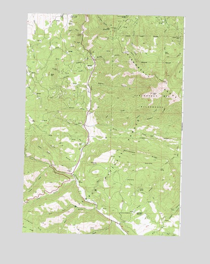
Canyon Mountain, OR USGS Topographic Map
Click on map above to begin viewing in our Map Viewer.

This topographic map contains these locations and features:
Feature Name Type Latitude Longitude GNIS ID View Map
Alder GulchValleyN44.2565°W118.9233°1137091View Map
Alder SpringSpringN44.2881°W118.8920°1137101View Map
Bear GulchValleyN44.2815°W118.9586°1137718View Map
Berry CreekStreamN44.3118°W118.9522°1137949View Map
Big RockPillarN44.3138°W118.9950°1138057View Map
Byram GulchValleyN44.3493°W118.9469°1139092View Map
Canyon City Municipal WatershedBasinN44.3610°W118.9302°1167105View Map
Canyon MountainSummitN44.3368°W118.8900°1139336View Map
Canyon Mountain Recreation Site (historical)LocaleN44.3610°W118.9225°1156234View Map
Canyon Mountain TrailheadLocaleN44.3624°W118.9275°1167630View Map
Cherry GulchValleyN44.3649°W118.9566°1139598View Map
Corral GulchValleyN44.2888°W118.9608°1140150View Map
Cougar CampLocaleN44.3071°W118.8974°1140203View Map
Cougar CreekStreamN44.3096°W118.9194°1140209View Map
Deer CreekStreamN44.3210°W118.9477°1140827View Map
Dry GulchValleyN44.3585°W118.9563°1141328View Map
Eagle PeakSummitN44.3735°W118.9655°1141482View Map
East Fork Canyon Creek TrailheadLocaleN44.2643°W118.8855°1167628View Map
East GulchValleyN44.2652°W118.9416°1141622View Map
Fawn CreekStreamN44.2690°W118.9486°1142037View Map
Fawn SpringSpringN44.2816°W118.9187°1142050View Map
Fawn Spring TrailTrailN44.2777°W118.9105°1142051View Map
Gold CreekStreamN44.3577°W118.9566°1142810View Map
Golden West MineMineN44.3663°W118.9297°1142840View Map
Great Northern MineMineN44.3740°W118.9216°1143018View Map
Grouse CreekStreamN44.3118°W118.9522°1143122View Map
Guernsey PondReservoirN44.2980°W118.9546°1116626View Map
Haggard MineMineN44.3627°W118.8791°1158273View Map
Horseshoe BarBarN44.3657°W118.9552°1160682View Map
Hot SpringsSpringN44.2798°W118.9571°1143833View Map
Iron King MineMineN44.3538°W118.9222°1122271View Map
J Bar L RanchLocaleN44.2888°W118.9608°1167108View Map
Jack Cabin MeadowFlatN44.2631°W118.9100°1144157View Map
Joaquin Miller Recreation SiteLocaleN44.2899°W118.8877°1156228View Map
Joaquin Miller TrailTrailN44.2949°W118.8802°1144286View Map
Joaquin Miller TrailheadLocaleN44.2893°W118.8913°1167629View Map
Little Canyon MountainSummitN44.3657°W118.9341°1145121View Map
Maiden SpringSpringN44.2912°W118.9044°1145756View Map
Miller MountainSummitN44.3399°W118.9808°1146282View Map
Miller Mountain MineMineN44.3432°W118.9750°1146283View Map
Mosier CampLocaleN44.2649°W118.8797°1146484View Map
Mud LakeLakeN44.3011°W118.9537°1146575View Map
Mud SpringSpringN44.3540°W118.8905°1146596View Map
New MineMineN44.3596°W118.8788°1167104View Map
Overholt CreekStreamN44.3418°W118.9475°1147301View Map
Painters GulchValleyN44.3699°W118.9136°1152802View Map
Rabbit RidgeRidgeN44.3165°W118.8955°1148125View Map
Rattlesnake RidgeRidgeN44.2929°W118.8944°1148240View Map
Rattlesnake SpringSpringN44.2898°W118.9424°1148246View Map
Ray Cole CampgroundLocaleN44.2624°W118.9230°1148252View Map
Rhodabush CreekStreamN44.3524°W118.9491°1148404View Map
Road GulchValleyN44.2582°W118.9280°1148507View Map
Sheep GulchValleyN44.3352°W118.9502°1149338View Map
Sheep RockSummitN44.3310°W118.8988°1149350View Map
Soda GulchValleyN44.2885°W118.9783°1149851View Map
South Fork Vance CreekStreamN44.2882°W118.9788°1150036View Map
Vance CreekStreamN44.2849°W118.9602°1151730View Map
Vance Creek Safety Rest Area (historical)LocaleN44.2888°W118.9775°1161747View Map
Wall CreekStreamN44.2527°W118.8936°1151848View Map
Watson GulchValleyN44.3190°W118.9502°1151969View Map
West Fork East GulchValleyN44.2646°W118.9561°1152073View Map
Williams RanchLocaleN44.2602°W118.9024°1167107View Map
Willow SpringSpringN44.2762°W118.9086°1152438View Map

Note: Coordinates in the location and feature list above are referenced to NAD83 datum.


Copyright (C) 2008-2025 Ryan Niemi / Sunset Dynamics ... All Rights Reserved