TopoQuest Logo
Do you find TopoQuest useful?
Help keep TopoQuest running and adding new maps/features by donating!
Bitcoin:  19c7KJd3qBynnjoSw5npx9KScwjBe4ifkT
Litecoin:  LXs6TkuXGGXo1vDsWCkWVdjQX94eUKd6ui
Home View Maps Find Maps Find Places Resources & Links


Seymour East, Iowa Topographic Map

USGS Map Title: Seymour East, IA
USGS Map MRC: 40093F1
DRG (GeoTIFF) Download: o40093f1.tif


Neighboring USGS Topographic Map Quads:


  Confidence, IA  
40093G2
 

  Plano, IA  
40093G1
 

  Mystic, IA  
40092G8
 

  Seymour West, IA  
40093F2
 

  Seymour East, IA  
40093F1
 

  Centerville West, IA  
40092F8
 

  Saint John, MO  
40093E2
 

  Lake Thunderhead, MO  
40093E1
 

  Mendota, MO  
40092E8


Map MRC Location:

N41°
W94°
N41°
W93°
H8 H7 H6 H5 H4 H3 H2 H1
G8 G7 G6 G5 G4 G3 G2 G1
F8 F7 F6 F5 F4 F3 F2 F1
E8 E7 E6 E5 E4 E3 E2 E1
D8 D7 D6 D5 D4 D3 D2 D1
C8 C7 C6 C5 C4 C3 C2 C1
B8 B7 B6 B5 B4 B3 B2 B1
A8 A7 A6 A5 A4 A3 A2 A1
N40°
W94°
N40°
W93°

Seymour East, IA USGS 1:24K Topographic Map Preview:
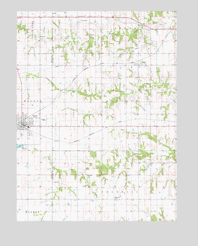
Seymour East, IA USGS Topographic Map
Click on map above to begin viewing in our Map Viewer.

This topographic map contains these locations and features:
Feature Name Type Latitude Longitude GNIS ID View Map
Assembly of God ChurchChurchN40.6883°W93.1202°1970525View Map
City of SeymourCivilN40.6824°W93.1212°2395851View Map
Crossroads CemeteryCemeteryN40.7445°W93.0755°455734View Map
First Baptist ChurchChurchN40.6822°W93.1183°1970523View Map
First Christian ChurchChurchN40.6792°W93.1197°1970522View Map
Fowler Elevator Incorporated ElevatorLocaleN40.6803°W93.1197°1970521View Map
Harkes Post Office (historical)Post OfficeN40.7395°W93.0113°1970147View Map
Hickory CreekStreamN40.6656°W93.0021°457425View Map
JeromeLocaleN40.7203°W93.0294°1970151View Map
JeromePopulated PlaceN40.7189°W93.0283°457945View Map
Jerome CemeteryCemeteryN40.7170°W93.0355°457946View Map
Jerome Post Office (historical)Post OfficeN40.7189°W93.0283°1970152View Map
Johnstown Post Office (historical)Post OfficeN40.7395°W93.0780°1970148View Map
Little Flock ChapelChurchN40.7470°W93.0777°458466View Map
Little Flock Chapel Roadside Rest AreaLocaleN40.7467°W93.0774°1970245View Map
Marsdenville (historical)LocaleN40.7375°W93.0066°1970149View Map
Marsdenville Post Office (historical)Post OfficeN40.7375°W93.0066°1970150View Map
Miller CemeteryCemeteryN40.6817°W93.0185°459098View Map
PianoLocaleN40.7395°W93.0030°466385View Map
Schultz CemeteryCemeteryN40.6481°W93.0916°461481View Map
SeymourLocaleN40.6861°W93.1174°1970518View Map
SeymourPopulated PlaceN40.6825°W93.1210°461518View Map
Seymour Care CenterHospitalN40.6845°W93.1119°1970526View Map
Seymour City ReservoirReservoirN40.6691°W93.1240°461519View Map
Seymour Elementary SchoolSchoolN40.6812°W93.1158°1970528View Map
Seymour Fire StationHospitalN40.6825°W93.1210°1970517View Map
Seymour High SchoolSchoolN40.6810°W93.1160°2719878View Map
Seymour Lake ParkParkN40.6695°W93.1244°1970529View Map
Seymour Medical ClinicHospitalN40.6828°W93.1219°1970527View Map
Seymour Post OfficePost OfficeN40.6833°W93.1197°1970519View Map
Seymour Public LibraryBuildingN40.6822°W93.1202°1970520View Map
Seymour Volunteer Fire DepartmentBuildingN40.6818°W93.1215°2577178View Map
Southlawn CemeteryCemeteryN40.6765°W93.1211°461832View Map
Township of FranklinCivilN40.6262°W93.0402°467849View Map
Township of LincolnCivilN40.6958°W93.0399°468239View Map
United Methodist ChurchChurchN40.6839°W93.1213°1970524View Map
Walsh Post Office (historical)Post OfficeN40.6625°W93.0969°1970146View Map

Note: Coordinates in the location and feature list above are referenced to NAD83 datum.


Copyright (C) 2008-2024 Ryan Niemi / Sunset Dynamics ... All Rights Reserved