TopoQuest Logo
Do you find TopoQuest useful?
Help keep TopoQuest running and adding new maps/features by donating!
Bitcoin:  19c7KJd3qBynnjoSw5npx9KScwjBe4ifkT
Litecoin:  LXs6TkuXGGXo1vDsWCkWVdjQX94eUKd6ui
Home View Maps Find Maps Find Places Resources & Links


Shackleford, Missouri Topographic Map

USGS Map Title: Shackleford, MO
USGS Map MRC: 39093A3
DRG (GeoTIFF) Download: o39093a3.tif


Neighboring USGS Topographic Map Quads:


  Grand Pass, MO  
39093B4
 

  Malta Bend, MO  
39093B3
 

  Marshall North, MO  
39093B2
 

  Blackburn, MO  
39093A4
 

  Shackleford, MO  
39093A3
 

  Marshall South, MO  
39093A2
 

  Sweet Springs, MO  
38093H4
 

  Houstonia, MO  
38093H3
 

  Longwood, MO  
38093H2


Map MRC Location:

N40°
W94°
N40°
W93°
H8 H7 H6 H5 H4 H3 H2 H1
G8 G7 G6 G5 G4 G3 G2 G1
F8 F7 F6 F5 F4 F3 F2 F1
E8 E7 E6 E5 E4 E3 E2 E1
D8 D7 D6 D5 D4 D3 D2 D1
C8 C7 C6 C5 C4 C3 C2 C1
B8 B7 B6 B5 B4 B3 B2 B1
A8 A7 A6 A5 A4 A3 A2 A1
N39°
W94°
N39°
W93°

Shackleford, MO USGS 1:24K Topographic Map Preview:
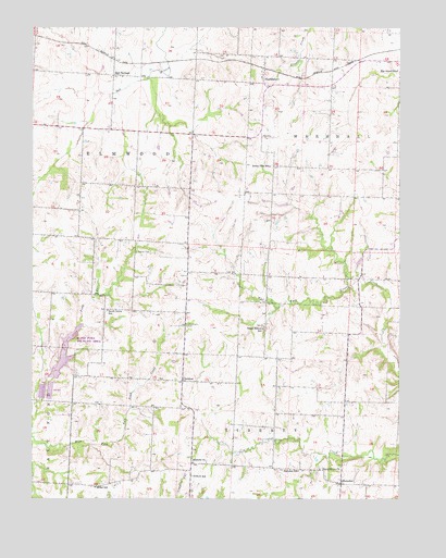
Shackleford, MO USGS Topographic Map
Click on map above to begin viewing in our Map Viewer.

This topographic map contains these locations and features:
Feature Name Type Latitude Longitude GNIS ID View Map
Antioch ChurchChurchN39.0097°W93.3208°713332View Map
Antioch School (historical)SchoolN39.0061°W93.3210°713347View Map
Blind Pony LakeReservoirN39.0390°W93.3637°762884View Map
Blind Pony Lake DamDamN39.0317°W93.3685°762883View Map
Blind Pony Wildlife AreaParkN39.0414°W93.3616°714369View Map
CretcherPopulated PlaceN39.0314°W93.3241°716493View Map
Elm Grove School (historical)SchoolN39.1136°W93.2508°717518View Map
Fulkerson School (historical)SchoolN39.0916°W93.3444°743571View Map
Goshen CemeteryCemeteryN39.0656°W93.3399°718626View Map
Green Mound School (historical)SchoolN39.0453°W93.2966°718803View Map
Hazel Grove ChurchChurchN39.0081°W93.2774°719290View Map
HerndonPopulated PlaceN39.0042°W93.2702°719400View Map
Herndon School (historical)SchoolN39.0075°W93.2844°719402View Map
Miller School (historical)SchoolN39.0028°W93.3535°722391View Map
Providence CemeteryCemeteryN39.0461°W93.3224°724966View Map
Salt SpringsPopulated PlaceN39.1122°W93.3474°741234View Map
ShacklefordPopulated PlaceN39.1125°W93.2969°726225View Map
South Grove School (historical)SchoolN39.0500°W93.3497°726761View Map
Stonewall School (historical)SchoolN39.0578°W93.2505°743605View Map
Sunny Side School (historical)SchoolN39.0884°W93.2941°727302View Map

Note: Coordinates in the location and feature list above are referenced to NAD83 datum.


Copyright (C) 2008-2025 Ryan Niemi / Sunset Dynamics ... All Rights Reserved