TopoQuest Logo
Do you find TopoQuest useful?
Help keep TopoQuest running and adding new maps/features by donating!
Bitcoin:  19c7KJd3qBynnjoSw5npx9KScwjBe4ifkT
Litecoin:  LXs6TkuXGGXo1vDsWCkWVdjQX94eUKd6ui
Home View Maps Find Maps Find Places Resources & Links


Marshall North, Missouri Topographic Map

USGS Map Title: Marshall North, MO
USGS Map MRC: 39093B2
DRG (GeoTIFF) Download: o39093b2.tif


Neighboring USGS Topographic Map Quads:


  Miami Station, MO  
39093C3
 

  Miami, MO  
39093C2
 

  New Frankfort, MO  
39093C1
 

  Malta Bend, MO  
39093B3
 

  Marshall North, MO  
39093B2
 

  Slater, MO  
39093B1
 

  Shackleford, MO  
39093A3
 

  Marshall South, MO  
39093A2
 

  Napton, MO  
39093A1


Map MRC Location:

N40°
W94°
N40°
W93°
H8 H7 H6 H5 H4 H3 H2 H1
G8 G7 G6 G5 G4 G3 G2 G1
F8 F7 F6 F5 F4 F3 F2 F1
E8 E7 E6 E5 E4 E3 E2 E1
D8 D7 D6 D5 D4 D3 D2 D1
C8 C7 C6 C5 C4 C3 C2 C1
B8 B7 B6 B5 B4 B3 B2 B1
A8 A7 A6 A5 A4 A3 A2 A1
N39°
W94°
N39°
W93°

Marshall North, MO USGS 1:24K Topographic Map Preview:
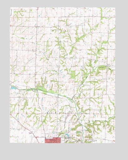
Marshall North, MO USGS Topographic Map
Click on map above to begin viewing in our Map Viewer.

This topographic map contains these locations and features:
Feature Name Type Latitude Longitude GNIS ID View Map
Bryan LakeReservoirN39.1654°W93.2117°762345View Map
Bryan Lake DamDamN39.1667°W93.2119°762344View Map
Chappell School (historical)SchoolN39.1520°W93.1933°743563View Map
Cow CreekStreamN39.1650°W93.1760°716405View Map
East Cow CreekStreamN39.1759°W93.1669°717266View Map
FairvillePopulated PlaceN39.2320°W93.2183°740843View Map
Herring School (historical)SchoolN39.1943°W93.2452°743574View Map
Jester School (historical)SchoolN39.1253°W93.1277°743576View Map
KMMO-AM (Marshall)TowerN39.1364°W93.2235°759224View Map
KMMO-FM (Marshall)TowerN39.1364°W93.2235°754249View Map
Maple Grove School (historical)SchoolN39.1606°W93.1552°743582View Map
Marsh LakeReservoirN39.1507°W93.1493°762347View Map
Marsh Lake DamDamN39.1500°W93.1485°762346View Map
Marshall Habilitation CenterSchoolN39.1297°W93.1808°721908View Map
Marshall Habilitation Center LakeReservoirN39.1324°W93.1814°761466View Map
Marshall State School Lake DamDamN39.1317°W93.1802°761465View Map
Montague HillPopulated PlaceN39.1284°W93.1524°722535View Map
Mount Carmel ChurchChurchN39.2100°W93.2230°722735View Map
NortonPopulated PlaceN39.1961°W93.1349°741109View Map
Odell CemeteryCemeteryN39.1353°W93.1841°723695View Map
Plum BranchStreamN39.2153°W93.1766°724660View Map
Prairie Home School (historical)SchoolN39.1520°W93.2391°743593View Map
Robert Leigh School (historical)SchoolN39.1878°W93.2109°743597View Map
Rock CreekStreamN39.1459°W93.1652°725443View Map
Saline CountyCivilN39.1368°W93.2019°758550View Map
Sandy Hill School (historical)SchoolN39.2035°W93.1866°2573570View Map
State School Dam BDamN39.1334°W93.1819°761467View Map
Sulphur Springs School (historical)SchoolN39.1851°W93.1641°743606View Map
Sunny Side School (historical)SchoolN39.2414°W93.1555°743607View Map
Thrailkill BranchStreamN39.1917°W93.1510°727626View Map
Wallys LakeReservoirN39.1350°W93.1669°760652View Map
Wallys Lake DamDamN39.1350°W93.1669°760651View Map
West Cow CreekStreamN39.1759°W93.1669°728543View Map
Wildcat BranchStreamN39.1695°W93.1930°728829View Map

Note: Coordinates in the location and feature list above are referenced to NAD83 datum.


Copyright (C) 2008-2025 Ryan Niemi / Sunset Dynamics ... All Rights Reserved