TopoQuest Logo
Do you find TopoQuest useful?
Help keep TopoQuest running and adding new maps/features by donating!
Bitcoin:  19c7KJd3qBynnjoSw5npx9KScwjBe4ifkT
Litecoin:  LXs6TkuXGGXo1vDsWCkWVdjQX94eUKd6ui
Home View Maps Find Maps Find Places Resources & Links


Marshall South, Missouri Topographic Map

USGS Map Title: Marshall South, MO
USGS Map MRC: 39093A2
DRG (GeoTIFF) Download: o39093a2.tif


Neighboring USGS Topographic Map Quads:


  Malta Bend, MO  
39093B3
 

  Marshall North, MO  
39093B2
 

  Slater, MO  
39093B1
 

  Shackleford, MO  
39093A3
 

  Marshall South, MO  
39093A2
 

  Napton, MO  
39093A1
 

  Houstonia, MO  
38093H3
 

  Longwood, MO  
38093H2
 

  Nelson, MO  
38093H1


Map MRC Location:

N40°
W94°
N40°
W93°
H8 H7 H6 H5 H4 H3 H2 H1
G8 G7 G6 G5 G4 G3 G2 G1
F8 F7 F6 F5 F4 F3 F2 F1
E8 E7 E6 E5 E4 E3 E2 E1
D8 D7 D6 D5 D4 D3 D2 D1
C8 C7 C6 C5 C4 C3 C2 C1
B8 B7 B6 B5 B4 B3 B2 B1
A8 A7 A6 A5 A4 A3 A2 A1
N39°
W94°
N39°
W93°

Marshall South, MO USGS 1:24K Topographic Map Preview:
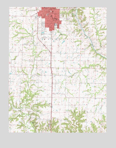
Marshall South, MO USGS Topographic Map
Click on map above to begin viewing in our Map Viewer.

This topographic map contains these locations and features:
Feature Name Type Latitude Longitude GNIS ID View Map
Benton Elementary SchoolSchoolN39.1172°W93.2013°713971View Map
Blue LickPopulated PlaceN39.0134°W93.2102°740682View Map
Blue Lick School (historical)SchoolN39.0127°W93.2010°743556View Map
Blue Lick SpringsSpringN39.0097°W93.2208°714412View Map
Bucksnort School (historical)SchoolN39.0075°W93.2477°743560View Map
Bueker Middle SchoolSchoolN39.1162°W93.1955°2545136View Map
Calvary Baptist SchoolSchoolN39.1016°W93.2106°2545244View Map
City of MarshallCivilN39.1144°W93.2010°2395023View Map
Crooked CreekStreamN39.0178°W93.2297°716518View Map
Downs School (historical)SchoolN39.0859°W93.1869°743566View Map
Eastwood Elementary SchoolSchoolN39.1234°W93.1927°717367View Map
Elgin School (historical)SchoolN39.0647°W93.1951°743652View Map
Fairview CemeteryCemeteryN39.1171°W93.1799°717759View Map
Fitzgibbon HospitalHospitalN39.0917°W93.2132°721907View Map
Indian Foothills ParkParkN39.1192°W93.1680°720130View Map
KNOS-FM (Marshall)TowerN39.1067°W93.1919°759040View Map
MarshallPopulated PlaceN39.1231°W93.1969°721900View Map
Marshall Fire DepartmentBuildingN39.1208°W93.2017°2621012View Map
Marshall High SchoolSchoolN39.1133°W93.2102°2545288View Map
Marshall Memorial Municipal AirportAirportN39.0971°W93.1987°758804View Map
Marshall Police DepartmentBuildingN39.1207°W93.2012°2752335View Map
Marshall Post OfficePost OfficeN39.1224°W93.1976°2782712View Map
MFA Research Farm LakeReservoirN39.0234°W93.1919°762349View Map
MFA Research Farm Lake DamDamN39.0234°W93.1919°762348View Map
Midway ChurchChurchN39.0292°W93.1960°722300View Map
Miles Lake DamDamN39.0717°W93.2052°762350View Map
Missouri Valley CollegeSchoolN39.1078°W93.1910°722478View Map
Mount Airy School (historical)SchoolN39.0386°W93.1785°743583View Map
Mount Olive ChurchChurchN39.0570°W93.2099°722819View Map
North Fork Finney CreekStreamN39.0209°W93.2341°723458View Map
Northwest Elementary SchoolSchoolN39.1249°W93.2045°723517View Map
Number 512 DamDamN39.0984°W93.1569°761475View Map
Peterson LakeReservoirN39.0050°W93.2385°762357View Map
Peterson Lake DamDamN39.0050°W93.2385°762356View Map
Plaza MallLocaleN39.1050°W93.1952°742512View Map
Rasse LakeReservoirN39.0912°W93.1927°762352View Map
Rasse Lake DamDamN39.0917°W93.1919°762351View Map
Ridge Park CemeteryCemeteryN39.1137°W93.1747°725291View Map
Saint Peter's Catholic SchoolSchoolN39.1185°W93.2001°725898View Map
Saline County Career CenterSchoolN39.1150°W93.2111°2545442View Map
Saline County High SchoolSchoolN39.1153°W93.2136°2545170View Map
Saline County Sheriff's OfficeBuildingN39.1166°W93.2230°2752109View Map
Shelby School (historical)SchoolN39.0191°W93.1311°743604View Map
Southeast Elementary SchoolSchoolN39.1125°W93.1937°726806View Map
Sunset Gardens CemeteryCemeteryN39.0997°W93.1963°727327View Map
Thornlea School (historical)SchoolN39.0014°W93.1625°743608View Map
Thorp School (historical)SchoolN39.0639°W93.1483°743609View Map
Town and Country LakeReservoirN39.0997°W93.2068°758355View Map
Town and Country Lake DamDamN39.1000°W93.2085°762353View Map
Town and Country MallLocaleN39.1089°W93.1949°742511View Map
Township of MarshallCivilN39.1230°W93.1998°767364View Map
Township of Salt ForkCivilN39.0200°W93.1395°767366View Map
Vogel LakeReservoirN39.1084°W93.2402°762355View Map
Vogel Lake DamDamN39.1084°W93.2402°762354View Map
West Fork Finney CreekStreamN39.0209°W93.2341°728564View Map

Note: Coordinates in the location and feature list above are referenced to NAD83 datum.


Copyright (C) 2008-2025 Ryan Niemi / Sunset Dynamics ... All Rights Reserved