TopoQuest Logo
Do you find TopoQuest useful?
Help keep TopoQuest running and adding new maps/features by donating!
Bitcoin:  19c7KJd3qBynnjoSw5npx9KScwjBe4ifkT
Litecoin:  LXs6TkuXGGXo1vDsWCkWVdjQX94eUKd6ui
Home View Maps Find Maps Find Places Resources & Links


Sharon, Wisconsin Topographic Map

USGS Map Title: Sharon, WI
USGS Map MRC: 42088E6
DRG (GeoTIFF) Download: o42088e6.tif


Neighboring USGS Topographic Map Quads:


  Avalon, WI  
42088F7
 

  Delavan, WI  
42088F6
 

  Elkhorn, WI  
42088F5
 

  Clinton, WI  
42088E7
 

  Sharon, WI  
42088E6
 

  Walworth, WI  
42088E5
 

  Belvidere NE, IL  
42088D7
 

  Capron, IL  
42088D6
 

  Harvard, IL  
42088D5


Map MRC Location:

N43°
W89°
N43°
W88°
H8 H7 H6 H5 H4 H3 H2 H1
G8 G7 G6 G5 G4 G3 G2 G1
F8 F7 F6 F5 F4 F3 F2 F1
E8 E7 E6 E5 E4 E3 E2 E1
D8 D7 D6 D5 D4 D3 D2 D1
C8 C7 C6 C5 C4 C3 C2 C1
B8 B7 B6 B5 B4 B3 B2 B1
A8 A7 A6 A5 A4 A3 A2 A1
N42°
W89°
N42°
W88°

Sharon, WI USGS 1:24K Topographic Map Preview:
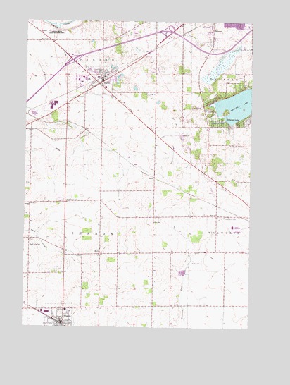
Sharon, WI USGS Topographic Map
Click on map above to begin viewing in our Map Viewer.

This topographic map contains these locations and features:
Feature Name Type Latitude Longitude GNIS ID View Map
Barten AirportAirportN42.5175°W88.7454°1582196View Map
Big Foot AirfieldAirportN42.5306°W88.6513°1582250View Map
Brick ChurchChurchN42.5464°W88.6440°1562187View Map
Brick Church CemeteryCemeteryN42.5452°W88.6392°1562188View Map
Christ Lutheran ChurchChurchN42.5050°W88.7273°2003875View Map
Community Baptist ChurchChurchN42.6011°W88.7062°2003876View Map
DarienPopulated PlaceN42.6017°W88.7076°1563712View Map
Darien CemeteryCemeteryN42.6056°W88.7173°2002802View Map
Darien Elementary SchoolSchoolN42.5980°W88.7059°1851239View Map
Darien Emergency Medical ServicesBuildingN42.6024°W88.7155°2698398View Map
Darien Police DepartmentBuildingN42.6009°W88.7080°2759379View Map
Darien Post OfficePost OfficeN42.6002°W88.7075°2768312View Map
Darien Volunteer Fire DepartmentBuildingN42.6024°W88.7155°2697952View Map
Delavan LakePopulated PlaceN42.5842°W88.6326°1563875View Map
Delavan Township Volunteer Fire Department Station 3BuildingN42.5896°W88.6508°2698090View Map
Elton SchoolSchoolN42.5431°W88.6782°1564596View Map
Fest ParkParkN42.6231°W88.6273°1851255View Map
North Sharon CemeteryCemeteryN42.5517°W88.7270°1570499View Map
Oakwood CemeteryCemeteryN42.5230°W88.7315°1570718View Map
Pioneer EstatesPopulated PlaceN42.6208°W88.6903°2508620View Map
Red SchoolSchoolN42.5306°W88.7082°1572156View Map
Saint Catherine Catholic ChurchChurchN42.5025°W88.7240°2003881View Map
Salt Box SchoolSchoolN42.5503°W88.7473°1573638View Map
SharonPopulated PlaceN42.5025°W88.7290°1573968View Map
Sharon Community SchoolSchoolN42.5072°W88.7259°1851336View Map
Sharon Fire and RescueBuildingN42.5002°W88.7222°2697873View Map
Sharon Police DepartmentBuildingN42.5027°W88.7298°2759669View Map
Smilin' Sam's Airport (historical)AirportN42.5872°W88.6582°1581021View Map
South Grove CemeteryCemeteryN42.5331°W88.7468°1574457View Map
Town of SharonCivilN42.5387°W88.7166°1584134View Map
Town of WalworthCivilN42.5387°W88.6291°1584343View Map
Van Dell FarmsLocaleN42.5231°W88.7358°2611852View Map
Village of DarienCivilN42.6007°W88.7127°1583050View Map
Village of SharonCivilN42.5011°W88.7300°1584133View Map

Note: Coordinates in the location and feature list above are referenced to NAD83 datum.


Copyright (C) 2008-2024 Ryan Niemi / Sunset Dynamics ... All Rights Reserved