TopoQuest Logo
Do you find TopoQuest useful?
Help keep TopoQuest running and adding new maps/features by donating!
Bitcoin:  19c7KJd3qBynnjoSw5npx9KScwjBe4ifkT
Litecoin:  LXs6TkuXGGXo1vDsWCkWVdjQX94eUKd6ui
Home View Maps Find Maps Find Places Resources & Links


Elkhorn, Wisconsin Topographic Map

USGS Map Title: Elkhorn, WI
USGS Map MRC: 42088F5
DRG (GeoTIFF) Download: o42088f5.tif


Neighboring USGS Topographic Map Quads:


  Whitewater, WI  
42088G6
 

  Little Prairie, WI  
42088G5
 

  East Troy, WI  
42088G4
 

  Delavan, WI  
42088F6
 

  Elkhorn, WI  
42088F5
 

  Springfield, WI  
42088F4
 

  Sharon, WI  
42088E6
 

  Walworth, WI  
42088E5
 

  Lake Geneva, WI  
42088E4


Map MRC Location:

N43°
W89°
N43°
W88°
H8 H7 H6 H5 H4 H3 H2 H1
G8 G7 G6 G5 G4 G3 G2 G1
F8 F7 F6 F5 F4 F3 F2 F1
E8 E7 E6 E5 E4 E3 E2 E1
D8 D7 D6 D5 D4 D3 D2 D1
C8 C7 C6 C5 C4 C3 C2 C1
B8 B7 B6 B5 B4 B3 B2 B1
A8 A7 A6 A5 A4 A3 A2 A1
N42°
W89°
N42°
W88°

Elkhorn, WI USGS 1:24K Topographic Map Preview:
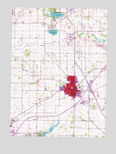
Elkhorn, WI USGS Topographic Map
Click on map above to begin viewing in our Map Viewer.

This topographic map contains these locations and features:
Feature Name Type Latitude Longitude GNIS ID View Map
Abells CornersPopulated PlaceN42.7261°W88.5426°1560665View Map
Apple Barn Orchard And WineryLocaleN42.6969°W88.6161°2516912View Map
Bethel United Methodist ChurchChurchN42.7417°W88.5529°1561632View Map
City of ElkhornCivilN42.6711°W88.5376°1583150View Map
Columbus HallBuildingN42.6714°W88.5451°1851234View Map
Delavan Prairie SchoolSchoolN42.6564°W88.5907°1563876View Map
Delavan Rescue SquadBuildingN42.6400°W88.6230°2698200View Map
Dunbar CemeteryCemeteryN42.6411°W88.5304°1564172View Map
ElkhornPopulated PlaceN42.6728°W88.5445°1564532View Map
Elkhorn Area Fire DepartmentBuildingN42.6712°W88.5444°2698066View Map
Elkhorn Area High SchoolSchoolN42.6720°W88.5319°1851247View Map
Elkhorn Area Middle SchoolSchoolN42.6798°W88.5296°2716561View Map
Elkhorn LakeLakeN42.6586°W88.5305°2764439View Map
Elkhorn Municipal BuildingBuildingN42.6714°W88.5447°2740386View Map
Elkhorn Police DepartmentBuildingN42.6717°W88.5444°2759360View Map
Elkhorn Post OfficePost OfficeN42.6721°W88.5420°1851248View Map
First Baptist ChurchChurchN42.6736°W88.5451°1851257View Map
First Congregational ChurchChurchN42.6706°W88.5437°1851260View Map
First Evangelical Lutheran ChurchChurchN42.6700°W88.5457°1851263View Map
First Lutheran SchoolSchoolN42.6655°W88.5536°1851265View Map
First United Methodist ChurchChurchN42.6736°W88.5445°1851267View Map
Hazel Ridge CemeteryCemeteryN42.6754°W88.5557°1566235View Map
InletPopulated PlaceN42.6272°W88.5851°1566941View Map
Jackson CreekStreamN42.6406°W88.5609°1567067View Map
Jackson Elementary SchoolSchoolN42.6724°W88.5386°1562907View Map
Lake LawnPopulated PlaceN42.6258°W88.5943°1567740View Map
Lake Lawn AirportAirportN42.6292°W88.6009°1581941View Map
Lake WandawegaLakeN42.7434°W88.5670°1576188View Map
Land O Lakes Mobile Home ParkPopulated PlaceN42.6681°W88.5319°2508622View Map
Matheson Memorial LibraryBuildingN42.6739°W88.5431°1851298View Map
MillardPopulated PlaceN42.7345°W88.6215°1569500View Map
Millard CemeteryCemeteryN42.7383°W88.6209°1569501View Map
Millard Community ChurchChurchN42.7350°W88.6218°1851303View Map
Mount Olivet CemeteryCemeteryN42.6740°W88.5601°1569825View Map
Mount Pleasant CemeteryCemeteryN42.7361°W88.5820°1569834View Map
Paddock FieldAirportN42.7374°W88.5795°1581966View Map
Paddock PitMineN42.7497°W88.5433°2633154View Map
Pecks Station (historical)LocaleN42.7383°W88.5134°1851311View Map
Potters CemeteryCemeteryN42.7200°W88.5287°1571846View Map
Saint John in the Wilderness Episcopal ChurchChurchN42.6706°W88.5457°1851323View Map
Saint Johns Lutheran ChurchChurchN42.6700°W88.5451°1851324View Map
Saint Patrick Parish SchoolSchoolN42.6819°W88.5519°1573416View Map
Saint Patricks Catholic ChurchChurchN42.6717°W88.5457°1851327View Map
Shadow Lawn SchoolSchoolN42.6411°W88.5907°1573945View Map
Silver LakeLakeN42.7264°W88.5708°1574129View Map
Sprague TheaterBuildingN42.6717°W88.5442°2740385View Map
Sugar Creek Lutheran CemeteryCemeteryN42.6983°W88.6104°2002811View Map
Sugar Creek Lutheran ChurchChurchN42.6981°W88.6104°1575022View Map
TibbetsPopulated PlaceN42.7347°W88.5815°1575433View Map
Tibbets Elementary SchoolSchoolN42.7393°W88.5595°1575434View Map
Town of Sugar CreekCivilN42.7145°W88.6045°1584244View Map
Walworth CountyCivilN42.6685°W88.5419°1581123View Map
Walworth County CourthouseBuildingN42.6728°W88.5448°1851350View Map
Walworth County Education Alternative High SchoolSchoolN42.6652°W88.5232°2716880View Map
Walworth County Fair GroundsLocaleN42.6758°W88.5340°1851351View Map
Walworth County Sheriff's OfficeBuildingN42.6642°W88.5002°2759417View Map
Weedhopper Meadow Airport (historical)AirportN42.6875°W88.6021°1581965View Map
West Side Elementary SchoolSchoolN42.6764°W88.5527°1576555View Map
Westville CemeteryCemeteryN42.7464°W88.5331°1576587View Map

Note: Coordinates in the location and feature list above are referenced to NAD83 datum.


Copyright (C) 2008-2025 Ryan Niemi / Sunset Dynamics ... All Rights Reserved