TopoQuest Logo
Do you find TopoQuest useful?
Help keep TopoQuest running and adding new maps/features by donating!
Bitcoin:  19c7KJd3qBynnjoSw5npx9KScwjBe4ifkT
Litecoin:  LXs6TkuXGGXo1vDsWCkWVdjQX94eUKd6ui
Home View Maps Find Maps Find Places Resources & Links


Sharon Springs, New York Topographic Map

USGS Map Title: Sharon Springs, NY
USGS Map MRC: 42074G5
DRG (GeoTIFF) Download: o42074g5.tif


Neighboring USGS Topographic Map Quads:


  Fort Plain, NY  
42074H6
 

  Canajoharie, NY  
42074H5
 

  Randall, NY  
42074H4
 

  Sprout Brook, NY  
42074G6
 

  Sharon Springs, NY  
42074G5
 

  Carlisle, NY  
42074G4
 

  South Valley, NY  
42074F6
 

  Richmondville, NY  
42074F5
 

  Cobleskill, NY  
42074F4


Map MRC Location:

N43°
W75°
N43°
W74°
H8 H7 H6 H5 H4 H3 H2 H1
G8 G7 G6 G5 G4 G3 G2 G1
F8 F7 F6 F5 F4 F3 F2 F1
E8 E7 E6 E5 E4 E3 E2 E1
D8 D7 D6 D5 D4 D3 D2 D1
C8 C7 C6 C5 C4 C3 C2 C1
B8 B7 B6 B5 B4 B3 B2 B1
A8 A7 A6 A5 A4 A3 A2 A1
N42°
W75°
N42°
W74°

Sharon Springs, NY USGS 1:24K Topographic Map Preview:
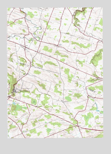
Sharon Springs, NY USGS Topographic Map
Click on map above to begin viewing in our Map Viewer.

This topographic map contains these locations and features:
Feature Name Type Latitude Longitude GNIS ID View Map
AmesPopulated PlaceN42.8376°W74.6015°942431View Map
Ames - Sprout Brook Methodist ChurchChurchN42.8369°W74.5993°2615524View Map
Ames Academy (historical)SchoolN42.8369°W74.6000°2571417View Map
Ames CemeteryCemeteryN42.8329°W74.6006°942432View Map
Ames Volunteer Fire DepartmentBuildingN42.8375°W74.6011°2718508View Map
ArgusvillePopulated PlaceN42.7906°W74.5190°942549View Map
Argusville CemeteryCemeteryN42.7887°W74.5197°2554824View Map
Argusville Lutheran Church CemeteryCemeteryN42.7888°W74.5147°2554823View Map
Ball CemeteryCemeteryN42.7682°W74.5535°942916View Map
Bellinger CemeteryCemeteryN42.7667°W74.5504°943618View Map
Brimstone CreekStreamN42.8467°W74.6076°944753View Map
Browns HollowPopulated PlaceN42.8076°W74.5068°944945View Map
Budd HillSummitN42.8234°W74.6024°945097View Map
Canajoharie Airport (historical)AirportN42.8473°W74.5304°977943View Map
Canajoharie Country ClubLocaleN42.8643°W74.6172°2615360View Map
Cedar SwampSwampN42.7851°W74.5901°946147View Map
Clausen PondLakeN42.7834°W74.6161°946800View Map
Dutch Reformed ChurchChurchN42.7554°W74.6057°948865View Map
Flanders CemeteryCemeteryN42.8662°W74.5221°950229View Map
Flat CreekPopulated PlaceN42.8429°W74.5015°950237View Map
Gilbert CornersPopulated PlaceN42.7840°W74.5518°951091View Map
Maple HillSummitN42.8740°W74.5782°970332View Map
MapletownPopulated PlaceN42.8387°W74.5593°956464View Map
Mapletown CemeteryCemeteryN42.8389°W74.5594°2548169View Map
Marchand Manor Assisted Living FacilityBuildingN42.7910°W74.6206°2614713View Map
Olmstead CemeteryCemeteryN42.8586°W74.5100°959352View Map
Parsons FarmLocaleN42.7828°W74.6072°2555047View Map
Ridgedale FarmLocaleN42.8261°W74.5822°2555043View Map
Rose of Sharon Church of GodChurchN42.7624°W74.5361°2616852View Map
Saint Matthew's Lutheran ChapelChurchN42.7946°W74.6179°2616981View Map
School Number 12 (historical)SchoolN42.8242°W74.5351°975036View Map
School Number 4 (historical)SchoolN42.7848°W74.5529°975350View Map
School Number 4 (historical)SchoolN42.8448°W74.5062°975355View Map
School Number 4 (historical)SchoolN42.8748°W74.5496°975357View Map
School Number 5 (historical)SchoolN42.8504°W74.5479°975424View Map
School Number 7 (historical)SchoolN42.7887°W74.5112°975543View Map
SharonPopulated PlaceN42.7612°W74.5326°964944View Map
Sharon AirportAirportN42.7801°W74.5811°978293View Map
Sharon CenterPopulated PlaceN42.7801°W74.5865°964945View Map
Sharon SpringsPopulated PlaceN42.7959°W74.6171°964946View Map
Sharon Springs Central SchoolSchoolN42.7883°W74.6246°2669109View Map
Sharon Springs Free LibraryBuildingN42.7910°W74.6200°2617422View Map
Sharon Springs Joint Fire DistrictBuildingN42.7924°W74.6236°2735232View Map
Sharon Springs Manor Adult HomeBuildingN42.7877°W74.6133°2614786View Map
Sharon Springs United Methodist ChurchChurchN42.7903°W74.6243°2616250View Map
Slate Hill CemeteryCemeteryN42.7542°W74.5658°965389View Map
StaleyvillePopulated PlaceN42.8117°W74.5990°966209View Map
Sunnycrest Orchards Farm MarketLocaleN42.8128°W74.5992°2555049View Map
Town of CanajoharieCivilN42.8657°W74.6051°978783View Map
Town of SharonCivilN42.7776°W74.5986°979485View Map
Village of AmesCivilN42.8375°W74.6017°2391513View Map
Village of Sharon SpringsCivilN42.7930°W74.6128°2391128View Map
WatervillePopulated PlaceN42.8462°W74.5904°973208View Map
Wessel HillSummitN42.8340°W74.5340°969074View Map

Note: Coordinates in the location and feature list above are referenced to NAD83 datum.


Copyright (C) 2008-2025 Ryan Niemi / Sunset Dynamics ... All Rights Reserved