TopoQuest Logo
Do you find TopoQuest useful?
Help keep TopoQuest running and adding new maps/features by donating!
Bitcoin:  19c7KJd3qBynnjoSw5npx9KScwjBe4ifkT
Litecoin:  LXs6TkuXGGXo1vDsWCkWVdjQX94eUKd6ui
Home View Maps Find Maps Find Places Resources & Links


Shawnee Reservoir, Oklahoma Topographic Map

USGS Map Title: Shawnee Reservoir, OK
USGS Map MRC: 35097C1
DRG (GeoTIFF) Download: o35097c1.tif


Neighboring USGS Topographic Map Quads:


  Harrah, OK  
35097D2
 

  McLoud, OK  
35097D1
 

  Aydelotte, OK  
35096D8
 

  Stella, OK  
35097C2
 

  Shawnee Reservoir, OK  
35097C1
 

  Shawnee, OK  
35096C8
 

  Little Axe, OK  
35097B2
 

  Macomb, OK  
35097B1
 

  Brooksville, OK  
35096B8


Map MRC Location:

N36°
W98°
N36°
W97°
H8 H7 H6 H5 H4 H3 H2 H1
G8 G7 G6 G5 G4 G3 G2 G1
F8 F7 F6 F5 F4 F3 F2 F1
E8 E7 E6 E5 E4 E3 E2 E1
D8 D7 D6 D5 D4 D3 D2 D1
C8 C7 C6 C5 C4 C3 C2 C1
B8 B7 B6 B5 B4 B3 B2 B1
A8 A7 A6 A5 A4 A3 A2 A1
N35°
W98°
N35°
W97°

Shawnee Reservoir, OK USGS 1:24K Topographic Map Preview:
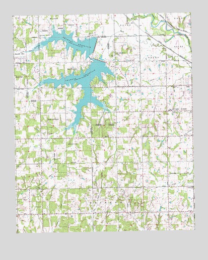
Shawnee Reservoir, OK USGS Topographic Map
Click on map above to begin viewing in our Map Viewer.

This topographic map contains these locations and features:
Feature Name Type Latitude Longitude GNIS ID View Map
Bethel AcresPopulated PlaceN35.3087°W97.0256°1102929View Map
Bethel Acres Fire Department Station 1BuildingN35.3014°W97.0183°2656811View Map
Bethel Acres Fire Department Station 2BuildingN35.3038°W97.0889°2657353View Map
Bethel CemeteryCemeteryN35.3050°W97.0278°2708658View Map
Bethel ChurchChurchN35.3042°W97.0281°1090057View Map
Bethel Elementary SchoolSchoolN35.3191°W97.0137°1819338View Map
Bethel High SchoolSchoolN35.3192°W97.0169°1819334View Map
Bethel Middle SchoolSchoolN35.3207°W97.0165°1790465View Map
Black CemeteryCemeteryN35.2753°W97.1072°1090192View Map
Blackburn ChapelChurchN35.3326°W97.0120°1090223View Map
Blackburn Chapel CemeteryCemeteryN35.3322°W97.0119°2708660View Map
Brown CemeteryCemeteryN35.2615°W97.0631°1090531View Map
Centerpoint Oil FieldOilfieldN35.2717°W97.0414°1091154View Map
GaddyPopulated PlaceN35.3331°W97.0009°1093086View Map
Hopewell CemeteryCemeteryN35.3039°W97.0275°2708665View Map
Hopewell ChurchChurchN35.3040°W97.0625°1093919View Map
Jazz Ranch AirportAirportN35.3204°W97.0405°2676482View Map
Longbranch Site 4 DamDamN35.2601°W97.1053°1755165View Map
Longbranch Site 4 ReservoirReservoirN35.2601°W97.1053°1755166View Map
Newhope SchoolSchoolN35.2748°W97.0014°1095855View Map
North Deer CreekStreamN35.3734°W97.0278°1095935View Map
PinkPopulated PlaceN35.2606°W97.1197°1100744View Map
Ray CemeteryCemeteryN35.3183°W97.1072°2708672View Map
Shawnee City Lake Number 1ReservoirN35.3484°W97.0653°1751873View Map
Shawnee City Lake Number 1 DamDamN35.3484°W97.0653°1751872View Map
Shawnee City Lake Number 2ReservoirN35.3551°W97.0686°1751843View Map
Shawnee City Lake Number 2 DamDamN35.3551°W97.0686°1751842View Map
Shawnee ReservoirReservoirN35.3373°W97.0979°1097973View Map
Town of Bethel AcresCivilN35.3048°W97.0370°2411683View Map
Township of BrintonCivilN35.2723°W97.0642°1824931View Map

Note: Coordinates in the location and feature list above are referenced to NAD83 datum.


Copyright (C) 2008-2025 Ryan Niemi / Sunset Dynamics ... All Rights Reserved