TopoQuest Logo
Do you find TopoQuest useful?
Help keep TopoQuest running and adding new maps/features by donating!
Bitcoin:  19c7KJd3qBynnjoSw5npx9KScwjBe4ifkT
Litecoin:  LXs6TkuXGGXo1vDsWCkWVdjQX94eUKd6ui
Home View Maps Find Maps Find Places Resources & Links


San Benito Mountain, California Topographic Map

USGS Map Title: San Benito Mountain, CA
USGS Map MRC: 36120C6
DRG (GeoTIFF) Download: o36120c6.tif


Neighboring USGS Topographic Map Quads:


  Hernandez Reservoir, CA  
36120D7
 

  Idria, CA  
36120D6
 

  Ciervo Mountain, CA  
36120D5
 

  Hepsedam Peak, CA  
36120C7
 

  San Benito Mountain, CA  
36120C6
 

  Santa Rita Peak, CA  
36120C5
 

  Monarch Peak, CA  
36120B7
 

  Priest Valley, CA  
36120B6
 

  Sherman Peak, CA  
36120B5


Map MRC Location:

N37°
W121°
N37°
W120°
H8 H7 H6 H5 H4 H3 H2 H1
G8 G7 G6 G5 G4 G3 G2 G1
F8 F7 F6 F5 F4 F3 F2 F1
E8 E7 E6 E5 E4 E3 E2 E1
D8 D7 D6 D5 D4 D3 D2 D1
C8 C7 C6 C5 C4 C3 C2 C1
B8 B7 B6 B5 B4 B3 B2 B1
A8 A7 A6 A5 A4 A3 A2 A1
N36°
W121°
N36°
W120°

San Benito Mountain, CA USGS 1:24K Topographic Map Preview:
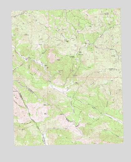
San Benito Mountain, CA USGS Topographic Map
Click on map above to begin viewing in our Map Viewer.

This topographic map contains these locations and features:
Feature Name Type Latitude Longitude GNIS ID View Map
Alpine MineMineN36.3655°W120.7232°238554View Map
Alta PeakSummitN36.3588°W120.6618°238558View Map
Asbestos Ridge MineMineN36.3308°W120.6327°238789View Map
Bald PeakSummitN36.2780°W120.6949°238924View Map
Breen MineMineN36.3216°W120.7116°239668View Map
Cascara SpringSpringN36.3002°W120.6255°240310View Map
Diablo RangeRangeN36.3697°W120.6443°238329View Map
Duckworth CanyonValleyN36.2777°W120.6454°241658View Map
Dunham CanyonValleyN36.2852°W120.7363°241669View Map
East Fork North Fork Lewis RiverStreamN36.2539°W120.7163°241764View Map
Fawn LakeLakeN36.3329°W120.6744°242185View Map
Fawn SpringSpringN36.3345°W120.6743°242186View Map
Fitzpatrick SpringSpringN36.3304°W120.6793°242282View Map
Florence Mack MineMineN36.3133°W120.6818°242322View Map
Fourth of July MineMineN36.3566°W120.6927°242417View Map
Garcia CanyonValleyN36.2863°W120.6602°242593View Map
Garrison CanyonValleyN36.2763°W120.6507°242633View Map
Goat MountainSummitN36.3522°W120.7355°242762View Map
Lewis FlatFlatN36.3294°W120.7352°244763View Map
Mulch SpringSpringN36.3007°W120.7459°246348View Map
Nimrod CanyonValleyN36.3308°W120.7380°246546View Map
Picacho CreekStreamN36.3266°W120.7218°247434View Map
Picacho MineMineN36.3466°W120.6949°247437View Map
Picacho PeakSummitN36.3455°W120.6885°247438View Map
Poison SpringSpringN36.2872°W120.7133°247659View Map
Rudolf CanyonValleyN36.3291°W120.7299°248467View Map
Saint Thomas MineMineN36.3350°W120.7168°248733View Map
San Benito MillLocaleN36.3430°W120.6649°248798View Map
San Benito MountainSummitN36.3697°W120.6443°254202View Map
Santa Margarita MineMineN36.3177°W120.6988°249080View Map
Sawmill CreekStreamN36.3425°W120.6588°249177View Map
Sylvester SpringSpringN36.3286°W120.6954°250219View Map
The PicachosRidgeN36.3527°W120.6941°250399View Map
The Rock TrailTrailN36.2705°W120.7366°250407View Map
Williams HollowValleyN36.2983°W120.6938°251598View Map
Williams MountainSummitN36.2652°W120.7432°251599View Map
Willow SpringSpringN36.2789°W120.7130°251647View Map
Willow SpringSpringN36.3060°W120.6764°251648View Map

Note: Coordinates in the location and feature list above are referenced to NAD83 datum.


Copyright (C) 2008-2025 Ryan Niemi / Sunset Dynamics ... All Rights Reserved