TopoQuest Logo
Do you find TopoQuest useful?
Help keep TopoQuest running and adding new maps/features by donating!
Bitcoin:  19c7KJd3qBynnjoSw5npx9KScwjBe4ifkT
Litecoin:  LXs6TkuXGGXo1vDsWCkWVdjQX94eUKd6ui
Home View Maps Find Maps Find Places Resources & Links


Shipshewana, Indiana Topographic Map

USGS Map Title: Shipshewana, IN
USGS Map MRC: 41085F5
DRG (GeoTIFF) Download: o41085f5.tif


Neighboring USGS Topographic Map Quads:


  Constantine, MI  
41085G6
 

  Klinger Lake, MI  
41085G5
 

  Sturgis, MI  
41085G4
 

  Middlebury, IN  
41085F6
 

  Shipshewana, IN  
41085F5
 

  Lagrange, IN  
41085F4
 

  Millersburg, IN  
41085E6
 

  Topeka, IN  
41085E5
 

  Oliver Lake, IN  
41085E4


Map MRC Location:

N42°
W86°
N42°
W85°
H8 H7 H6 H5 H4 H3 H2 H1
G8 G7 G6 G5 G4 G3 G2 G1
F8 F7 F6 F5 F4 F3 F2 F1
E8 E7 E6 E5 E4 E3 E2 E1
D8 D7 D6 D5 D4 D3 D2 D1
C8 C7 C6 C5 C4 C3 C2 C1
B8 B7 B6 B5 B4 B3 B2 B1
A8 A7 A6 A5 A4 A3 A2 A1
N41°
W86°
N41°
W85°

Shipshewana, IN USGS 1:24K Topographic Map Preview:
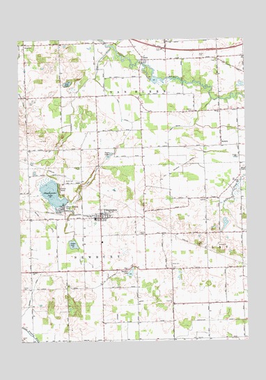
Shipshewana, IN USGS Topographic Map
Click on map above to begin viewing in our Map Viewer.

This topographic map contains these locations and features:
Feature Name Type Latitude Longitude GNIS ID View Map
Barton CemeteryCemeteryN41.7346°W85.5240°430549View Map
Beatys BeachPopulated PlaceN41.6842°W85.6036°430668View Map
Bethel CemeteryCemeteryN41.7392°W85.6214°430904View Map
Cotton LakeLakeN41.6654°W85.5959°433020View Map
Cotton Lake DitchCanalN41.6537°W85.5822°433021View Map
Farver DitchCanalN41.6392°W85.5622°434417View Map
Fetch DitchCanalN41.7256°W85.6228°434464View Map
Haarer DitchCanalN41.6431°W85.6197°435574View Map
Hostetler DitchCanalN41.6326°W85.5211°436507View Map
Huff SchoolSchoolN41.6798°W85.5225°436580View Map
Lima ChurchChurchN41.7331°W85.5153°437892View Map
Lupold CemeteryCemeteryN41.6659°W85.5572°438408View Map
Marion ChurchChurchN41.7137°W85.5142°438615View Map
Miller CemeteryCemeteryN41.6545°W85.5416°439196View Map
Page DitchCanalN41.7076°W85.5625°440827View Map
Pashan CemeteryCemeteryN41.6456°W85.6239°440916View Map
Pashan SchoolSchoolN41.6517°W85.6189°440917View Map
Rainbow LakeLakeN41.6536°W85.5643°441746View Map
ScottPopulated PlaceN41.7337°W85.5569°443137View Map
Scott Mill Pond Public Fishing AreaParkN41.7376°W85.5500°447671View Map
SeybertsPopulated PlaceN41.7003°W85.5133°443231View Map
ShipshewanaPopulated PlaceN41.6728°W85.5803°443413View Map
Shipshewana LakeLakeN41.6864°W85.6072°443414View Map
Shipshewana Police DepartmentBuildingN41.6792°W85.5776°2758277View Map
Shipshewana Volunteer Fire DepartmentBuildingN41.6888°W85.5815°2626285View Map
Shipshewana-Scott Elementary SchoolSchoolN41.6723°W85.5836°440137View Map
Shore ChurchChurchN41.6531°W85.5655°443446View Map
Sidener CemeteryCemeteryN41.7204°W85.5286°443477View Map
Taylor LakeLakeN41.7019°W85.5754°444601View Map
Town of ShipshewanaCivilN41.6744°W85.5765°2397658View Map
Township of NewburyCivilN41.6542°W85.5996°453661View Map
Township of Van BurenCivilN41.7285°W85.5728°453948View Map
Truesdale DitchCanalN41.7128°W85.5955°444931View Map
United Brethren CampParkN41.6770°W85.6003°445141View Map
Van Natta DitchCanalN41.7101°W85.5272°445214View Map
Wolfe FieldAirportN41.6910°W85.5914°449349View Map
Yoder SchoolSchoolN41.6251°W85.5883°446397View Map

Note: Coordinates in the location and feature list above are referenced to NAD83 datum.


Copyright (C) 2008-2024 Ryan Niemi / Sunset Dynamics ... All Rights Reserved