TopoQuest Logo
Do you find TopoQuest useful?
Help keep TopoQuest running and adding new maps/features by donating!
Bitcoin:  19c7KJd3qBynnjoSw5npx9KScwjBe4ifkT
Litecoin:  LXs6TkuXGGXo1vDsWCkWVdjQX94eUKd6ui
Home View Maps Find Maps Find Places Resources & Links


Short Run, Pennsylvania Topographic Map

USGS Map Title: Short Run, PA
USGS Map MRC: 41077E7
DRG (GeoTIFF) Download: o41077e7.tif


Neighboring USGS Topographic Map Quads:


  Ayers Hill, PA  
41077F8
 

  Cherry Springs, PA  
41077F7
 

  Galeton, PA  
41077F6
 

  Conrad, PA  
41077E8
 

  Short Run, PA  
41077E7
 

  Oleona, PA  
41077E6
 

  Hammersley Fork, PA  
41077D8
 

  Tamarack, PA  
41077D7
 

  Young Womans Creek, PA  
41077D6


Map MRC Location:

N42°
W78°
N42°
W77°
H8 H7 H6 H5 H4 H3 H2 H1
G8 G7 G6 G5 G4 G3 G2 G1
F8 F7 F6 F5 F4 F3 F2 F1
E8 E7 E6 E5 E4 E3 E2 E1
D8 D7 D6 D5 D4 D3 D2 D1
C8 C7 C6 C5 C4 C3 C2 C1
B8 B7 B6 B5 B4 B3 B2 B1
A8 A7 A6 A5 A4 A3 A2 A1
N41°
W78°
N41°
W77°

Short Run, PA USGS 1:24K Topographic Map Preview:
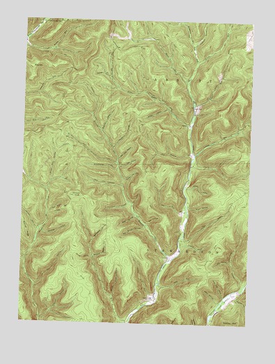
Short Run, PA USGS Topographic Map
Click on map above to begin viewing in our Map Viewer.

This topographic map contains these locations and features:
Feature Name Type Latitude Longitude GNIS ID View Map
AbbottPopulated PlaceN41.5823°W77.7844°1202942View Map
Ash Tree HollowValleyN41.5682°W77.8224°1168446View Map
Bachman HollowValleyN41.5795°W77.8317°1168553View Map
Barrel Slide HollowValleyN41.5113°W77.8238°1168755View Map
Bergstresser HollowValleyN41.5174°W77.7527°1169295View Map
Big Bench HollowValleyN41.5396°W77.8068°1169477View Map
Big RunStreamN41.5442°W77.7833°1169571View Map
Black Mark HollowValleyN41.5587°W77.8590°1169717View Map
Blacksmith HollowValleyN41.5349°W77.8350°1169775View Map
Bolich RunStreamN41.6081°W77.7797°1169961View Map
Boone RunStreamN41.5995°W77.7847°1192178View Map
Bunnell RunStreamN41.5384°W77.8658°1170691View Map
Cassidy HollowValleyN41.5322°W77.7865°1171312View Map
Cherry RunStreamN41.5648°W77.7825°1171671View Map
Coon HollowValleyN41.5494°W77.8137°1172407View Map
Cross Fork TrailTrailN41.6115°W77.7811°1192317View Map
Dry HollowValleyN41.5158°W77.8666°1173513View Map
Dry HollowValleyN41.5703°W77.7827°1173514View Map
Dyke RunStreamN41.5162°W77.7986°1173685View Map
Elk Lick KnobSummitN41.5523°W77.8467°1174116View Map
Elk Lick RunStreamN41.5001°W77.8147°1198703View Map
Elkhorn HollowValleyN41.5020°W77.8637°1174133View Map
Elkhorn TrailTrailN41.5012°W77.8447°1174135View Map
Gravel LickPopulated PlaceN41.5109°W77.8011°1203709View Map
Gravel Lick RunStreamN41.5098°W77.8003°1176002View Map
Gravel Lick TrailTrailN41.5315°W77.8203°1176005View Map
Green HollowValleyN41.5727°W77.8252°1176079View Map
Green HollowValleyN41.6245°W77.7910°1176080View Map
Hailstone HollowValleyN41.5389°W77.8636°1176365View Map
Hammersley TrailTrailN41.5315°W77.8692°1176437View Map
Hogback HollowValleyN41.6152°W77.7818°1177174View Map
Hollow Ridge TrailTrailN41.5290°W77.7708°1177218View Map
Hoover HollowValleyN41.5273°W77.8358°1177367View Map
Horton Run TrailTrailN41.6217°W77.8472°1177478View Map
Horton Run VistaSummitN41.6051°W77.8414°1201390View Map
Hungry HollowValleyN41.5344°W77.7852°1177595View Map
Jamison Run VistaSummitN41.5967°W77.8589°1201389View Map
Jordan HollowValleyN41.5888°W77.7960°1178167View Map
Keeney HollowValleyN41.5109°W77.7556°1178292View Map
Keeney MountainSummitN41.5001°W77.7555°1198965View Map
Knickerbocker HollowValleyN41.5639°W77.8230°1178606View Map
Laurel BottomBendN41.5090°W77.7622°1178922View Map
Lick HollowValleyN41.5496°W77.8166°1179285View Map
Lick Ridge TrailTrailN41.6173°W77.7958°1179293View Map
Little Burdick HollowValleyN41.5257°W77.8728°1179491View Map
Little Lyman RunStreamN41.5815°W77.7828°1179589View Map
Mink HollowValleyN41.5445°W77.8124°1181340View Map
Mud Lick HollowValleyN41.5568°W77.8198°1182005View Map
Parker HollowValleyN41.5561°W77.7840°1183317View Map
Pine HillSummitN41.6053°W77.8708°1183834View Map
Pine Tree HollowValleyN41.5112°W77.7628°1183918View Map
Rebel HollowValleyN41.5091°W77.7655°1184742View Map
Rhulo HollowValleyN41.5487°W77.7831°1184985View Map
Ridge TrailTrailN41.5531°W77.8067°1185038View Map
Road District of East Fork (historical)CivilN41.5456°W77.8706°1729743View Map
Road HollowValleyN41.5267°W77.8722°1185158View Map
Robin HollowValleyN41.5597°W77.8193°1185217View Map
Short RunPopulated PlaceN41.5898°W77.7817°1204645View Map
Short RunStreamN41.5926°W77.7822°1187601View Map
Slip HollowValleyN41.5409°W77.8055°1187818View Map
Splash Dam TrailTrailN41.6242°W77.8556°1188187View Map
Stepping Stone HollowValleyN41.5273°W77.8347°1188611View Map
Tobe HollowValleyN41.5646°W77.8217°1189609View Map
Tub HollowValleyN41.5261°W77.7591°1189894View Map
Twin Sisters HollowsValleyN41.5456°W77.8602°1190016View Map
Twin Sisters TrailTrailN41.5384°W77.8455°1190017View Map
Windfall RunStreamN41.5265°W77.7928°1191573View Map
Wingerter RunStreamN41.5995°W77.7847°1191598View Map
Yochum RunStreamN41.5698°W77.7803°1191889View Map

Note: Coordinates in the location and feature list above are referenced to NAD83 datum.


Copyright (C) 2008-2025 Ryan Niemi / Sunset Dynamics ... All Rights Reserved