TopoQuest Logo
Do you find TopoQuest useful?
Help keep TopoQuest running and adding new maps/features by donating!
Bitcoin:  19c7KJd3qBynnjoSw5npx9KScwjBe4ifkT
Litecoin:  LXs6TkuXGGXo1vDsWCkWVdjQX94eUKd6ui
Home View Maps Find Maps Find Places Resources & Links


Oleona, Pennsylvania Topographic Map

USGS Map Title: Oleona, PA
USGS Map MRC: 41077E6
DRG (GeoTIFF) Download: o41077e6.tif


Neighboring USGS Topographic Map Quads:


  Cherry Springs, PA  
41077F7
 

  Galeton, PA  
41077F6
 

  Marshlands, PA  
41077F5
 

  Short Run, PA  
41077E7
 

  Oleona, PA  
41077E6
 

  Lee Fire Tower, PA  
41077E5
 

  Tamarack, PA  
41077D7
 

  Young Womans Creek, PA  
41077D6
 

  Slate Run, PA  
41077D5


Map MRC Location:

N42°
W78°
N42°
W77°
H8 H7 H6 H5 H4 H3 H2 H1
G8 G7 G6 G5 G4 G3 G2 G1
F8 F7 F6 F5 F4 F3 F2 F1
E8 E7 E6 E5 E4 E3 E2 E1
D8 D7 D6 D5 D4 D3 D2 D1
C8 C7 C6 C5 C4 C3 C2 C1
B8 B7 B6 B5 B4 B3 B2 B1
A8 A7 A6 A5 A4 A3 A2 A1
N41°
W78°
N41°
W77°

Oleona, PA USGS 1:24K Topographic Map Preview:
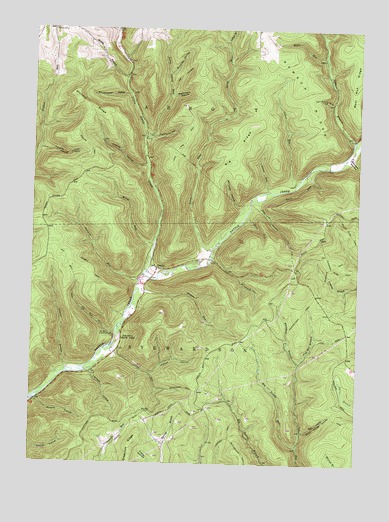
Oleona, PA USGS Topographic Map
Click on map above to begin viewing in our Map Viewer.

This topographic map contains these locations and features:
Feature Name Type Latitude Longitude GNIS ID View Map
Bear Run RidgeRidgeN41.6165°W77.6253°1168936View Map
Big RidgeRidgeN41.5926°W77.6686°1169554View Map
Big Trestle RunStreamN41.5045°W77.6458°1169604View Map
Big Trestle TrailTrailN41.5173°W77.6539°1205869View Map
Bloss HollowValleyN41.6112°W77.7148°1169858View Map
Bohunk HollowValleyN41.6241°W77.7190°1169947View Map
Bohunk TrailTrailN41.5765°W77.7169°1169948View Map
Burnisky HollowValleyN41.6122°W77.6983°1170730View Map
Cherry HollowValleyN41.5280°W77.7365°1171643View Map
Cherry Hollow TrailTrailN41.5359°W77.7397°1205867View Map
Dead Horse HollowValleyN41.5094°W77.6452°1173022View Map
Face RunStreamN41.5712°W77.6678°1174401View Map
Germania BranchStreamN41.5931°W77.6264°1175554View Map
Greenlick RidgeRidgeN41.5067°W77.7086°1198836View Map
Hartman TrailTrailN41.5065°W77.6755°1176617View Map
Hickory RidgeRidgeN41.6053°W77.7336°1176970View Map
Hopper RunStreamN41.5501°W77.7086°1177409View Map
Impson HollowValleyN41.5261°W77.7040°1177717View Map
Indian RunStreamN41.5792°W77.6492°1177777View Map
Klondike Ridge TrailTrailN41.5567°W77.6347°1178595View Map
Klondike TrailTrailN41.5576°W77.6330°1178596View Map
Kortz RunStreamN41.6170°W77.6383°1178654View Map
Layfield HollowValleyN41.5261°W77.7263°1179067View Map
Lechler BranchStreamN41.6215°W77.6753°1192759View Map
Lick HollowValleyN41.6079°W77.6973°1179286View Map
Little Indian RunStreamN41.5942°W77.7072°1179567View Map
Little Kettle CreekStreamN41.5542°W77.7067°1179576View Map
Long RunStreamN41.5612°W77.6803°1179896View Map
Long Run TrailTrailN41.5945°W77.6900°1199082View Map
Miller RunStreamN41.5631°W77.7022°1181228View Map
Miller Run TrailTrailN41.5712°W77.7119°1205866View Map
NordjeuskaldSummitN41.5365°W77.7186°1214748View Map
Ole Bull Castle (historical)LocaleN41.5365°W77.7186°1213308View Map
Ole Bull RunStreamN41.5381°W77.7169°1182962View Map
Ole Bull State ParkParkN41.5362°W77.7122°1198259View Map
Ole Bull State ParkParkN41.5359°W77.7153°1182963View Map
Ole Bull TrailTrailN41.5462°W77.7333°1171955View Map
OleonaPopulated PlaceN41.5562°W77.7017°1214042View Map
Pigs Ear BranchStreamN41.5292°W77.6461°1183725View Map
Pike-Whitman TrailTrailN41.5437°W77.6450°1183730View Map
Pipe Line HollowValleyN41.5745°W77.6633°1183958View Map
Pipe Line HollowValleyN41.5940°W77.7064°1183959View Map
Pritchard HollowValleyN41.5537°W77.6703°1184428View Map
Rawson RidgeRidgeN41.6165°W77.6583°1184722View Map
Rhinehimmer HollowValleyN41.6065°W77.7139°1184978View Map
Rhinehimmer TrailTrailN41.6056°W77.7303°1205865View Map
Rixford HollowValleyN41.5180°W77.7474°1185156View Map
Rob Horse TrailTrailN41.5137°W77.6353°1185190View Map
Sawmill RunStreamN41.5526°W77.7086°1187033View Map
Sawmill TrailTrailN41.5556°W77.7258°1187040View Map
Silver RunStreamN41.5787°W77.6594°1187689View Map
Stone Watering Trough HollowValleyN41.6042°W77.6351°1188741View Map
Straight RunStreamN41.6223°W77.6386°1193488View Map
Swartwood TrailTrailN41.5217°W77.6903°1199656View Map
Township of AbbottCivilN41.6119°W77.7140°1216967View Map
Township of StewardsonCivilN41.5232°W77.7123°1216984View Map
Traplog HollowValleyN41.5863°W77.7065°1189725View Map
Warpath HollowValleyN41.5876°W77.6275°1193610View Map
Waterfalls HollowValleyN41.6063°W77.6975°1190672View Map
Welch Ridge TrailTrailN41.5684°W77.6289°1190801View Map
Whitman BranchStreamN41.5295°W77.6461°1191351View Map
Wild Cat HollowValleyN41.5793°W77.6597°1198015View Map
Williams HollowValleyN41.5738°W77.6700°1191463View Map
Yaudes HollowValleyN41.5907°W77.7473°1191866View Map
Yochum Hill CemeteryCemeteryN41.6249°W77.7424°1168021View Map
Yochum TrailTrailN41.5887°W77.7364°1191890View Map

Note: Coordinates in the location and feature list above are referenced to NAD83 datum.


Copyright (C) 2008-2024 Ryan Niemi / Sunset Dynamics ... All Rights Reserved