TopoQuest Logo
Do you find TopoQuest useful?
Help keep TopoQuest running and adding new maps/features by donating!
Bitcoin:  19c7KJd3qBynnjoSw5npx9KScwjBe4ifkT
Litecoin:  LXs6TkuXGGXo1vDsWCkWVdjQX94eUKd6ui
Home View Maps Find Maps Find Places Resources & Links


Alberta, Virginia Topographic Map

USGS Map Title: Alberta, VA
USGS Map MRC: 36077G8
DRG (GeoTIFF) Download: o36077g8.tif


Neighboring USGS Topographic Map Quads:


  Kenbridge East, VA  
36078H1
 

  Danieltown, VA  
36077H8
 

  Warfield, VA  
36077H7
 

  Forksville, VA  
36078G1
 

  Alberta, VA  
36077G8
 

  Lawrenceville, VA  
36077G7
 

  La Crosse, VA  
36078F1
 

  White Plains, VA  
36077F8
 

  Powellton, VA  
36077F7


Map MRC Location:

N37°
W78°
N37°
W77°
H8 H7 H6 H5 H4 H3 H2 H1
G8 G7 G6 G5 G4 G3 G2 G1
F8 F7 F6 F5 F4 F3 F2 F1
E8 E7 E6 E5 E4 E3 E2 E1
D8 D7 D6 D5 D4 D3 D2 D1
C8 C7 C6 C5 C4 C3 C2 C1
B8 B7 B6 B5 B4 B3 B2 B1
A8 A7 A6 A5 A4 A3 A2 A1
N36°
W78°
N36°
W77°

Alberta, VA USGS 1:24K Topographic Map Preview:
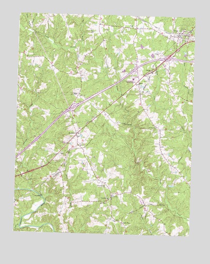
Alberta, VA USGS Topographic Map
Click on map above to begin viewing in our Map Viewer.

This topographic map contains these locations and features:
Feature Name Type Latitude Longitude GNIS ID View Map
AlbertaPopulated PlaceN36.8657°W77.8864°1498398View Map
Alberta Police DepartmentBuildingN36.8641°W77.8856°2332115View Map
Alberta Post OfficePost OfficeN36.8638°W77.8864°2767198View Map
Alberta Volunteer Fire Department Company 1BuildingN36.8548°W77.8878°2075523View Map
Becky BranchStreamN36.8668°W77.9917°1462985View Map
Brooks SchoolSchoolN36.8679°W77.9186°1463893View Map
Charlie HopeLocaleN36.7565°W77.9228°1464750View Map
Charlie Hope Number 1 SchoolSchoolN36.7699°W77.9314°1491123View Map
Charlie Hope Number 2 SchoolSchoolN36.7779°W77.9356°1491124View Map
CochranPopulated PlaceN36.8432°W77.9050°1477211View Map
Dugger CemeteryCemeteryN36.8049°W77.9564°1466032View Map
Epperson DamDamN36.8535°W77.8814°1489258View Map
Gees BridgeBridgeN36.7710°W77.9811°1467027View Map
GrandyPopulated PlaceN36.8004°W77.9553°1493983View Map
Green ChapelChurchN36.7674°W77.9344°1467460View Map
Gum BranchStreamN36.8307°W77.8756°1467597View Map
Interchange 24CrossingN36.8218°W77.9597°1493987View Map
Interchange 27CrossingN36.8454°W77.9153°1493988View Map
Interchange 28CrossingN36.8510°W77.8942°1493989View Map
Johnson CemeteryCemeteryN36.8532°W77.8992°1468784View Map
L M Epperson DamDamN36.8568°W77.9131°1489259View Map
Laffoon CemeteryCemeteryN36.8657°W77.9483°1469095View Map
MeredithvillePopulated PlaceN36.8068°W77.9567°1477534View Map
Meredithville Post OfficePost OfficeN36.8078°W77.9563°2766473View Map
Oak Grove SchoolSchoolN36.8115°W77.9003°1471742View Map
Ogden ChurchChurchN36.7574°W77.9244°1471816View Map
Orgain CemeteryCemeteryN36.7951°W77.9653°1471948View Map
Pleasant Grove ChurchChurchN36.7718°W77.9308°1472473View Map
Powell CreekStreamN36.8646°W77.9889°1472732View Map
Price MillPopulated PlaceN36.8129°W77.9219°1493454View Map
Saint Marks CemeteryCemeteryN36.8357°W77.9142°1494028View Map
Saint Marks ChurchChurchN36.8360°W77.9136°1473820View Map
Saint Pauls ChapelChurchN36.8290°W77.9594°1473863View Map
Salem ChurchChurchN36.8001°W77.9550°1473938View Map
Shining CreekStreamN36.7738°W77.9869°1474531View Map
Southside Virginia Community College - Christanna CampusSchoolN36.8391°W77.9180°1494033View Map
Taylors CreekStreamN36.7535°W77.9958°1462313View Map
Tea BranchStreamN36.8590°W77.9547°1475524View Map
Totaro DistrictCivilN36.7748°W77.9086°1927538View Map
Town of AlbertaCivilN36.8551°W77.8937°2390698View Map
Walden CemeteryCemeteryN36.7579°W77.9269°1476228View Map
Woodsdale School (historical)SchoolN36.8496°W77.9731°1690077View Map

Note: Coordinates in the location and feature list above are referenced to NAD83 datum.


Copyright (C) 2008-2025 Ryan Niemi / Sunset Dynamics ... All Rights Reserved