TopoQuest Logo
Do you find TopoQuest useful?
Help keep TopoQuest running and adding new maps/features by donating!
Bitcoin:  19c7KJd3qBynnjoSw5npx9KScwjBe4ifkT
Litecoin:  LXs6TkuXGGXo1vDsWCkWVdjQX94eUKd6ui
Home View Maps Find Maps Find Places Resources & Links


La Crosse, Virginia Topographic Map

USGS Map Title: La Crosse, VA
USGS Map MRC: 36078F1
DRG (GeoTIFF) Download: o36078f1.tif


Neighboring USGS Topographic Map Quads:


  North View, VA  
36078G2
 

  Forksville, VA  
36078G1
 

  Alberta, VA  
36077G8
 

  South Hill, VA  
36078F2
 

  La Crosse, VA  
36078F1
 

  White Plains, VA  
36077F8
 

  Bracey, VA  
36078E2
 

  South Hill SE, VA  
36078E1
 

  Gasburg, VA  
36077E8


Map MRC Location:

N37°
W79°
N37°
W78°
H8 H7 H6 H5 H4 H3 H2 H1
G8 G7 G6 G5 G4 G3 G2 G1
F8 F7 F6 F5 F4 F3 F2 F1
E8 E7 E6 E5 E4 E3 E2 E1
D8 D7 D6 D5 D4 D3 D2 D1
C8 C7 C6 C5 C4 C3 C2 C1
B8 B7 B6 B5 B4 B3 B2 B1
A8 A7 A6 A5 A4 A3 A2 A1
N36°
W79°
N36°
W78°

La Crosse, VA USGS 1:24K Topographic Map Preview:
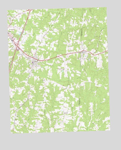
La Crosse, VA USGS Topographic Map
Click on map above to begin viewing in our Map Viewer.

This topographic map contains these locations and features:
Feature Name Type Latitude Longitude GNIS ID View Map
American Lifeline Medical TransportationBuildingN36.7003°W78.0940°2721156View Map
Amity ChurchChurchN36.7457°W78.1103°1462448View Map
Bennett CemeteryCemeteryN36.7376°W78.0147°1493955View Map
BlackridgePopulated PlaceN36.6451°W78.0569°1495274View Map
Booker-Boyd SchoolSchoolN36.6779°W78.0811°1463662View Map
BrodnaxPopulated PlaceN36.7065°W78.0314°1463870View Map
Brodnax Police DepartmentBuildingN36.7063°W78.0321°2767079View Map
Brodnax Post OfficePost OfficeN36.7058°W78.0332°2767202View Map
Brodnax Volunteer Fire Department Station 2BuildingN36.7065°W78.0290°2075524View Map
Canaan CemeteryCemeteryN36.6685°W78.0530°1500640View Map
Canaan ChurchChurchN36.6690°W78.0542°1464386View Map
Church of the Good ShepherdChurchN36.7463°W78.1050°1464902View Map
Crestview Memorial ParkCemeteryN36.6993°W78.0869°1500671View Map
District 3CivilN36.6507°W78.0763°1927225View Map
District 5CivilN36.7399°W78.1152°1927266View Map
Full Gospel TabernacleChurchN36.7274°W78.1244°1466918View Map
HagoodPopulated PlaceN36.6474°W78.1175°1500710View Map
Interchange 12CrossingN36.7135°W78.1133°1500721View Map
La CrossePopulated PlaceN36.7001°W78.0997°1495802View Map
La Crosse CemeteryCemeteryN36.6862°W78.0972°1469085View Map
La Crosse Police DepartmentBuildingN36.6951°W78.0921°2086138View Map
La Crosse Post OfficePost OfficeN36.6950°W78.0942°2766234View Map
La Crosse Volunteer Fire Department Company 5BuildingN36.6951°W78.0921°2086162View Map
LaCrosse Elementary SchoolSchoolN36.6781°W78.0810°1500735View Map
LaCrosse School (historical)SchoolN36.6985°W78.0806°1500736View Map
Liberty Grove School (historical)SchoolN36.7385°W78.0150°1494002View Map
Little Bethel ChurchChurchN36.7043°W78.1069°1469472View Map
Little Bethel Church CemeteryCemeteryN36.6987°W78.1139°1469476View Map
Long BranchStreamN36.6310°W78.0761°1469757View Map
Main CreekStreamN36.6301°W78.0281°1470017View Map
MarengoPopulated PlaceN36.6385°W78.1194°1477519View Map
Mecklenburg-Brunswick Regional AirportAirportN36.6897°W78.0520°1480244View Map
Miles ChapelChurchN36.6726°W78.0517°1470457View Map
Mount Herman ChurchChurchN36.7171°W78.0206°1470882View Map
Mount Hermon School (historical)SchoolN36.7176°W78.0200°1494049View Map
Mount Sinai ChurchChurchN36.7210°W78.0150°1471062View Map
Mount Vernon School (historical)SchoolN36.6271°W78.0589°1500758View Map
N V Boyd School (historical)SchoolN36.6499°W78.1131°1500760View Map
New Testament ChurchChurchN36.7074°W78.1033°1471499View Map
Northside Industrial ParkLocaleN36.7499°W78.0997°1500769View Map
Olive Branch CemeteryCemeteryN36.6437°W78.0580°1500776View Map
Olive Branch ChurchChurchN36.6435°W78.0575°1471900View Map
Pleasant Hill ChurchChurchN36.6540°W78.1089°1472492View Map
Pole CreekStreamN36.6271°W78.0275°1472575View Map
Raineys DamDamN36.7101°W78.1197°1490402View Map
Sardis ChurchChurchN36.6429°W78.1164°1474059View Map
Smith CemeteryCemeteryN36.6929°W78.0705°1500822View Map
South Hill Post OfficePost OfficeN36.7327°W78.1177°1500828View Map
Town of BrodnaxCivilN36.7033°W78.0319°2390754View Map
Town of La CrosseCivilN36.7014°W78.0940°2391259View Map
Trinity ChurchChurchN36.7140°W78.1181°1475861View Map
Trinity ChurchChurchN36.7343°W78.0364°1475862View Map
Union Meherrin ChurchChurchN36.7368°W78.0250°1476086View Map
Virginia State Police Division 3 Area 22 OfficeBuildingN36.7432°W78.1151°2767152View Map
Whites Store (historical)LocaleN36.6304°W78.0928°1500848View Map
Winkle DamDamN36.6851°W78.0564°1490401View Map

Note: Coordinates in the location and feature list above are referenced to NAD83 datum.


Copyright (C) 2008-2025 Ryan Niemi / Sunset Dynamics ... All Rights Reserved