TopoQuest Logo
Do you find TopoQuest useful?
Help keep TopoQuest running and adding new maps/features by donating!
Bitcoin:  19c7KJd3qBynnjoSw5npx9KScwjBe4ifkT
Litecoin:  LXs6TkuXGGXo1vDsWCkWVdjQX94eUKd6ui
Home View Maps Find Maps Find Places Resources & Links


Silver Ridge, Arkansas Topographic Map

USGS Map Title: Silver Ridge, AR
USGS Map MRC: 33094H1
DRG (GeoTIFF) Download: o33094h1.tif


Neighboring USGS Topographic Map Quads:


  Geneva, AR  
34094A2
 

  Dierks, AR  
34094A1
 

  Center Point, AR  
34093A8
 

  Lockesburg, AR  
33094H2
 

  Silver Ridge, AR  
33094H1
 

  Mineral Springs North, AR  
33093H8
 

  Falls Chapel, AR  
33094G2
 

  Ben Lomond, AR  
33094G1
 

  Mineral Springs South, AR  
33093G8


Map MRC Location:

N34°
W95°
N34°
W94°
H8 H7 H6 H5 H4 H3 H2 H1
G8 G7 G6 G5 G4 G3 G2 G1
F8 F7 F6 F5 F4 F3 F2 F1
E8 E7 E6 E5 E4 E3 E2 E1
D8 D7 D6 D5 D4 D3 D2 D1
C8 C7 C6 C5 C4 C3 C2 C1
B8 B7 B6 B5 B4 B3 B2 B1
A8 A7 A6 A5 A4 A3 A2 A1
N33°
W95°
N33°
W94°

Silver Ridge, AR USGS 1:24K Topographic Map Preview:
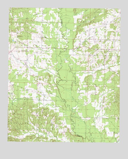
Silver Ridge, AR USGS Topographic Map
Click on map above to begin viewing in our Map Viewer.

This topographic map contains these locations and features:
Feature Name Type Latitude Longitude GNIS ID View Map
Brushy CreekStreamN33.9718°W94.0599°47076View Map
Center Methodist ChurchChurchN33.9707°W94.0113°76565View Map
Center School (historical)SchoolN33.9712°W94.0113°62554View Map
Coulter CemeteryCemeteryN33.9859°W94.0177°48080View Map
Cypress SloughGutN33.8754°W94.0305°76738View Map
Graves CemeteryCemeteryN33.9557°W94.0002°49598View Map
Gravity Point ChurchChurchN33.9196°W94.1210°49605View Map
Hickory Grove CemeteryCemeteryN33.9140°W94.0019°50057View Map
Hickory Grove Church (historical)ChurchN33.9137°W94.0024°62597View Map
Holly Springs ChurchChurchN33.9729°W94.1160°50249View Map
Kennedys Store (historical)LocaleN33.9618°W94.0044°62608View Map
Kingree ChapelChurchN33.9598°W94.1046°50861View Map
Kingree Chapel CemeteryCemeteryN33.9590°W94.1046°67306View Map
Lick CreekStreamN33.9046°W94.0555°51143View Map
Longview School (historical)SchoolN33.9534°W94.0319°62612View Map
Lyons United Methodist ChurchChurchN33.8918°W94.0746°77567View Map
Messer CreekStreamN33.9996°W94.0663°51921View Map
MilfordPopulated PlaceN33.9187°W94.0855°57118View Map
Mount Carmen CemeteryCemeteryN33.9971°W94.0274°77708View Map
Murphy FordCrossingN33.9951°W94.0694°62627View Map
Nutt School (historical)SchoolN33.8873°W94.0027°62635View Map
Prairie CreekStreamN33.9621°W94.0482°53760View Map
Rock CreekStreamN33.9393°W94.0499°54092View Map
Rosedale (historical)Populated PlaceN33.9771°W94.0419°62664View Map
Rosedale Baptist Church (historical)ChurchN33.9704°W94.0296°62665View Map
Rosedale School (historical)SchoolN33.9704°W94.0296°62666View Map
Saltworks FordCrossingN33.8973°W94.0552°62673View Map
Sanctified Church (historical)ChurchN33.9251°W94.0244°62674View Map
Sand CreekStreamN33.9926°W94.0666°54535View Map
Silver RidgeLocaleN33.9723°W94.0891°54850View Map
Spring CreekStreamN33.9132°W94.0630°55089View Map
Steele HillSummitN33.9051°W94.0849°58685View Map
Sulphur SloughStreamN33.9307°W94.0530°55322View Map
Township of Blue BayouCivilN33.8779°W94.0044°66672View Map
Township of SalineCivilN33.9287°W94.0175°66689View Map

Note: Coordinates in the location and feature list above are referenced to NAD83 datum.


Copyright (C) 2008-2025 Ryan Niemi / Sunset Dynamics ... All Rights Reserved