TopoQuest Logo
Do you find TopoQuest useful?
Help keep TopoQuest running and adding new maps/features by donating!
Bitcoin:  19c7KJd3qBynnjoSw5npx9KScwjBe4ifkT
Litecoin:  LXs6TkuXGGXo1vDsWCkWVdjQX94eUKd6ui
Home View Maps Find Maps Find Places Resources & Links


Lockesburg, Arkansas Topographic Map

USGS Map Title: Lockesburg, AR
USGS Map MRC: 33094H2
DRG (GeoTIFF) Download: o33094h2.tif


Neighboring USGS Topographic Map Quads:


  De Queen, AR  
34094A3
 

  Geneva, AR  
34094A2
 

  Dierks, AR  
34094A1
 

  Horatio, AR  
33094H3
 

  Lockesburg, AR  
33094H2
 

  Silver Ridge, AR  
33094H1
 

  Winthrop, AR  
33094G3
 

  Falls Chapel, AR  
33094G2
 

  Ben Lomond, AR  
33094G1


Map MRC Location:

N34°
W95°
N34°
W94°
H8 H7 H6 H5 H4 H3 H2 H1
G8 G7 G6 G5 G4 G3 G2 G1
F8 F7 F6 F5 F4 F3 F2 F1
E8 E7 E6 E5 E4 E3 E2 E1
D8 D7 D6 D5 D4 D3 D2 D1
C8 C7 C6 C5 C4 C3 C2 C1
B8 B7 B6 B5 B4 B3 B2 B1
A8 A7 A6 A5 A4 A3 A2 A1
N33°
W95°
N33°
W94°

Lockesburg, AR USGS 1:24K Topographic Map Preview:
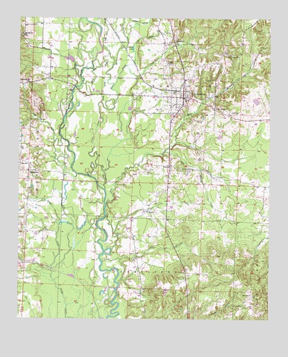
Lockesburg, AR USGS Topographic Map
Click on map above to begin viewing in our Map Viewer.

This topographic map contains these locations and features:
Feature Name Type Latitude Longitude GNIS ID View Map
BellvillePopulated PlaceN33.9387°W94.1749°76298View Map
Bellville CemeteryCemeteryN33.9382°W94.1696°67304View Map
Bellville CreekStreamN33.9226°W94.2066°46373View Map
Borne Mill SloughGutN33.9796°W94.2116°46845View Map
City of LockesburgCivilN33.9716°W94.1762°2404945View Map
Cold BranchStreamN33.9807°W94.1963°47900View Map
Coulter LakeReservoirN33.9657°W94.1321°80683View Map
Coulter Lake DamDamN33.9651°W94.1319°80682View Map
DilworthPopulated PlaceN33.9398°W94.2494°76799View Map
Dry CreekStreamN33.9357°W94.2210°48639View Map
Fraser PondReservoirN33.9501°W94.1435°81038View Map
Fraser Pond DamDamN33.9501°W94.1435°81037View Map
Johns BranchStreamN33.8901°W94.1999°50667View Map
Johnson SloughGutN33.9984°W94.1902°50705View Map
Little Bellville CreekStreamN33.9446°W94.1774°51196View Map
Little Cossatot RiverStreamN33.9343°W94.2138°51229View Map
Little CreekStreamN33.8968°W94.2341°51240View Map
LockesburgPopulated PlaceN33.9673°W94.1685°77533View Map
Lockesburg CemeteryCemeteryN33.9754°W94.1691°67301View Map
Lockesburg Elementary SchoolSchoolN33.9615°W94.1535°67302View Map
Lockesburg Fire DepartmentBuildingN33.9725°W94.1687°2116733View Map
Lockesburg High SchoolSchoolN33.9666°W94.1663°67303View Map
Lockesburg Post OfficePost OfficeN33.9678°W94.1679°2781880View Map
Lone Oak ChurchChurchN33.9734°W94.2491°51398View Map
Melrose School (historical)SchoolN33.9201°W94.1846°67300View Map
Mill SloughStreamN33.9290°W94.2071°52050View Map
MilrosePopulated PlaceN33.9201°W94.1860°58192View Map
Mount Carmel ChurchChurchN33.9626°W94.1516°52274View Map
Mount Ida ChurchChurchN33.9932°W94.2483°77719View Map
Oak GrovePopulated PlaceN33.8859°W94.1335°52878View Map
Oak Grove School (historical)SchoolN33.8862°W94.1333°67319View Map
Old Bellville ChurchChurchN33.9371°W94.1696°77899View Map
Old Union CemeteryCemeteryN33.9840°W94.1410°67305View Map
Old Union ChurchChurchN33.9843°W94.1410°53035View Map
PennysPopulated PlaceN33.8782°W94.1652°58344View Map
Rock HillLocaleN33.9909°W94.1721°54097View Map
Russey CreekStreamN33.9729°W94.2027°54289View Map
Russey LakeLakeN33.9876°W94.1935°75115View Map
Sand Field CemeteryCemeteryN33.9612°W94.1407°54537View Map
Sandy SloughStreamN33.9654°W94.2096°54582View Map
Sevier CountyCivilN33.9972°W94.2412°69182View Map
Southwest Transport Service (Basic Life Support)BuildingN33.9631°W94.1698°2119052View Map
StringtownPopulated PlaceN33.9365°W94.2441°58699View Map
Sycamore CreekStreamN33.9876°W94.1999°55404View Map
Tobin LakeReservoirN33.9832°W94.2251°81036View Map
Tobin Lake DamDamN33.9818°W94.2235°81035View Map
United States Fish and Wildlife Pond Creek National Wildlife Refuge Park SecurityBuildingN33.8857°W94.1989°2118961View Map
White Oak SloughStreamN33.9879°W94.2091°56298View Map

Note: Coordinates in the location and feature list above are referenced to NAD83 datum.


Copyright (C) 2008-2024 Ryan Niemi / Sunset Dynamics ... All Rights Reserved