TopoQuest Logo
Do you find TopoQuest useful?
Help keep TopoQuest running and adding new maps/features by donating!
Bitcoin:  19c7KJd3qBynnjoSw5npx9KScwjBe4ifkT
Litecoin:  LXs6TkuXGGXo1vDsWCkWVdjQX94eUKd6ui
Home View Maps Find Maps Find Places Resources & Links


Simpsonville, Kentucky Topographic Map

USGS Map Title: Simpsonville, KY
USGS Map MRC: 38085B3
DRG (GeoTIFF) Download: o38085b3.tif


Neighboring USGS Topographic Map Quads:


  Crestwood, KY  
38085C4
 

  Ballardsville, KY  
38085C3
 

  Eminence, KY  
38085C2
 

  Fisherville, KY  
38085B4
 

  Simpsonville, KY  
38085B3
 

  Shelbyville, KY  
38085B2
 

  Waterford, KY  
38085A4
 

  Taylorsville, KY  
38085A3
 

  Mount Eden, KY  
38085A2


Map MRC Location:

N39°
W86°
N39°
W85°
H8 H7 H6 H5 H4 H3 H2 H1
G8 G7 G6 G5 G4 G3 G2 G1
F8 F7 F6 F5 F4 F3 F2 F1
E8 E7 E6 E5 E4 E3 E2 E1
D8 D7 D6 D5 D4 D3 D2 D1
C8 C7 C6 C5 C4 C3 C2 C1
B8 B7 B6 B5 B4 B3 B2 B1
A8 A7 A6 A5 A4 A3 A2 A1
N38°
W86°
N38°
W85°

Simpsonville, KY USGS 1:24K Topographic Map Preview:
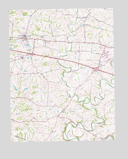
Simpsonville, KY USGS Topographic Map
Click on map above to begin viewing in our Map Viewer.

This topographic map contains these locations and features:
Feature Name Type Latitude Longitude GNIS ID View Map
Beechwood Church (historical)ChurchN38.2170°W85.2812°2567277View Map
Beechwood School (historical)SchoolN38.2170°W85.2815°2567278View Map
Buck Creek Baptist Church (historical)ChurchN38.1348°W85.3260°2567181View Map
Buck Creek CemeteryCemeteryN38.1469°W85.3321°2567182View Map
Buck Creek SchoolSchoolN38.1345°W85.3261°488219View Map
Buck Creek Station (historical)LocaleN38.1455°W85.3306°2567183View Map
Bullskin CreekStreamN38.1617°W85.2800°488381View Map
Captain Samuel Wells Station (historical)LocaleN38.2396°W85.2576°2567186View Map
City of SimpsonvilleCivilN38.2166°W85.3515°2405466View Map
Clear CreekStreamN38.1620°W85.2800°489615View Map
Dry RunStreamN38.1831°W85.2647°491237View Map
Finchs Railroad Station (historical)LocaleN38.1502°W85.3169°2567209View Map
FinchvillePopulated PlaceN38.1537°W85.3127°492079View Map
Finchville Christian Church (historical)ChurchN38.1520°W85.3143°2567210View Map
Finchville School (historical)SchoolN38.1491°W85.3184°2567211View Map
Fox RunStreamN38.2415°W85.2894°492416View Map
Gath Railroad Station (historical)LocaleN38.1963°W85.2666°2567281View Map
Herrington Mills (historical)LocaleN38.2417°W85.2834°2567225View Map
JoyesPopulated PlaceN38.2098°W85.2911°508360View Map
Little Bullskin CreekStreamN38.2051°W85.3144°496653View Map
Meadow RunStreamN38.1359°W85.2772°497993View Map
MontclairPopulated PlaceN38.2201°W85.3288°498495View Map
Newlands Station (historical)LocaleN38.1264°W85.2664°2567238View Map
Olive BranchPopulated PlaceN38.1256°W85.2650°508747View Map
Olive Branch United Methodist ChurchChurchN38.1271°W85.2625°2515094View Map
Pickett Railroad Station (historical)LocaleN38.1387°W85.3184°2567286View Map
Picketts CemeteryCemeteryN38.1398°W85.2952°500560View Map
Popes CornerBendN38.1645°W85.2652°2567248View Map
School Number Twenty-One (historical)SchoolN38.1896°W85.3488°2567256View Map
Scotts StationLocaleN38.2342°W85.2850°503117View Map
Scotts Station Post Office (historical)Post OfficeN38.2342°W85.2853°2567257View Map
Shelby Academy (historical)SchoolN38.1505°W85.3168°2567259View Map
Shelby County Fire Department Station 2BuildingN38.2014°W85.2681°2637423View Map
Shelby County Fire Department Station 4BuildingN38.1444°W85.3010°2637425View Map
Shiloh ChurchChurchN38.2415°W85.2825°503382View Map
SimpsonvillePopulated PlaceN38.2226°W85.3552°503542View Map
Simpsonville DivisionCivilN38.2172°W85.3582°1937260View Map
Simpsonville Fire DepartmentBuildingN38.2234°W85.3443°2636547View Map
Simpsonville Post OfficePost OfficeN38.2218°W85.3468°2460371View Map
Simpsonville Rural Fire Protection District Station 3BuildingN38.1451°W85.3594°2637428View Map
Taggart Railroad Station (historical)LocaleN38.1661°W85.3007°2567268View Map
Thelma L Stovall Historical MarkerParkN38.2035°W85.3299°2744716View Map
VeechdalePopulated PlaceN38.2112°W85.3500°506015View Map
Veechdale Post Office (historical)Post OfficeN38.2115°W85.3492°2567295View Map
Veechdale Railroad Station (historical)LocaleN38.2111°W85.3497°2567296View Map

Note: Coordinates in the location and feature list above are referenced to NAD83 datum.


Copyright (C) 2008-2024 Ryan Niemi / Sunset Dynamics ... All Rights Reserved