TopoQuest Logo
Do you find TopoQuest useful?
Help keep TopoQuest running and adding new maps/features by donating!
Bitcoin:  19c7KJd3qBynnjoSw5npx9KScwjBe4ifkT
Litecoin:  LXs6TkuXGGXo1vDsWCkWVdjQX94eUKd6ui
Home View Maps Find Maps Find Places Resources & Links


Singleton, Texas Topographic Map

USGS Map Title: Singleton, TX
USGS Map MRC: 30095F8
DRG (GeoTIFF) Download: o30095f8.tif


Neighboring USGS Topographic Map Quads:


  Iola, TX  
30096G1
 

  Bedias, TX  
30095G8
 

  Steep Branch, TX  
30095G7
 

  Keith, TX  
30096F1
 

  Singleton, TX  
30095F8
 

  Loma, TX  
30095F7
 

  Carlos, TX  
30096E1
 

  Roans Prairie, TX  
30095E8
 

  Richards, TX  
30095E7


Map MRC Location:

N31°
W96°
N31°
W95°
H8 H7 H6 H5 H4 H3 H2 H1
G8 G7 G6 G5 G4 G3 G2 G1
F8 F7 F6 F5 F4 F3 F2 F1
E8 E7 E6 E5 E4 E3 E2 E1
D8 D7 D6 D5 D4 D3 D2 D1
C8 C7 C6 C5 C4 C3 C2 C1
B8 B7 B6 B5 B4 B3 B2 B1
A8 A7 A6 A5 A4 A3 A2 A1
N30°
W96°
N30°
W95°

Singleton, TX USGS 1:24K Topographic Map Preview:
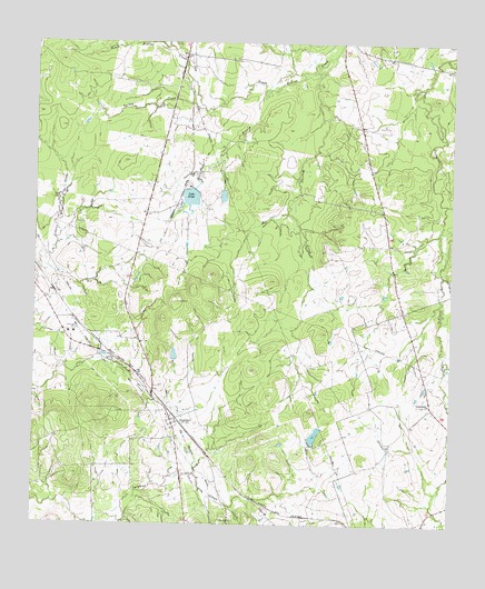
Singleton, TX USGS Topographic Map
Click on map above to begin viewing in our Map Viewer.

This topographic map contains these locations and features:
Feature Name Type Latitude Longitude GNIS ID View Map
Anderson-Bedias DivisionCivilN30.6492°W95.9998°1938491View Map
Eichenour LakeReservoirN30.7044°W95.9277°1860292View Map
Eichenour Lake DamDamN30.7052°W95.9269°1860291View Map
Independence ChurchChurchN30.6566°W95.8816°1359908View Map
Lake Irene DamDamN30.7119°W95.9519°1860287View Map
Lake IrineReservoirN30.7100°W95.9537°1360026View Map
Mooring CreekStreamN30.7427°W95.9161°1363130View Map
Pine BranchStreamN30.7382°W95.9305°1365263View Map
Rocky BranchStreamN30.7460°W95.9563°1375799View Map
SingletonPopulated PlaceN30.6521°W95.9586°1368319View Map
Stuart LakeReservoirN30.6482°W95.9159°1860294View Map
Stuart Lake DamDamN30.6469°W95.9169°1860293View Map
Turkey CreekStreamN30.7327°W95.9500°1370222View Map
Wilson DamDamN30.6685°W95.9569°1860289View Map
Wilson LakeReservoirN30.6689°W95.9581°1860290View Map
Zion Hill ChurchChurchN30.6263°W95.9402°1372097View Map

Note: Coordinates in the location and feature list above are referenced to NAD83 datum.


Copyright (C) 2008-2025 Ryan Niemi / Sunset Dynamics ... All Rights Reserved