TopoQuest Logo
Do you find TopoQuest useful?
Help keep TopoQuest running and adding new maps/features by donating!
Bitcoin:  19c7KJd3qBynnjoSw5npx9KScwjBe4ifkT
Litecoin:  LXs6TkuXGGXo1vDsWCkWVdjQX94eUKd6ui
Home View Maps Find Maps Find Places Resources & Links


Campbellton, Florida Topographic Map

USGS Map Title: Campbellton, FL
USGS Map MRC: 30085H4
DRG (GeoTIFF) Download: o30085h4.tif


Neighboring USGS Topographic Map Quads:


  Slocomb, AL  
31085A5
 

  Madrid, AL  
31085A4
 

  Cottonwood, AL  
31085A3
 

  Graceville, FL  
30085H5
 

  Campbellton, FL  
30085H4
 

  Sills, FL  
30085H3
 

  Chipley, FL  
30085G5
 

  Cottondale West, FL  
30085G4
 

  Cottondale East, FL  
30085G3


Map MRC Location:

N31°
W86°
N31°
W85°
H8 H7 H6 H5 H4 H3 H2 H1
G8 G7 G6 G5 G4 G3 G2 G1
F8 F7 F6 F5 F4 F3 F2 F1
E8 E7 E6 E5 E4 E3 E2 E1
D8 D7 D6 D5 D4 D3 D2 D1
C8 C7 C6 C5 C4 C3 C2 C1
B8 B7 B6 B5 B4 B3 B2 B1
A8 A7 A6 A5 A4 A3 A2 A1
N30°
W86°
N30°
W85°

Campbellton, FL USGS 1:24K Topographic Map Preview:
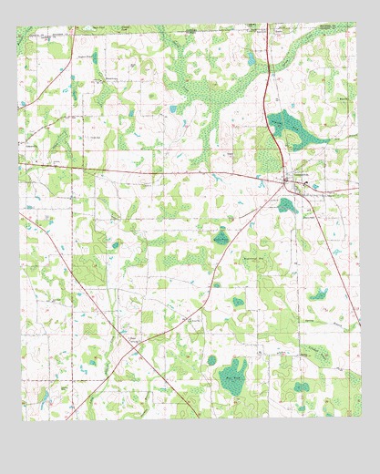
Campbellton, FL USGS Topographic Map
Click on map above to begin viewing in our Map Viewer.

This topographic map contains these locations and features:
Feature Name Type Latitude Longitude GNIS ID View Map
Apostolic ChurchChurchN30.9563°W85.4869°277924View Map
Brantley PondSwampN30.9677°W85.3994°279341View Map
BrowntownPopulated PlaceN30.9824°W85.4672°295157View Map
Brushy PondLakeN30.9999°W85.4641°115068View Map
CampbelltonPopulated PlaceN30.9494°W85.4022°279954View Map
Campbellton Post OfficePost OfficeN30.9505°W85.4026°2759157View Map
City of Jacob CityCivilN30.8926°W85.4106°2404786View Map
Crooked IslandSwampN30.8970°W85.3914°281072View Map
EllavillePopulated PlaceN30.9749°W85.3766°295263View Map
Gaynor PondLakeN30.9888°W85.4712°282995View Map
Graceville Correctional FacilityBuildingN30.9442°W85.4895°2753063View Map
Grant PondSwampN30.9321°W85.4261°283285View Map
Hinson CemeteryCemeteryN30.9646°W85.4735°284050View Map
Jackson County Fire and Rescue Station 2BuildingN30.9511°W85.4032°2644698View Map
Jackson County Fire Rescue Station 2BuildingN30.9505°W85.4015°2644629View Map
JacobsPopulated PlaceN30.8949°W85.3977°284706View Map
Kirkland AirportAirportN30.9807°W85.4926°309461View Map
New Bethel ChurchChurchN30.9452°W85.3880°287604View Map
New Hope ChurchChurchN30.9130°W85.4880°287645View Map
RamboPopulated PlaceN30.9968°W85.4038°295566View Map
Registered BaySwampN30.9263°W85.4152°289630View Map
Rum PondSwampN30.8881°W85.4221°290051View Map
Saint Marys ChurchChurchN30.8955°W85.4058°290309View Map
Saint Michael ChurchChurchN30.9060°W85.4383°290322View Map
Saint Paul ChurchChurchN30.9441°W85.4074°290333View Map
Shiloh SchoolSchoolN30.9488°W85.4535°291045View Map
Spring Hill ChurchChurchN30.8999°W85.4560°291543View Map
State LineLocaleN30.9982°W85.4077°291650View Map
Town of CampbelltonCivilN30.9510°W85.4019°2405371View Map
Watson Airport (historical)AirportN30.9524°W85.4145°309304View Map

Note: Coordinates in the location and feature list above are referenced to NAD83 datum.


Copyright (C) 2008-2024 Ryan Niemi / Sunset Dynamics ... All Rights Reserved