TopoQuest Logo
Do you find TopoQuest useful?
Help keep TopoQuest running and adding new maps/features by donating!
Bitcoin:  19c7KJd3qBynnjoSw5npx9KScwjBe4ifkT
Litecoin:  LXs6TkuXGGXo1vDsWCkWVdjQX94eUKd6ui
Home View Maps Find Maps Find Places Resources & Links


Smith River Falls, Oregon Topographic Map

USGS Map Title: Smith River Falls, OR
USGS Map MRC: 43123G7
DRG (GeoTIFF) Download: o43123g7.tif


Neighboring USGS Topographic Map Quads:


  Goodwin Peak, OR  
43123H8
 

  Baldy Mountain, OR  
43123H7
 

  Roman Nose Mountain, OR  
43123H6
 

  North Fork, OR  
43123G8
 

  Smith River Falls, OR  
43123G7
 

  Twin Sisters, OR  
43123G6
 

  Deer Head Point, OR  
43123F8
 

  Scottsburg, OR  
43123F7
 

  Devils Graveyard, OR  
43123F6


Map MRC Location:

N44°
W124°
N44°
W123°
H8 H7 H6 H5 H4 H3 H2 H1
G8 G7 G6 G5 G4 G3 G2 G1
F8 F7 F6 F5 F4 F3 F2 F1
E8 E7 E6 E5 E4 E3 E2 E1
D8 D7 D6 D5 D4 D3 D2 D1
C8 C7 C6 C5 C4 C3 C2 C1
B8 B7 B6 B5 B4 B3 B2 B1
A8 A7 A6 A5 A4 A3 A2 A1
N43°
W124°
N43°
W123°

Smith River Falls, OR USGS 1:24K Topographic Map Preview:
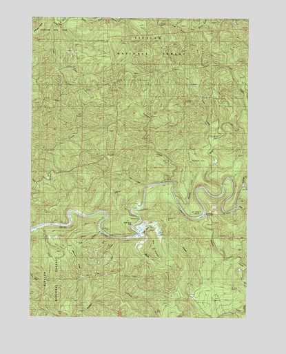
Smith River Falls, OR USGS Topographic Map
Click on map above to begin viewing in our Map Viewer.

This topographic map contains these locations and features:
Feature Name Type Latitude Longitude GNIS ID View Map
Bear CreekStreamN43.8054°W123.8107°1137654View Map
Blackwell CreekStreamN43.8054°W123.7540°1153681View Map
Buck CreekStreamN43.7843°W123.8134°1138756View Map
Cedar CreekStreamN43.8726°W123.8634°1139499View Map
Clearwater CreekStreamN43.8018°W123.7501°1134886View Map
Coon CreekStreamN43.8246°W123.7757°1140068View Map
Crane CreekStreamN43.8365°W123.7554°1140369View Map
Dailey CreekStreamN43.7879°W123.8704°1134885View Map
Doe CreekStreamN43.7860°W123.8362°1134882View Map
Dog CreekStreamN43.8060°W123.8726°1159297View Map
Fawn CreekStreamN43.7835°W123.8276°1134884View Map
Fawn Creek Recreation SiteLocaleN43.7840°W123.8297°1638053View Map
Fisher CreekStreamN43.8690°W123.8637°1153670View Map
Johnson CreekStreamN43.8065°W123.8023°1144328View Map
Little Buck CreekStreamN43.7862°W123.8134°1145112View Map
Rachel CreekStreamN43.7954°W123.7884°1134883View Map
Scare CreekStreamN43.7971°W123.7593°1149115View Map
Smith River FallsFallsN43.7882°W123.8187°1149765View Map
The IslandSummitN43.7779°W123.8061°1151020View Map
Vincent CreekStreamN43.7929°W123.7762°1151770View Map
Vincent Creek Guard Station (historical)LocaleN43.7948°W123.7768°1151772View Map
Vincent Creek Recreation SiteLocaleN43.7929°W123.7766°2554112View Map
Wasson RidgeRidgeN43.7721°W123.8498°1153672View Map
West Fork Smith RiverStreamN43.8062°W123.7668°1152115View Map

Note: Coordinates in the location and feature list above are referenced to NAD83 datum.


Copyright (C) 2008-2025 Ryan Niemi / Sunset Dynamics ... All Rights Reserved