TopoQuest Logo
Do you find TopoQuest useful?
Help keep TopoQuest running and adding new maps/features by donating!
Bitcoin:  19c7KJd3qBynnjoSw5npx9KScwjBe4ifkT
Litecoin:  LXs6TkuXGGXo1vDsWCkWVdjQX94eUKd6ui
Home View Maps Find Maps Find Places Resources & Links


Deer Head Point, Oregon Topographic Map

USGS Map Title: Deer Head Point, OR
USGS Map MRC: 43123F8
DRG (GeoTIFF) Download: o43123f8.tif


Neighboring USGS Topographic Map Quads:


  Fivemile Creek, OR  
43124G1
 

  North Fork, OR  
43123G8
 

  Smith River Falls, OR  
43123G7
 

  Reedsport, OR  
43124F1
 

  Deer Head Point, OR  
43123F8
 

  Scottsburg, OR  
43123F7
 

  Trail Butte, OR  
43124E1
 

  Elk Peak, OR  
43123E8
 

  Loon Lake, OR  
43123E7


Map MRC Location:

N44°
W124°
N44°
W123°
H8 H7 H6 H5 H4 H3 H2 H1
G8 G7 G6 G5 G4 G3 G2 G1
F8 F7 F6 F5 F4 F3 F2 F1
E8 E7 E6 E5 E4 E3 E2 E1
D8 D7 D6 D5 D4 D3 D2 D1
C8 C7 C6 C5 C4 C3 C2 C1
B8 B7 B6 B5 B4 B3 B2 B1
A8 A7 A6 A5 A4 A3 A2 A1
N43°
W124°
N43°
W123°

Deer Head Point, OR USGS 1:24K Topographic Map Preview:
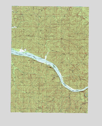
Deer Head Point, OR USGS Topographic Map
Click on map above to begin viewing in our Map Viewer.

This topographic map contains these locations and features:
Feature Name Type Latitude Longitude GNIS ID View Map
Bear CreekStreamN43.7043°W123.9451°1137653View Map
Brandy BarBarN43.6790°W123.9295°1138571View Map
Cedar CreekStreamN43.7093°W123.9432°1139496View Map
Charlotte CreekStreamN43.6607°W123.9187°1139579View Map
Deer Head PointSummitN43.6939°W123.9138°1140850View Map
Devils Club CanyonValleyN43.6692°W123.8926°1140945View Map
Echo IslandIslandN43.6954°W123.9802°1141663View Map
Fischer CreekStreamN43.6982°W123.9387°1142144View Map
Franklin CreekStreamN43.6679°W123.9182°1142410View Map
Harvey CreekStreamN43.6873°W123.9445°1143344View Map
Indian Charlie CreekStreamN43.6684°W123.9237°1144018View Map
Johnson CreekStreamN43.6773°W123.9957°1144327View Map
Little Franklin CreekStreamN43.6818°W123.8859°1155298View Map
Luder CreekStreamN43.6507°W123.9018°1145669View Map
Lunch RidgeRidgeN43.7193°W123.9526°1155304View Map
Reedsport DivisionCivilN43.7081°W123.9456°1938104View Map
Skagit RidgeRidgeN43.7336°W123.9505°1155303View Map
Umpqua State Scenic CorridorParkN43.6512°W123.9059°1151645View Map
Umpqua Wayside State ParkLocaleN43.6557°W123.9133°2668597View Map

Note: Coordinates in the location and feature list above are referenced to NAD83 datum.


Copyright (C) 2008-2025 Ryan Niemi / Sunset Dynamics ... All Rights Reserved