TopoQuest Logo
Do you find TopoQuest useful?
Help keep TopoQuest running and adding new maps/features by donating!
Bitcoin:  19c7KJd3qBynnjoSw5npx9KScwjBe4ifkT
Litecoin:  LXs6TkuXGGXo1vDsWCkWVdjQX94eUKd6ui
Home View Maps Find Maps Find Places Resources & Links


North Fork, Oregon Topographic Map

USGS Map Title: North Fork, OR
USGS Map MRC: 43123G8
DRG (GeoTIFF) Download: o43123g8.tif


Neighboring USGS Topographic Map Quads:


  Florence, OR  
43124H1
 

  Goodwin Peak, OR  
43123H8
 

  Baldy Mountain, OR  
43123H7
 

  Fivemile Creek, OR  
43124G1
 

  North Fork, OR  
43123G8
 

  Smith River Falls, OR  
43123G7
 

  Reedsport, OR  
43124F1
 

  Deer Head Point, OR  
43123F8
 

  Scottsburg, OR  
43123F7


Map MRC Location:

N44°
W124°
N44°
W123°
H8 H7 H6 H5 H4 H3 H2 H1
G8 G7 G6 G5 G4 G3 G2 G1
F8 F7 F6 F5 F4 F3 F2 F1
E8 E7 E6 E5 E4 E3 E2 E1
D8 D7 D6 D5 D4 D3 D2 D1
C8 C7 C6 C5 C4 C3 C2 C1
B8 B7 B6 B5 B4 B3 B2 B1
A8 A7 A6 A5 A4 A3 A2 A1
N43°
W124°
N43°
W123°

North Fork, OR USGS 1:24K Topographic Map Preview:
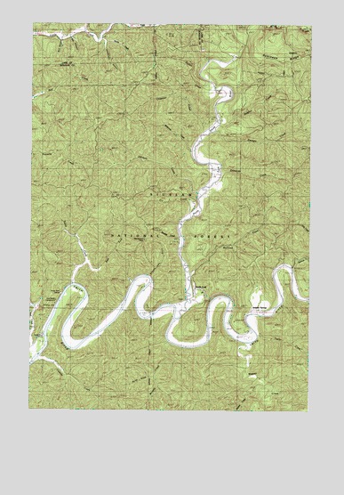
North Fork, OR USGS Topographic Map
Click on map above to begin viewing in our Map Viewer.

This topographic map contains these locations and features:
Feature Name Type Latitude Longitude GNIS ID View Map
Big CanyonValleyN43.8704°W123.9829°1135591View Map
Billy Moore CreekStreamN43.8726°W123.9787°1138127View Map
Bull CanyonValleyN43.8698°W123.9887°1135606View Map
Buzzards ButteSummitN43.7971°W123.9609°1153674View Map
Cassidy CreekStreamN43.7671°W123.9971°1639296View Map
Chapman CreekStreamN43.8393°W123.9240°1150576View Map
Dailey RanchLocaleN43.7821°W123.9473°1140594View Map
Dry CreekStreamN43.8123°W123.9293°1139569View Map
East Fork Eslick CreekStreamN43.7976°W123.9765°1141562View Map
Edmonds CreekStreamN43.8248°W123.9182°1141679View Map
Eslick CreekStreamN43.7910°W123.9821°1141894View Map
Georgia CreekStreamN43.8407°W123.9187°1142617View Map
Harlan CreekStreamN43.8532°W123.9193°1143309View Map
Henderson CanyonValleyN43.8665°W123.9679°1135590View Map
Henderson PeakSummitN43.8050°W123.9504°1143489View Map
Horse GulchValleyN43.7632°W123.9454°1135614View Map
Johnson CreekStreamN43.8204°W123.9251°1144329View Map
Lower Smith River CemeteryCemeteryN43.7852°W123.9339°1153673View Map
McKinney CreekStreamN43.8346°W123.9284°1155329View Map
Morris CreekStreamN43.8704°W123.9698°1135607View Map
Murphy CreekStreamN43.7732°W123.9404°1146677View Map
Noel CreekStreamN43.7671°W123.9998°1146863View Map
Noel Ranch Recreation SiteLocaleN43.7828°W123.9902°1135610View Map
Noel Ranch Recreation Site Boat LaunchLocaleN43.7827°W123.9899°2668463View Map
Norfolk Post Office (historical)Post OfficeN43.7848°W123.9354°1165711View Map
North ForkPopulated PlaceN43.7891°W123.9270°1135613View Map
North Fork Smith RiverStreamN43.7804°W123.9373°1147001View Map
Perkins CreekStreamN43.7554°W123.9032°1147596View Map
Railroad CreekStreamN43.7948°W123.9301°1148162View Map
Robinson RidgeRidgeN43.8629°W123.8909°1153671View Map
Russian John GulchValleyN43.7935°W123.9473°1135609View Map
School House County Park Boat RampLocaleN43.7741°W123.9732°2668541View Map
Smith River GrangeBuildingN43.7878°W123.9876°1149766View Map
Smith River MarinaHarborN43.7745°W123.9949°1135612View Map
Spencer CreekStreamN43.7965°W123.8843°1150113View Map
Straddle CreekStreamN43.8065°W123.9343°1135608View Map
Sulphur CreekStreamN43.8421°W123.9171°1135615View Map
Sulphur RidgeRidgeN43.8540°W123.9318°1153675View Map
Sulphur SpringsLocaleN43.7832°W123.9012°1150591View Map
Sulphur Springs Post Office (historical)Post OfficeN43.7832°W123.9012°1166001View Map
Taylor CreekStreamN43.7740°W123.8934°1159356View Map
Wasson CreekStreamN43.7721°W123.9012°1639342View Map
Weiss RanchLocaleN43.7762°W123.9026°1151996View Map
Wroe Post Office (historical)Post OfficeN43.8443°W123.9184°1164796View Map

Note: Coordinates in the location and feature list above are referenced to NAD83 datum.


Copyright (C) 2008-2025 Ryan Niemi / Sunset Dynamics ... All Rights Reserved