TopoQuest Logo
Do you find TopoQuest useful?
Help keep TopoQuest running and adding new maps/features by donating!
Bitcoin:  19c7KJd3qBynnjoSw5npx9KScwjBe4ifkT
Litecoin:  LXs6TkuXGGXo1vDsWCkWVdjQX94eUKd6ui
Home View Maps Find Maps Find Places Resources & Links


Scottsburg, Oregon Topographic Map

USGS Map Title: Scottsburg, OR
USGS Map MRC: 43123F7
DRG (GeoTIFF) Download: o43123f7.tif


Neighboring USGS Topographic Map Quads:


  North Fork, OR  
43123G8
 

  Smith River Falls, OR  
43123G7
 

  Twin Sisters, OR  
43123G6
 

  Deer Head Point, OR  
43123F8
 

  Scottsburg, OR  
43123F7
 

  Devils Graveyard, OR  
43123F6
 

  Elk Peak, OR  
43123E8
 

  Loon Lake, OR  
43123E7
 

  Old Blue, OR  
43123E6


Map MRC Location:

N44°
W124°
N44°
W123°
H8 H7 H6 H5 H4 H3 H2 H1
G8 G7 G6 G5 G4 G3 G2 G1
F8 F7 F6 F5 F4 F3 F2 F1
E8 E7 E6 E5 E4 E3 E2 E1
D8 D7 D6 D5 D4 D3 D2 D1
C8 C7 C6 C5 C4 C3 C2 C1
B8 B7 B6 B5 B4 B3 B2 B1
A8 A7 A6 A5 A4 A3 A2 A1
N43°
W124°
N43°
W123°

Scottsburg, OR USGS 1:24K Topographic Map Preview:
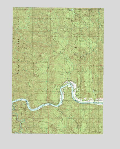
Scottsburg, OR USGS Topographic Map
Click on map above to begin viewing in our Map Viewer.

This topographic map contains these locations and features:
Feature Name Type Latitude Longitude GNIS ID View Map
Burchard CreekStreamN43.6565°W123.7626°1138963View Map
Burchard LakeReservoirN43.6678°W123.7649°1155299View Map
Fern TopSummitN43.7105°W123.7896°1142071View Map
Footlog CreekStreamN43.6429°W123.8679°1158996View Map
Golden CreekStreamN43.6685°W123.7915°1142832View Map
Golden RidgeRidgeN43.7082°W123.8568°1155302View Map
Green AcresPopulated PlaceN43.6758°W123.7952°1158894View Map
Little Mill CreekStreamN43.6546°W123.8265°1145210View Map
Mill CreekStreamN43.6554°W123.8743°1146236View Map
Murphys Camp (historical)LocaleN43.6471°W123.8429°1162537View Map
Myrtle City Post Office (historical)Post OfficeN43.6687°W123.7929°1164533View Map
Purdy CreekStreamN43.6640°W123.7620°1148055View Map
Rock IslandIslandN43.6676°W123.8091°1155300View Map
ScottsburgPopulated PlaceN43.6540°W123.8168°1149180View Map
Scottsburg CemeteryCemeteryN43.6692°W123.7868°1155301View Map
Scottsburg County Park Boat RampLocaleN43.6497°W123.8390°2668145View Map
Scottsburg ParkParkN43.6504°W123.8367°1162538View Map
Scottsburg Post OfficePost OfficeN43.6545°W123.8198°1165923View Map
Scottsburg Rural Fire Protection DistrictBuildingN43.6749°W123.8042°2576944View Map
Umpqua River Safety Rest Area (historical)LocaleN43.6498°W123.8512°1162536View Map
Wasson LakeLakeN43.7478°W123.7953°1639343View Map
Wells CreekStreamN43.6748°W123.7973°1152010View Map

Note: Coordinates in the location and feature list above are referenced to NAD83 datum.


Copyright (C) 2008-2024 Ryan Niemi / Sunset Dynamics ... All Rights Reserved