TopoQuest Logo
Do you find TopoQuest useful?
Help keep TopoQuest running and adding new maps/features by donating!
Bitcoin:  19c7KJd3qBynnjoSw5npx9KScwjBe4ifkT
Litecoin:  LXs6TkuXGGXo1vDsWCkWVdjQX94eUKd6ui
Home View Maps Find Maps Find Places Resources & Links


Smithburg, West Virginia Topographic Map

USGS Map Title: Smithburg, WV
USGS Map MRC: 39080C6
DRG (GeoTIFF) Download: o39080c6.tif


Neighboring USGS Topographic Map Quads:


  Shirley, WV  
39080D7
 

  Center Point, WV  
39080D6
 

  Folsom, WV  
39080D5
 

  West Union, WV  
39080C7
 

  Smithburg, WV  
39080C6
 

  Salem, WV  
39080C5
 

  Oxford, WV  
39080B7
 

  New Milton, WV  
39080B6
 

  Big Isaac, WV  
39080B5


Map MRC Location:

N40°
W81°
N40°
W80°
H8 H7 H6 H5 H4 H3 H2 H1
G8 G7 G6 G5 G4 G3 G2 G1
F8 F7 F6 F5 F4 F3 F2 F1
E8 E7 E6 E5 E4 E3 E2 E1
D8 D7 D6 D5 D4 D3 D2 D1
C8 C7 C6 C5 C4 C3 C2 C1
B8 B7 B6 B5 B4 B3 B2 B1
A8 A7 A6 A5 A4 A3 A2 A1
N39°
W81°
N39°
W80°

Smithburg, WV USGS 1:24K Topographic Map Preview:
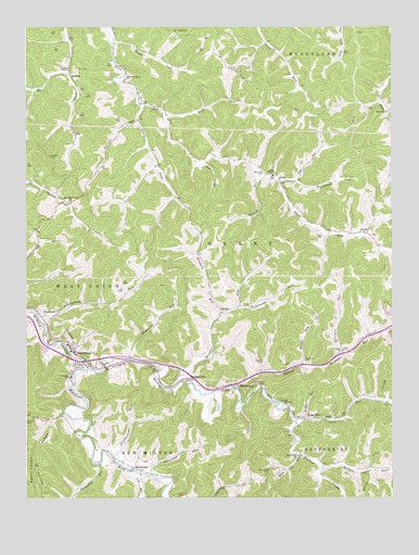
Smithburg, WV USGS Topographic Map
Click on map above to begin viewing in our Map Viewer.

This topographic map contains these locations and features:
Feature Name Type Latitude Longitude GNIS ID View Map
Archbold CemeteryCemeteryN39.2856°W80.7251°1534997View Map
AvondalePopulated PlaceN39.2979°W80.7445°1553770View Map
Beech DistrictCivilN39.3657°W80.6257°1928165View Map
Big Battle (historical)Populated PlaceN39.3515°W80.6262°1689441View Map
Black Lick Baptist ChurchChurchN39.2609°W80.6570°1536053View Map
Black Lick RunStreamN39.2615°W80.6562°1536054View Map
BlandvillePopulated PlaceN39.2568°W80.7107°1536087View Map
Blandville CemeteryCemeteryN39.2595°W80.7101°1689448View Map
Blandville Post OfficePost OfficeN39.2579°W80.7129°1689449View Map
Blandville United Methodist ChurchChurchN39.2579°W80.7137°1689450View Map
Brush RunStreamN39.3712°W80.7204°1536477View Map
Buckeye CreekStreamN39.2843°W80.7282°1536586View Map
Buckeye RunStreamN39.2793°W80.6779°1536593View Map
Buffalo Calf ForkStreamN39.2579°W80.6495°1536617View Map
CantonPopulated PlaceN39.3631°W80.7354°1554062View Map
Carr Elementary School (historical)SchoolN39.3359°W80.6659°1537063View Map
Chestnut Grove CemeteryCemeteryN39.3609°W80.7157°1689467View Map
Chestnut Grove ChurchChurchN39.3609°W80.7168°1537280View Map
DoakPopulated PlaceN39.3204°W80.6334°1554310View Map
Doak CemeteryCemeteryN39.3198°W80.6323°1689474View Map
Doddridge CountyCivilN39.2692°W80.7070°1689476View Map
Doddridge County Elementary SchoolSchoolN39.2876°W80.7433°2088181View Map
Doddridge County Middle SchoolSchoolN39.2885°W80.7415°1689479View Map
Douglascamp RunStreamN39.2604°W80.7207°1538299View Map
East RunStreamN39.3334°W80.6634°1538515View Map
Eibscamp RunStreamN39.2559°W80.7076°1538577View Map
Englands RunStreamN39.2865°W80.7134°1538715View Map
FlintPopulated PlaceN39.3340°W80.6632°1539089View Map
General John Craddock BridgeBridgeN39.2864°W80.7298°2635381View Map
Georgescamp RunStreamN39.2590°W80.7248°1539376View Map
Glade RunStreamN39.3390°W80.6898°1539436View Map
Glade Run School (historical)SchoolN39.3395°W80.6893°1689495View Map
HarlinPopulated PlaceN39.2995°W80.6834°1554650View Map
Howell RunStreamN39.3359°W80.6707°1540533View Map
Isarel ForkStreamN39.3548°W80.7095°1540733View Map
Jockeycamp RunStreamN39.2968°W80.7443°1540917View Map
Jockeycamp Run School (historical)SchoolN39.3015°W80.7307°1689507View Map
Kates ChapelChurchN39.3362°W80.6654°1541082View Map
Keys CemeteryCemeteryN39.3195°W80.6484°1541178View Map
Keys School (historical)SchoolN39.3206°W80.6465°1689512View Map
Knights ChapelChurchN39.3642°W80.7357°1541267View Map
Liberty Baptist ChurchChurchN39.3365°W80.6695°1541821View Map
Lick RunStreamN39.2562°W80.7115°1541943View Map
Long RunPopulated PlaceN39.2704°W80.6526°1554992View Map
Long RunStreamN39.2704°W80.6573°1542420View Map
Long Run CemeteryCemeteryN39.2717°W80.6539°2726454View Map
Lowther School (historical)SchoolN39.2843°W80.6484°1689526View Map
Maple DistrictCivilN39.3340°W80.7263°1928309View Map
Maxwell RidgeRidgeN39.2501°W80.7443°1542889View Map
McMillen School (historical)SchoolN39.3543°W80.7057°1689533View Map
Meathouse ForkStreamN39.2843°W80.7282°1543103View Map
Morgans RunStreamN39.2804°W80.6951°1543555View Map
MorgansvillePopulated PlaceN39.2815°W80.6965°1543556View Map
Neds RunStreamN39.3504°W80.7020°1544075View Map
Poverty RunStreamN39.3504°W80.7109°1545203View Map
Red Oak Grove United Methodist ChurchChurchN39.3290°W80.7348°1545459View Map
Ridge School (historical)SchoolN39.3634°W80.6768°1689566View Map
Righthand Fork East RunStreamN39.3343°W80.6584°1545737View Map
Righthand Fork Morgans RunStreamN39.3006°W80.6776°1545740View Map
Roberts CemeteryCemeteryN39.3642°W80.6784°1545844View Map
Salem Baptist School (historical)SchoolN39.3073°W80.6763°2088343View Map
SherwoodPopulated PlaceN39.2795°W80.6776°1549927View Map
SmithburgPopulated PlaceN39.2893°W80.7343°1547006View Map
Smithburg Post OfficePost OfficeN39.2904°W80.7350°1689584View Map
Smithburg United Methodist ChurchChurchN39.2898°W80.7343°1689586View Map
Smithburg Volunteer Fire DepartmentBuildingN39.2915°W80.7364°2577844View Map
Stanley CemeteryCemeteryN39.2859°W80.6693°1547335View Map
Trough School (historical)SchoolN39.2590°W80.6518°1689604View Map
Upper Big Battle School (historical)SchoolN39.3515°W80.6265°1689608View Map
Upper Nutter Fork School (historical)SchoolN39.3281°W80.7343°1689615View Map
Upper Riggins Run School (historical)SchoolN39.3684°W80.6637°1689617View Map
Victory Baptist ChurchChurchN39.2893°W80.6415°1548661View Map
Victory CemeteryCemeteryN39.2892°W80.6415°1689622View Map
Waldo RunStreamN39.2845°W80.6559°1548710View Map
Welcome Baptist ChurchChurchN39.3529°W80.6259°1548891View Map
Wiseman RunStreamN39.2881°W80.6418°1549256View Map
Wolfpen RunStreamN39.2706°W80.6548°1549350View Map
Wolfpen RunStreamN39.2990°W80.6834°1549351View Map
Wolverton CemeteryCemeteryN39.2856°W80.6543°1549364View Map

Note: Coordinates in the location and feature list above are referenced to NAD83 datum.


Copyright (C) 2008-2024 Ryan Niemi / Sunset Dynamics ... All Rights Reserved