TopoQuest Logo
Do you find TopoQuest useful?
Help keep TopoQuest running and adding new maps/features by donating!
Bitcoin:  19c7KJd3qBynnjoSw5npx9KScwjBe4ifkT
Litecoin:  LXs6TkuXGGXo1vDsWCkWVdjQX94eUKd6ui
Home View Maps Find Maps Find Places Resources & Links


West Union, West Virginia Topographic Map

USGS Map Title: West Union, WV
USGS Map MRC: 39080C7
DRG (GeoTIFF) Download: o39080c7.tif


Neighboring USGS Topographic Map Quads:


  Middlebourne, WV  
39080D8
 

  Shirley, WV  
39080D7
 

  Center Point, WV  
39080D6
 

  Pennsboro, WV  
39080C8
 

  West Union, WV  
39080C7
 

  Smithburg, WV  
39080C6
 

  Pullman, WV  
39080B8
 

  Oxford, WV  
39080B7
 

  New Milton, WV  
39080B6


Map MRC Location:

N40°
W81°
N40°
W80°
H8 H7 H6 H5 H4 H3 H2 H1
G8 G7 G6 G5 G4 G3 G2 G1
F8 F7 F6 F5 F4 F3 F2 F1
E8 E7 E6 E5 E4 E3 E2 E1
D8 D7 D6 D5 D4 D3 D2 D1
C8 C7 C6 C5 C4 C3 C2 C1
B8 B7 B6 B5 B4 B3 B2 B1
A8 A7 A6 A5 A4 A3 A2 A1
N39°
W81°
N39°
W80°

West Union, WV USGS 1:24K Topographic Map Preview:
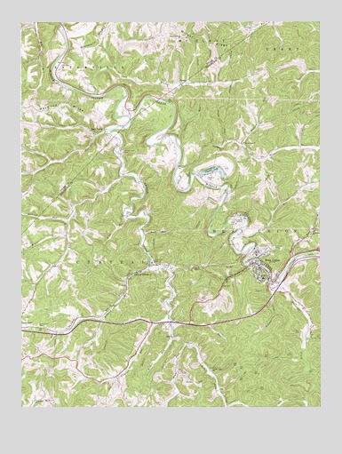
West Union, WV USGS Topographic Map
Click on map above to begin viewing in our Map Viewer.

This topographic map contains these locations and features:
Feature Name Type Latitude Longitude GNIS ID View Map
Arnold CreekStreamN39.3434°W80.8293°1535021View Map
Arnold Creek CemeteryCemeteryN39.3326°W80.8326°1535022View Map
Arnold Creek ChurchChurchN39.2620°W80.7957°1535023View Map
Bluestone CreekStreamN39.2887°W80.7693°1536143View Map
Brushy ForkStreamN39.2884°W80.7707°1536506View Map
Cain School (historical)SchoolN39.3301°W80.8615°1678624View Map
CampLocaleN39.3545°W80.8079°1536885View Map
Camp Mistake RunStreamN39.3509°W80.8434°1536936View Map
Camp Mistake School (historical)SchoolN39.3559°W80.7973°1689453View Map
Cedar Run School (historical)SchoolN39.3201°W80.7884°1689460View Map
Central StationPopulated PlaceN39.2940°W80.8257°1554100View Map
Claylick RunStreamN39.2804°W80.8143°1537376View Map
Claylick School (historical)SchoolN39.2592°W80.8396°1689468View Map
Crystal LakeLakeN39.3270°W80.7952°1537887View Map
Crystal LakeReservoirN39.3584°W80.7998°1557427View Map
Crystal Lake CemeteryCemeteryN39.3279°W80.7893°1689473View Map
Crystal Lake DamDamN39.3584°W80.7998°1560609View Map
Deep ValleyPopulated PlaceN39.3387°W80.8437°1554277View Map
Doddridge County CourthouseBuildingN39.2948°W80.7741°1689477View Map
Doddridge County Emergency SquadBuildingN39.2958°W80.7751°2581080View Map
Doddridge County High SchoolSchoolN39.2776°W80.7842°1689478View Map
Doddridge County Sheriff's OfficeBuildingN39.2941°W80.7746°2727902View Map
Duckworth CemeteryCemeteryN39.2767°W80.8682°1538401View Map
Duckworth RidgeRidgeN39.3673°W80.8429°1538402View Map
Fairview ChurchChurchN39.3701°W80.8084°1538824View Map
Fairview School (historical)SchoolN39.3715°W80.8082°1678636View Map
Fleming CemeteryCemeteryN39.2623°W80.7957°1539077View Map
Forks of Arnold Creek School (historical)SchoolN39.2701°W80.8065°1689487View Map
Freeman CemeteryCemeteryN39.3020°W80.7690°1539249View Map
Gain School (historical)SchoolN39.2598°W80.7937°1689489View Map
Gorby RunStreamN39.3362°W80.7893°1539532View Map
Harris School (historical)SchoolN39.2962°W80.8607°1689501View Map
Haymond RidgeRidgeN39.3484°W80.8729°1540088View Map
Haymond Ridge School (historical)SchoolN39.3470°W80.8632°1678646View Map
Hugle RunStreamN39.3059°W80.8559°1540574View Map
Hunter Stansberry SpringSpringN39.3051°W80.7857°1677975View Map
Knight Fork School (historical)SchoolN39.3617°W80.7593°1689513View Map
Left Fork Arnold CreekStreamN39.2712°W80.8073°1541622View Map
Lick RunStreamN39.3115°W80.8309°1541924View Map
Long RunStreamN39.3256°W80.8326°1542418View Map
Masonic CemeteryCemeteryN39.3242°W80.7979°1689529View Map
Middle RunStreamN39.2720°W80.8123°1543221View Map
Montgomery School (historical)SchoolN39.3226°W80.8376°1689537View Map
Morning Star School (historical)SchoolN39.3692°W80.8270°1678669View Map
Mudlick RunStreamN39.3104°W80.8551°1543976View Map
North Central Regional JailBuildingN39.2808°W80.8534°2634732View Map
Nutter ForkStreamN39.3290°W80.8093°1544260View Map
Nutter Fork ChurchChurchN39.3359°W80.7820°1544261View Map
Piggin RunStreamN39.3067°W80.7845°1544838View Map
Piggin Run School (historical)SchoolN39.3173°W80.7637°1689554View Map
Piggott CemeteryCemeteryN39.3120°W80.8309°1689555View Map
Piggott School (historical)SchoolN39.3126°W80.8296°1689556View Map
Pigott ChurchChurchN39.3123°W80.8307°1544839View Map
Pine DistrictCivilN39.2701°W80.8256°1928337View Map
Pine Run School (historical)SchoolN39.3329°W80.7793°1689559View Map
Pritchard RunStreamN39.2773°W80.8123°1545279View Map
Right Fork Arnold CreekStreamN39.2712°W80.8073°1545606View Map
Rock RunStreamN39.3065°W80.8237°1545924View Map
Rock RunStreamN39.2984°W80.7612°1545929View Map
Rock Run ChurchChurchN39.3070°W80.7523°1545931View Map
Rock Run School (historical)SchoolN39.3070°W80.7523°1689569View Map
Ruley CemeteryCemeteryN39.2731°W80.8112°1689572View Map
Ruley ChurchChurchN39.2729°W80.8118°1546148View Map
Short RunStreamN39.3395°W80.8387°1546739View Map
Slaughter RunStreamN39.3345°W80.8087°1546925View Map
Slaughter Run School (historical)SchoolN39.3351°W80.8084°1689582View Map
Sycamore Grove School (historical)SchoolN39.3415°W80.8301°1689600View Map
Town of West UnionCivilN39.2964°W80.7752°2391481View Map
Upper Long Run School (historical)SchoolN39.2906°W80.8701°1689614View Map
West UnionPopulated PlaceN39.2965°W80.7770°1548944View Map
West Union Elementary School (historical)SchoolN39.2995°W80.7765°1689624View Map
West Union Police DepartmentBuildingN39.2945°W80.7756°2780333View Map
West Union Post OfficePost OfficeN39.2940°W80.7773°1689625View Map
West Union Volunteer Fire DepartmentBuildingN39.2959°W80.7754°2577670View Map
West Virginia State Police Troop 1 - West Union DetachmentBuildingN39.2808°W80.8523°2727901View Map
Wilbur RidgeRidgeN39.3740°W80.8098°1549128View Map
Wilhelm RunStreamN39.2951°W80.8218°1549153View Map
Wolfpen RunStreamN39.3351°W80.7834°1549352View Map

Note: Coordinates in the location and feature list above are referenced to NAD83 datum.


Copyright (C) 2008-2025 Ryan Niemi / Sunset Dynamics ... All Rights Reserved