TopoQuest Logo
Do you find TopoQuest useful?
Help keep TopoQuest running and adding new maps/features by donating!
Bitcoin:  19c7KJd3qBynnjoSw5npx9KScwjBe4ifkT
Litecoin:  LXs6TkuXGGXo1vDsWCkWVdjQX94eUKd6ui
Home View Maps Find Maps Find Places Resources & Links


Smithland, Kentucky Topographic Map

USGS Map Title: Smithland, KY
USGS Map MRC: 37088B4
DRG (GeoTIFF) Download: o37088b4.tif


Neighboring USGS Topographic Map Quads:


  Brownfield, IL  
37088C5
 

  Golconda, IL  
37088C4
 

  Lola, KY  
37088C3
 

  Paducah NE, IL  
37088B5
 

  Smithland, KY  
37088B4
 

  Burna, KY  
37088B3
 

  Paducah East, KY  
37088A5
 

  Little Cypress, KY  
37088A4
 

  Calvert City, KY  
37088A3


Map MRC Location:

N38°
W89°
N38°
W88°
H8 H7 H6 H5 H4 H3 H2 H1
G8 G7 G6 G5 G4 G3 G2 G1
F8 F7 F6 F5 F4 F3 F2 F1
E8 E7 E6 E5 E4 E3 E2 E1
D8 D7 D6 D5 D4 D3 D2 D1
C8 C7 C6 C5 C4 C3 C2 C1
B8 B7 B6 B5 B4 B3 B2 B1
A8 A7 A6 A5 A4 A3 A2 A1
N37°
W89°
N37°
W88°

Smithland, KY USGS 1:24K Topographic Map Preview:
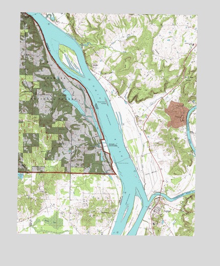
Smithland, KY USGS Topographic Map
Click on map above to begin viewing in our Map Viewer.

This topographic map contains these locations and features:
Feature Name Type Latitude Longitude GNIS ID View Map
Alcorn CreekStreamN37.1770°W88.4412°424563View Map
Audubon CemeteryCemeteryN37.1484°W88.4811°1820631View Map
Audubon ChurchChurchN37.1487°W88.4812°403721View Map
Barnett CemeteryCemeteryN37.1287°W88.4081°486400View Map
Bay CityPopulated PlaceN37.2489°W88.4967°424606View Map
BayouPopulated PlaceN37.2448°W88.4750°507463View Map
Bayou CreekStreamN37.2467°W88.4823°510435View Map
BirdsvillePopulated PlaceN37.2212°W88.4481°487338View Map
Caley SpringSpringN37.1759°W88.4712°405352View Map
Cemetery HillSummitN37.1292°W88.4003°489257View Map
City of SmithlandCivilN37.1387°W88.4038°2405474View Map
Cowper CemeteryCemeteryN37.1900°W88.4153°490210View Map
Cumberland IslandIslandN37.1359°W88.4178°490477View Map
Cumberland RiverStreamN37.1434°W88.4075°517018View Map
Dog CreekStreamN37.1620°W88.4328°424837View Map
Dog Island (historical)IslandN37.1626°W88.4278°490983View Map
Dog Island State WetlandsParkN37.1751°W88.4389°1820641View Map
Dyer HillSummitN37.2239°W88.3789°491388View Map
Dyer Hill ChurchChurchN37.2137°W88.3825°491389View Map
Dyer Hill CreekStreamN37.1506°W88.4109°491390View Map
Dyer Hill MineMineN37.2153°W88.3892°491391View Map
Dyer Hill SpringSpringN37.2145°W88.3834°491392View Map
Edmonds CemeteryCemeteryN37.1773°W88.4000°491569View Map
HamletsburgPopulated PlaceN37.1387°W88.4317°409706View Map
Hamletsburg CemeteryCemeteryN37.1389°W88.4359°1820649View Map
Hampton CemeteryCemeteryN37.1900°W88.3823°493655View Map
Hastings CemeteryCemeteryN37.1850°W88.4706°409913View Map
Hohman Lake DamDamN37.1573°W88.4962°1690917View Map
Jacobs School (historical)SchoolN37.1745°W88.4625°1725771View Map
Jameison CemeteryCemeteryN37.2187°W88.4014°495154View Map
Jameison HillSummitN37.2264°W88.3998°495155View Map
Japanese HillSummitN37.1800°W88.3910°495170View Map
Kalberer QuarryMineN37.1381°W88.3781°495565View Map
Kickasola CemeteryCemeteryN37.1887°W88.4906°411453View Map
Lewis CemeteryCemeteryN37.1912°W88.4870°411966View Map
Lewis HillSummitN37.2070°W88.4114°496332View Map
Livingston Central High SchoolSchoolN37.1397°W88.4043°496910View Map
Livingston County Ambulance ServiceBuildingN37.1413°W88.4005°2719078View Map
Livingston County Sheriff's OfficeBuildingN37.1391°W88.4043°2767531View Map
Lucy Jefferson Lewis Memorial BridgeBridgeN37.1489°W88.3992°497338View Map
McCormick CreekStreamN37.1478°W88.3831°497805View Map
McKinley School (historical)SchoolN37.2334°W88.4970°1725776View Map
McKinney BottomsBendN37.2070°W88.4228°497907View Map
Miller LandingPopulated PlaceN37.1839°W88.3792°508606View Map
Morrison LandingLocaleN37.1667°W88.4334°507328View Map
Muddy Church (historical)ChurchN37.1523°W88.4634°1725779View Map
North Branch Phelps CreekStreamN37.2309°W88.4372°499537View Map
Oakdale School (historical)SchoolN37.2106°W88.4853°1725781View Map
Old Maid CrossingBuildingN37.1500°W88.4333°2677874View Map
Owens CemeteryCemeteryN37.1367°W88.4695°415273View Map
Phelps CreekStreamN37.2301°W88.4562°500517View Map
Randle HillSummitN37.2242°W88.4236°501566View Map
Rappolee CemeteryCemeteryN37.1978°W88.3798°501578View Map
Red House BluffsCliffN37.1462°W88.3786°501662View Map
Rock Quarry CemeteryCemeteryN37.1984°W88.3853°502141View Map
Round PondSwampN37.1322°W88.4737°417000View Map
Rural Pope County Fire Protection District Station 3BuildingN37.2257°W88.4962°2682518View Map
Shaw HillSummitN37.1773°W88.3923°503278View Map
Silver MineMineN37.1739°W88.3786°2632200View Map
Sloan CemeteryCemeteryN37.2220°W88.4814°418606View Map
SmithlandPopulated PlaceN37.1389°W88.4034°503811View Map
Smithland Fire and RescueBuildingN37.1383°W88.4040°2636270View Map
Smithland Lock and DamDamN37.1637°W88.4304°1877395View Map
Stewart IslandIslandN37.2245°W88.4641°517066View Map
Stewart Island TowheadIslandN37.2003°W88.4375°504384View Map
Three Rivers QuarryMineN37.1917°W88.3853°505241View Map
WDXR-FM (Golconda)TowerN37.2345°W88.4967°428496View Map
Yellowbird SchoolSchoolN37.1451°W88.4625°421572View Map

Note: Coordinates in the location and feature list above are referenced to NAD83 datum.


Copyright (C) 2008-2024 Ryan Niemi / Sunset Dynamics ... All Rights Reserved