TopoQuest Logo
Do you find TopoQuest useful?
Help keep TopoQuest running and adding new maps/features by donating!
Bitcoin:  19c7KJd3qBynnjoSw5npx9KScwjBe4ifkT
Litecoin:  LXs6TkuXGGXo1vDsWCkWVdjQX94eUKd6ui
Home View Maps Find Maps Find Places Resources & Links


Solano, New Mexico Topographic Map

USGS Map Title: Solano, NM
USGS Map MRC: 35104G1
DRG (GeoTIFF) Download: o35104g1.tif


Neighboring USGS Topographic Map Quads:


  Roy, NM  
35104H2
 

  Kansas Valley Lake, NM  
35104H1
 

  Sabino, NM  
35103H8
 

  La Cinta Canyon, NM  
35104G2
 

  Solano, NM  
35104G1
 

  Mosquero, NM  
35103G8
 

  Montoya Point, NM  
35104F2
 

  Waggoner Ranch, NM  
35104F1
 

  Chinaberry Canyon, NM  
35103F8


Map MRC Location:

N36°
W105°
N36°
W104°
H8 H7 H6 H5 H4 H3 H2 H1
G8 G7 G6 G5 G4 G3 G2 G1
F8 F7 F6 F5 F4 F3 F2 F1
E8 E7 E6 E5 E4 E3 E2 E1
D8 D7 D6 D5 D4 D3 D2 D1
C8 C7 C6 C5 C4 C3 C2 C1
B8 B7 B6 B5 B4 B3 B2 B1
A8 A7 A6 A5 A4 A3 A2 A1
N35°
W105°
N35°
W104°

Solano, NM USGS 1:24K Topographic Map Preview:
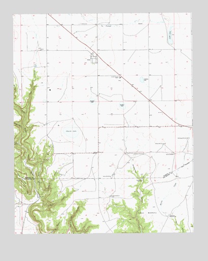
Solano, NM USGS Topographic Map
Click on map above to begin viewing in our Map Viewer.

This topographic map contains these locations and features:
Feature Name Type Latitude Longitude GNIS ID View Map
Barn Point WindmillLocaleN35.7595°W104.0169°886073View Map
Bowmann WindmillLocaleN35.7709°W104.0586°886668View Map
Bradley and UptonLocaleN35.7678°W104.1214°924332View Map
Burro CanyonValleyN35.7687°W104.1153°897324View Map
Callahan LakeLakeN35.8370°W104.0354°887089View Map
Caņada BonitaValleyN35.8011°W104.1219°897722View Map
Caņon VigasValleyN35.8111°W104.1197°897852View Map
Church LakeLakeN35.8081°W104.0851°887587View Map
Deer CanyonValleyN35.7689°W104.1089°888289View Map
Goodhue LakeLakeN35.8226°W104.0492°889501View Map
Harding County Fire District 1 Burro Hill SubstationBuildingN35.7626°W104.1177°2658055View Map
Harding County Fire District 1 Solano SubstationBuildingN35.8515°W104.0668°2657967View Map
HeafnerLocaleN35.7756°W104.0314°924557View Map
Herton WindmillLocaleN35.7823°W104.0580°889933View Map
Johnson WindmillLocaleN35.8006°W104.0208°890532View Map
La Pompa DrawValleyN35.8689°W104.0141°890834View Map
Ladd LakeLakeN35.8615°W104.0153°890857View Map
Leatherman WindmillLocaleN35.7948°W104.0350°891018View Map
McNeil WindmillLocaleN35.7953°W104.0133°891799View Map
Mesa CortadaSummitN35.7850°W104.1241°899777View Map
Ross CanyonValleyN35.8189°W104.1166°894166View Map
Seventyfour WindmillLocaleN35.7798°W104.0358°894734View Map
SolanoPopulated PlaceN35.8484°W104.0675°894990View Map
Solano CemeteryCemeteryN35.8692°W104.0780°894991View Map
Solano Post OfficePost OfficeN35.8484°W104.0675°937773View Map
Solano Weather StationLocaleN35.8484°W104.0675°932590View Map
Steinbaugh WindmillLocaleN35.8036°W104.0041°895331View Map
Thompson CanyonValleyN35.7720°W104.1078°895629View Map
Trujillo CampLocaleN35.7956°W104.0469°895843View Map
Westfall LakeLakeN35.8252°W104.0701°896461View Map

Note: Coordinates in the location and feature list above are referenced to NAD83 datum.


Copyright (C) 2008-2025 Ryan Niemi / Sunset Dynamics ... All Rights Reserved