TopoQuest Logo
Do you find TopoQuest useful?
Help keep TopoQuest running and adding new maps/features by donating!
Bitcoin:  19c7KJd3qBynnjoSw5npx9KScwjBe4ifkT
Litecoin:  LXs6TkuXGGXo1vDsWCkWVdjQX94eUKd6ui
Home View Maps Find Maps Find Places Resources & Links


Sorrento, Florida Topographic Map

USGS Map Title: Sorrento, FL
USGS Map MRC: 28081G5
DRG (GeoTIFF) Download: o28081g5.tif


Neighboring USGS Topographic Map Quads:


  Umatilla, FL  
28081H6
 

  Paisley, FL  
28081H5
 

  Pine Lakes, FL  
28081H4
 

  Eustis, FL  
28081G6
 

  Sorrento, FL  
28081G5
 

  Sanford SW, FL  
28081G4
 

  Astatula, FL  
28081F6
 

  Apopka, FL  
28081F5
 

  Forest City, FL  
28081F4


Map MRC Location:

N29°
W82°
N29°
W81°
H8 H7 H6 H5 H4 H3 H2 H1
G8 G7 G6 G5 G4 G3 G2 G1
F8 F7 F6 F5 F4 F3 F2 F1
E8 E7 E6 E5 E4 E3 E2 E1
D8 D7 D6 D5 D4 D3 D2 D1
C8 C7 C6 C5 C4 C3 C2 C1
B8 B7 B6 B5 B4 B3 B2 B1
A8 A7 A6 A5 A4 A3 A2 A1
N28°
W82°
N28°
W81°

Sorrento, FL USGS 1:24K Topographic Map Preview:
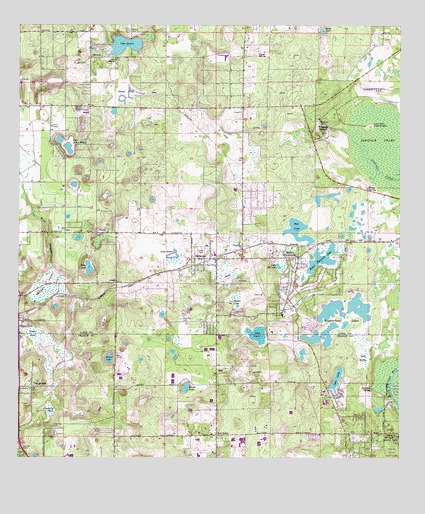
Sorrento, FL USGS Topographic Map
Click on map above to begin viewing in our Map Viewer.

This topographic map contains these locations and features:
Feature Name Type Latitude Longitude GNIS ID View Map
Adams LakeLakeN28.7964°W81.5543°277678View Map
Bay RidgePopulated PlaceN28.7567°W81.5598°295116View Map
Bear PondLakeN28.8184°W81.5341°278342View Map
Brightwood Manor Trailer ParkPopulated PlaceN28.7557°W81.5278°2447542View Map
Cemetery PondLakeN28.7640°W81.6144°280233View Map
Droty SpringSpringN28.8280°W81.5103°281771View Map
Grass PondSwampN28.7864°W81.6211°283304View Map
Island PondLakeN28.8546°W81.5898°284620View Map
Kelly ParkParkN28.7578°W81.5009°285043View Map
Lake AmosLakeN28.8095°W81.5854°277841View Map
Lake BarthoSwampN28.7791°W81.5115°285219View Map
Lake BundyLakeN28.8608°W81.5937°279671View Map
Lake County Fire Rescue Station 39BuildingN28.8076°W81.5362°2331250View Map
Lake EdwardsSwampN28.8058°W81.5390°282115View Map
Lake Emergency Medical Services Station 131BuildingN28.8537°W81.5245°2661863View Map
Lake KittyLakeN28.8434°W81.5576°307115View Map
Lake LerlaLakeN28.7734°W81.5204°285466View Map
Lake LucieLakeN28.7857°W81.5456°286196View Map
Lake MadgeLakeN28.8651°W81.5928°286273View Map
Lake of the WoodsLakeN28.8397°W81.6087°288057View Map
Lake Ola ChapelChurchN28.7525°W81.6234°285266View Map
Lake SenecaLakeN28.8695°W81.5903°290856View Map
Live Oak HammockIslandN28.8464°W81.5101°285870View Map
Metrowest Country ClubLocaleN28.8273°W81.6246°2450854View Map
Mount Dora DivisionCivilN28.8158°W81.5329°1935859View Map
Mount PlymouthPopulated PlaceN28.8080°W81.5331°287309View Map
Mount Plymouth Census Designated PlaceCensusN28.8024°W81.5350°2403311View Map
Mount Plymouth LakeLakeN28.8078°W81.5254°287310View Map
Mount Plymouth LakesPopulated PlaceN28.7680°W81.5198°299941View Map
Mount Post Office Plymouth (historical)Post OfficeN28.8080°W81.5331°2026985View Map
Neighborhood LakesSwampN28.7935°W81.5179°287579View Map
New Hope ChurchChurchN28.8114°W81.5515°287627View Map
New Hope Missionary Baptist ChurchChurchN28.8110°W81.5511°2452382View Map
Oak Springs Mobile Home CommunityPopulated PlaceN28.7879°W81.5307°2452381View Map
Oak Tree ParkPopulated PlaceN28.7539°W81.5589°2447544View Map
Orange County Fire Rescue Station 29BuildingN28.7587°W81.5051°2644345View Map
Prays PondLakeN28.7808°W81.5319°299940View Map
Refuge Church of Our Lord Jesus ChristChurchN28.8078°W81.5403°2452383View Map
Rock SpringsSpringN28.7564°W81.5015°289857View Map
Round LakeLakeN28.7791°W81.5951°290002View Map
Round Lake Christian ChurchChurchN28.8037°W81.5944°2450866View Map
Sand LakeLakeN28.8041°W81.6017°290536View Map
Sand LakeLakeN28.8736°W81.5253°290537View Map
Seminole CemeteryCemeteryN28.8469°W81.5265°290830View Map
Seminole SpringsPopulated PlaceN28.8455°W81.5281°295611View Map
SenecaPopulated PlaceN28.8661°W81.6012°295612View Map
Seneca CemeteryCemeteryN28.8730°W81.5889°290854View Map
Smith LakeLakeN28.7707°W81.5699°291254View Map
SorrentoPopulated PlaceN28.8078°W81.5637°291330View Map
Sorrento CemeteryCemeteryN28.7903°W81.5715°291331View Map
Sorrento Census Designated PlaceCensusN28.8087°W81.5632°2402865View Map
Sorrento Christian CenterChurchN28.8218°W81.5521°2452384View Map
Sorrento Church of GodChurchN28.8090°W81.5687°2452385View Map
Sorrento Post OfficePost OfficeN28.8074°W81.5582°2480364View Map
Sorrento Presbyterian ChurchChurchN28.8043°W81.5643°2452386View Map
Sulphur SpringSpringN28.7700°W81.5092°291795View Map
Sunset ValleyValleyN28.7945°W81.6207°291883View Map
Tangerine AirportAirportN28.7602°W81.6051°309991View Map
Tangerine CemeteryCemeteryN28.7592°W81.6134°292016View Map
The President Country ClubLocaleN28.7986°W81.5311°2452380View Map
Valley Mobile Home ParkPopulated PlaceN28.7582°W81.5962°2447555View Map
Wekiwa Springs State ParkParkN28.7703°W81.5009°301598View Map
Wolf BranchStreamN28.8030°W81.6154°293454View Map

Note: Coordinates in the location and feature list above are referenced to NAD83 datum.


Copyright (C) 2008-2024 Ryan Niemi / Sunset Dynamics ... All Rights Reserved