TopoQuest Logo
Do you find TopoQuest useful?
Help keep TopoQuest running and adding new maps/features by donating!
Bitcoin:  19c7KJd3qBynnjoSw5npx9KScwjBe4ifkT
Litecoin:  LXs6TkuXGGXo1vDsWCkWVdjQX94eUKd6ui
Home View Maps Find Maps Find Places Resources & Links


Pine Lakes, Florida Topographic Map

USGS Map Title: Pine Lakes, FL
USGS Map MRC: 28081H4
DRG (GeoTIFF) Download: o28081h4.tif


Neighboring USGS Topographic Map Quads:


  Alexander Springs, FL  
29081A5
 

  Lake Woodruff, FL  
29081A4
 

  De Land, FL  
29081A3
 

  Paisley, FL  
28081H5
 

  Pine Lakes, FL  
28081H4
 

  Orange City, FL  
28081H3
 

  Sorrento, FL  
28081G5
 

  Sanford SW, FL  
28081G4
 

  Sanford, FL  
28081G3


Map MRC Location:

N29°
W82°
N29°
W81°
H8 H7 H6 H5 H4 H3 H2 H1
G8 G7 G6 G5 G4 G3 G2 G1
F8 F7 F6 F5 F4 F3 F2 F1
E8 E7 E6 E5 E4 E3 E2 E1
D8 D7 D6 D5 D4 D3 D2 D1
C8 C7 C6 C5 C4 C3 C2 C1
B8 B7 B6 B5 B4 B3 B2 B1
A8 A7 A6 A5 A4 A3 A2 A1
N28°
W82°
N28°
W81°

Pine Lakes, FL USGS 1:24K Topographic Map Preview:
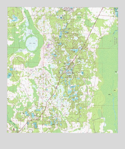
Pine Lakes, FL USGS Topographic Map
Click on map above to begin viewing in our Map Viewer.

This topographic map contains these locations and features:
Feature Name Type Latitude Longitude GNIS ID View Map
Bass LakeLakeN28.9342°W81.4284°305237View Map
Bear LakeLakeN28.9801°W81.4349°305257View Map
Benton LakeLakeN28.9355°W81.4359°305273View Map
Bradshaw Tree Farm AirportAirportN28.9484°W81.4130°309367View Map
Buck LakeLakeN28.9729°W81.4395°305395View Map
Bush IslandIslandN28.9178°W81.3767°305419View Map
CassiaPopulated PlaceN28.8894°W81.4653°305453View Map
Cassia CemeteryCemeteryN28.8950°W81.4662°305454View Map
Cooter PondLakeN28.9786°W81.4315°305506View Map
Crystal LakeLakeN28.9438°W81.4310°305534View Map
Dade LakeLakeN28.9596°W81.4163°305542View Map
Deer LakeLakeN28.9348°W81.4389°305563View Map
Drigger IslandsIslandN28.9975°W81.3756°305599View Map
First Baptist Church of Pine LakesChurchN28.9470°W81.4265°2448866View Map
Fish LakeLakeN28.9215°W81.4257°305671View Map
Florida HillsPopulated PlaceN28.9467°W81.4253°305680View Map
Gaiter LakeLakeN28.9083°W81.4251°305712View Map
Gourd LakeLakeN28.9323°W81.4977°305739View Map
Grass LakeLakeN28.9374°W81.4376°305749View Map
Grass LakeSwampN28.9458°W81.4180°305751View Map
Hanna LakeLakeN28.9756°W81.4335°305786View Map
Hedges PondLakeN28.8943°W81.4776°305799View Map
Jack LakeLakeN28.9350°W81.4149°305863View Map
Jake BaySwampN28.9883°W81.4211°305867View Map
Lake County Fire Rescue Station 15BuildingN28.9395°W81.4305°2331244View Map
Lake DotLakeN28.9338°W81.4308°305591View Map
Lake HollyLakeN28.9966°W81.4309°305826View Map
Lake JordanLakeN28.8849°W81.4499°305882View Map
Lake LappinLakeN28.9574°W81.4227°305931View Map
Lake MackLakeN28.9898°W81.4393°305999View Map
Lake Mack ParkPopulated PlaceN28.9897°W81.4362°305923View Map
Lake MarionLakeN28.9521°W81.4455°306005View Map
Lake TracyLakeN28.9638°W81.4722°306510View Map
Otter MoundIslandN28.9144°W81.3820°306176View Map
Owens PondLakeN28.8832°W81.4678°306181View Map
Pine HillsPopulated PlaceN28.9497°W81.4181°306223View Map
Pine LakeLakeN28.9372°W81.4287°306224View Map
Pine LakesPopulated PlaceN28.9411°W81.4301°306225View Map
Pine Lakes Census Designated PlaceCensusN28.9390°W81.4308°2403415View Map
Pine Lakes Farm Airport (historical)AirportN28.9451°W81.4080°309368View Map
Rose Ranch AirportAirportN28.9050°W81.4331°309391View Map
Royal Trails Airport (historical)AirportN28.9378°W81.4737°309311View Map
Saint Claire LakeLakeN28.9637°W81.4402°306316View Map
South LakeLakeN28.9329°W81.4310°306419View Map
South Pine LakesPopulated PlaceN28.9317°W81.4320°306423View Map
Spruce LakeLakeN28.9389°W81.4332°306441View Map
Walker PondLakeN28.8927°W81.4707°306558View Map
WWLV-FM (Daytona Beach)TowerN28.9822°W81.4548°308973View Map

Note: Coordinates in the location and feature list above are referenced to NAD83 datum.


Copyright (C) 2008-2025 Ryan Niemi / Sunset Dynamics ... All Rights Reserved