TopoQuest Logo
Do you find TopoQuest useful?
Help keep TopoQuest running and adding new maps/features by donating!
Bitcoin:  19c7KJd3qBynnjoSw5npx9KScwjBe4ifkT
Litecoin:  LXs6TkuXGGXo1vDsWCkWVdjQX94eUKd6ui
Home View Maps Find Maps Find Places Resources & Links


Seven-up Butte, Montana Topographic Map

USGS Map Title: Seven-up Butte, MT
USGS Map MRC: 46104B5
DRG (GeoTIFF) Download: o46104b5.tif


Neighboring USGS Topographic Map Quads:


  T G Creek, MT  
46104C6
 

  Little Pine Creek, MT  
46104C5
 

  South Sandstone Reservoir, MT  
46104C4
 

  Harmon Butte, MT  
46104B6
 

  Seven-up Butte, MT  
46104B5
 

  Sportsman Pond, MT  
46104B4
 

  Piney Butte SW, MT  
46104A6
 

  Piney Butte, MT  
46104A5
 

  Medicine Rocks State Park, MT  
46104A4


Map MRC Location:

N47°
W105°
N47°
W104°
H8 H7 H6 H5 H4 H3 H2 H1
G8 G7 G6 G5 G4 G3 G2 G1
F8 F7 F6 F5 F4 F3 F2 F1
E8 E7 E6 E5 E4 E3 E2 E1
D8 D7 D6 D5 D4 D3 D2 D1
C8 C7 C6 C5 C4 C3 C2 C1
B8 B7 B6 B5 B4 B3 B2 B1
A8 A7 A6 A5 A4 A3 A2 A1
N46°
W105°
N46°
W104°

Seven-up Butte, MT USGS 1:24K Topographic Map Preview:
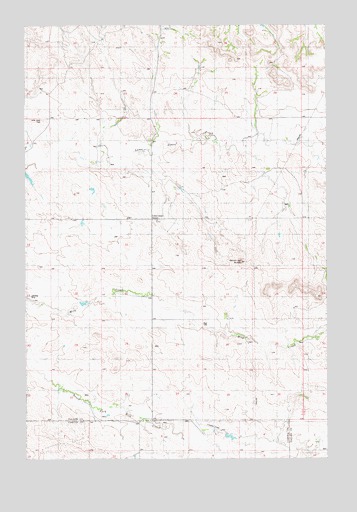
Seven-up Butte, MT USGS Topographic Map
Click on map above to begin viewing in our Map Viewer.

This topographic map contains these locations and features:
Feature Name Type Latitude Longitude GNIS ID View Map
04N57E04CCC_01 WellWellN46.1278°W104.5994°814112View Map
05N57E04AD__01 WellWellN46.2181°W104.5755°814633View Map
05N57E04ADAC01 WellWellN46.2178°W104.5750°814631View Map
05N57E04BD__01 WellWellN46.2194°W104.5894°814638View Map
05N57E05DDAA01 WellWellN46.2139°W104.5977°814617View Map
05N57E12AB__01 WellWellN46.2083°W104.5199°814596View Map
05N57E12DBDC01 WellWellN46.1981°W104.5186°814535View Map
05N57E12DC__01 WellWellN46.1958°W104.5199°814521View Map
05N57E13BD__01 WellWellN46.1889°W104.5233°814492View Map
05N57E33CC__01 WellWellN46.1389°W104.5922°814178View Map
05N57E34BC__01 WellWellN46.1478°W104.5700°814241View Map
05N57E34BCCD01 WellWellN46.1439°W104.5711°814217View Map
05N57E36DCAA01 WellWellN46.1389°W104.5244°814177View Map
06N57E32DC__01 WellWellN46.2264°W104.6019°814678View Map
Calumet Post Office (historical)Post OfficeN46.1681°W104.5094°1688672View Map
Ed Rath Number 1 DamDamN46.1300°W104.5455°797503View Map
Lame Jones CemeteryCemeteryN46.2228°W104.6183°799263View Map
Lame Jones School (historical)SchoolN46.1939°W104.5727°799264View Map
Palm Ranch Number 2 DamDamN46.1667°W104.5988°797859View Map
Riley Number 1 DamDamN46.1317°W104.5272°796309View Map
Seven-up ButteSummitN46.1817°W104.5361°799265View Map

Note: Coordinates in the location and feature list above are referenced to NAD83 datum.


Copyright (C) 2008-2025 Ryan Niemi / Sunset Dynamics ... All Rights Reserved