TopoQuest Logo
Do you find TopoQuest useful?
Help keep TopoQuest running and adding new maps/features by donating!
Bitcoin:  19c7KJd3qBynnjoSw5npx9KScwjBe4ifkT
Litecoin:  LXs6TkuXGGXo1vDsWCkWVdjQX94eUKd6ui
Home View Maps Find Maps Find Places Resources & Links


Southwest Palestine, Texas Topographic Map

USGS Map Title: Southwest Palestine, TX
USGS Map MRC: 31095F6
DRG (GeoTIFF) Download: o31095f6.tif


Neighboring USGS Topographic Map Quads:


  Tennessee Colony, TX  
31095G7
 

  Northwest Palestine, TX  
31095G6
 

  Northeast Palestine, TX  
31095G5
 

  Long Lake, TX  
31095F7
 

  Southwest Palestine, TX  
31095F6
 

  Southeast Palestine, TX  
31095F5
 

  Oakwood, TX  
31095E7
 

  Indian Lake, TX  
31095E6
 

  Elkhart Creek, TX  
31095E5


Map MRC Location:

N32°
W96°
N32°
W95°
H8 H7 H6 H5 H4 H3 H2 H1
G8 G7 G6 G5 G4 G3 G2 G1
F8 F7 F6 F5 F4 F3 F2 F1
E8 E7 E6 E5 E4 E3 E2 E1
D8 D7 D6 D5 D4 D3 D2 D1
C8 C7 C6 C5 C4 C3 C2 C1
B8 B7 B6 B5 B4 B3 B2 B1
A8 A7 A6 A5 A4 A3 A2 A1
N31°
W96°
N31°
W95°

Southwest Palestine, TX USGS 1:24K Topographic Map Preview:
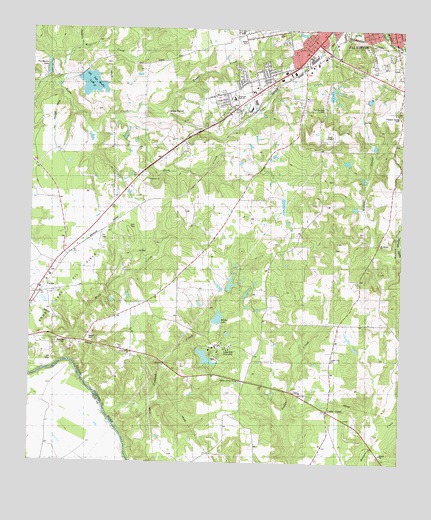
Southwest Palestine, TX USGS Topographic Map
Click on map above to begin viewing in our Map Viewer.

This topographic map contains these locations and features:
Feature Name Type Latitude Longitude GNIS ID View Map
Bacon CemeteryCemeteryN31.6616°W95.7305°1364386View Map
Basset CreekStreamN31.7252°W95.7069°1351579View Map
Bassett Road Baptist ChurchChurchN31.7452°W95.6777°2016526View Map
Cedar Creek CemeteryCemeteryN31.6460°W95.6608°1354081View Map
Cedar Creek ChurchChurchN31.6549°W95.6480°1354084View Map
Chalybeate CreekStreamN31.7438°W95.7347°1354276View Map
Church of ChristChurchN31.7416°W95.6352°2016540View Map
Crooked CreekStreamN31.6374°W95.7225°1355381View Map
Duggeys Lake DamDamN31.7368°W95.7369°1854509View Map
Ebenezer ChurchChurchN31.7068°W95.7108°1356785View Map
Fort Houston CemeteryCemeteryN31.7274°W95.6522°1357590View Map
Four Pines SchoolSchoolN31.7491°W95.6802°1357631View Map
Gooch LakeReservoirN31.7318°W95.6669°1864233View Map
Gooch Lake DamDamN31.7318°W95.6669°1864232View Map
Gum CreekStreamN31.7243°W95.7208°1358513View Map
Lakeview AssemblyPopulated PlaceN31.6585°W95.6861°1360880View Map
Lakeview Methodist LakeReservoirN31.6555°W95.6910°1854521View Map
Lakeview Methodist Lake DamDamN31.6585°W95.6936°1854520View Map
Lighthouse Pentecostal ChurchChurchN31.7491°W95.6347°2016550View Map
Living Green ChurchChurchN31.6621°W95.7155°1361572View Map
Long Lake Oil FieldOilfieldN31.6757°W95.7383°1889593View Map
Mack CreekStreamN31.6543°W95.7372°1362039View Map
Magnolia CemeteryCemeteryN31.6591°W95.7377°1362076View Map
Mount Moriah ChurchChurchN31.6888°W95.6322°1363271View Map
New Salem ChurchChurchN31.7010°W95.6525°1363776View Map
Old Salt Works LakeLakeN31.7341°W95.7304°1356416View Map
Palestine / Southside Volunteer Fire DepartmentBuildingN31.7270°W95.6262°2655686View Map
Palestine Fire Department Station 2BuildingN31.7433°W95.6580°2655314View Map
Palestine Regional Medical CenterHospitalN31.7325°W95.6272°2015603View Map
Palestine Regional Rehabilitation HospitalHospitalN31.7394°W95.6447°2015604View Map
Pat Morris DamDamN31.7385°W95.7452°1862831View Map
Pat Morris LakeLakeN31.7383°W95.7448°1862832View Map
Pilgrim Hill ChurchChurchN31.7363°W95.6452°1365226View Map
Pleasant Springs CemeteryCemeteryN31.7252°W95.6258°1365447View Map
Sheridan Terrace Baptist ChurchChurchN31.7471°W95.6513°2016537View Map
Southside Primary SchoolSchoolN31.7407°W95.6258°2003047View Map
Sulphur Springs ChurchChurchN31.6488°W95.6802°1369372View Map
TuckerPopulated PlaceN31.6735°W95.7480°1370179View Map
Tucker Volunteer Fire DepartmentBuildingN31.6735°W95.7477°2655509View Map
Westwood Elementary SchoolSchoolN31.7493°W95.6775°2003050View Map
Westwood High SchoolSchoolN31.7302°W95.6816°2003051View Map
Westwood High SchoolSchoolN31.7299°W95.6822°1889592View Map
Westwood Junior High SchoolSchoolN31.7304°W95.6819°2003052View Map
Westwood Primary SchoolSchoolN31.7316°W95.6872°2003053View Map
Westwood United Methodist ChurchChurchN31.7354°W95.6691°2016549View Map
William and Caroline Broyles HouseBuildingN31.7491°W95.6286°2032414View Map
Willow SloughStreamN31.6855°W95.6275°1371665View Map
Wilson LakeReservoirN31.6663°W95.6869°1854519View Map
Wilson LakeLakeN31.6666°W95.6866°1889591View Map
Wilson Lake DamDamN31.6652°W95.6902°1854518View Map
Wolf CreekStreamN31.7343°W95.7444°1371837View Map

Note: Coordinates in the location and feature list above are referenced to NAD83 datum.


Copyright (C) 2008-2025 Ryan Niemi / Sunset Dynamics ... All Rights Reserved