TopoQuest Logo
Do you find TopoQuest useful?
Help keep TopoQuest running and adding new maps/features by donating!
Bitcoin:  19c7KJd3qBynnjoSw5npx9KScwjBe4ifkT
Litecoin:  LXs6TkuXGGXo1vDsWCkWVdjQX94eUKd6ui
Home View Maps Find Maps Find Places Resources & Links


Southeast Palestine, Texas Topographic Map

USGS Map Title: Southeast Palestine, TX
USGS Map MRC: 31095F5
DRG (GeoTIFF) Download: o31095f5.tif


Neighboring USGS Topographic Map Quads:


  Northwest Palestine, TX  
31095G6
 

  Northeast Palestine, TX  
31095G5
 

  Neches, TX  
31095G4
 

  Southwest Palestine, TX  
31095F6
 

  Southeast Palestine, TX  
31095F5
 

  Slocum, TX  
31095F4
 

  Indian Lake, TX  
31095E6
 

  Elkhart Creek, TX  
31095E5
 

  Percilla, TX  
31095E4


Map MRC Location:

N32°
W96°
N32°
W95°
H8 H7 H6 H5 H4 H3 H2 H1
G8 G7 G6 G5 G4 G3 G2 G1
F8 F7 F6 F5 F4 F3 F2 F1
E8 E7 E6 E5 E4 E3 E2 E1
D8 D7 D6 D5 D4 D3 D2 D1
C8 C7 C6 C5 C4 C3 C2 C1
B8 B7 B6 B5 B4 B3 B2 B1
A8 A7 A6 A5 A4 A3 A2 A1
N31°
W96°
N31°
W95°

Southeast Palestine, TX USGS 1:24K Topographic Map Preview:
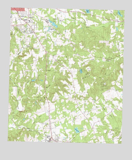
Southeast Palestine, TX USGS Topographic Map
Click on map above to begin viewing in our Map Viewer.

This topographic map contains these locations and features:
Feature Name Type Latitude Longitude GNIS ID View Map
84 East Volunteer Fire DepartmentBuildingN31.7458°W95.5371°2655708View Map
Antioch ChurchChurchN31.7407°W95.5075°1889595View Map
Bell CemeteryCemeteryN31.7049°W95.5633°1366992View Map
Bethlehem Lutheran ChurchChurchN31.7482°W95.6058°2016546View Map
Beulah ChurchChurchN31.6907°W95.6075°1351985View Map
Broyles LakeReservoirN31.6802°W95.6002°1854515View Map
Broyles Lake DamDamN31.6802°W95.6002°1854514View Map
CalhounLocaleN31.7385°W95.5855°1890042View Map
Calhoun Lake Number 1ReservoirN31.7349°W95.5770°1854511View Map
Calhoun Lake Number 1 DamDamN31.7368°W95.5802°1854510View Map
Calhoun Lake Number 2ReservoirN31.7335°W95.5719°1854513View Map
Calhoun Lake Number 2 DamDamN31.7335°W95.5719°1854512View Map
Camp CemeteryCemeteryN31.6785°W95.5719°1889601View Map
Camp HillSummitN31.6932°W95.5375°1889598View Map
Camp Hill Oil FieldOilfieldN31.6805°W95.5202°1889599View Map
Campbell CemeteryCemeteryN31.6924°W95.5830°1889600View Map
Chambers CemeteryCemeteryN31.7055°W95.5775°1354280View Map
Church of ChristChurchN31.7491°W95.6205°2016541View Map
Circle R Dam Number 1DamN31.7468°W95.5386°1854559View Map
Circle R Lake Number 1ReservoirN31.7500°W95.5408°1854560View Map
CroninPopulated PlaceN31.6763°W95.6166°1379607View Map
Crystal LakeReservoirN31.7487°W95.5065°1355453View Map
Crystal LakePopulated PlaceN31.7396°W95.5052°2034804View Map
Crystal Lake DamDamN31.7452°W95.5019°1854507View Map
Days ChapelChurchN31.6593°W95.5150°1355730View Map
Daytop School CampusSchoolN31.7468°W95.6058°2003033View Map
DeanwrightPopulated PlaceN31.7366°W95.5427°1379644View Map
Delany BranchStreamN31.6393°W95.5041°1355882View Map
Delany CemeteryCemeteryN31.6591°W95.5288°1355883View Map
Douthit CemeteryCemeteryN31.6757°W95.5844°1356216View Map
ElkhartPopulated PlaceN31.6252°W95.5794°1373620View Map
Elkhart LakeReservoirN31.6368°W95.5494°1854517View Map
Elkhart Lake DamDamN31.6352°W95.5519°1854516View Map
Elkhart Post OfficePost OfficeN31.6261°W95.5799°2731691View Map
Elkhart Volunteer Fire DepartmentBuildingN31.6260°W95.5796°2655354View Map
Ferguson CemeteryCemeteryN31.7032°W95.5186°1357294View Map
Ferguson ChurchChurchN31.7013°W95.5052°1357295View Map
Frost CreekStreamN31.6632°W95.6144°1357783View Map
Garden of Memories CemeteryCemeteryN31.6403°W95.5811°1889603View Map
Great Pine Hill ChurchChurchN31.7049°W95.5127°1889596View Map
KHIM Radio Tower (Palestine)TowerN31.7416°W95.6044°1889594View Map
KTDN-FM (Palestine)TowerN31.7321°W95.6238°1385963View Map
Lake MaryLakeN31.6921°W95.5463°1889994View Map
Lake MaryReservoirN31.6925°W95.5470°1863741View Map
Lake Mary DamDamN31.6968°W95.5469°1863740View Map
Milan SchoolSchoolN31.7371°W95.6025°1362828View Map
Palestine Fire Department Station 3BuildingN31.7404°W95.6034°2655228View Map
Palestine High SchoolSchoolN31.7468°W95.6058°2003042View Map
Palestine Middle SchoolSchoolN31.7368°W95.6030°2003043View Map
Parker BranchStreamN31.6360°W95.6005°1889602View Map
Perry Starr CemeteryCemeteryN31.6696°W95.5955°1365084View Map
Pine Hill ChurchChurchN31.7043°W95.5205°1889597View Map
Saddler CreekStreamN31.6668°W95.6075°1367108View Map
South Anderson County Volunteer EmergencyBuildingN31.6260°W95.5796°2720934View Map
Southside ChurchChurchN31.7468°W95.6172°1368841View Map
Spring BranchStreamN31.6388°W95.6158°1368936View Map
Starr CemeteryCemeteryN31.6663°W95.5847°1889954View Map
Swanson Hill ChurchChurchN31.7268°W95.5711°1369451View Map
Texas State Railroad State Historical ParkParkN31.7402°W95.5777°2030072View Map
Thomas Starr CemeteryCemeteryN31.6663°W95.5847°1369843View Map
Town of ElkhartCivilN31.6280°W95.5790°2412476View Map
Walston Springs ChurchChurchN31.7018°W95.5738°1370832View Map

Note: Coordinates in the location and feature list above are referenced to NAD83 datum.


Copyright (C) 2008-2025 Ryan Niemi / Sunset Dynamics ... All Rights Reserved