TopoQuest Logo
Do you find TopoQuest useful?
Help keep TopoQuest running and adding new maps/features by donating!
Bitcoin:  19c7KJd3qBynnjoSw5npx9KScwjBe4ifkT
Litecoin:  LXs6TkuXGGXo1vDsWCkWVdjQX94eUKd6ui
Home View Maps Find Maps Find Places Resources & Links


Spencer, Tennessee Topographic Map

USGS Map Title: Spencer, TN
USGS Map MRC: 35085F4
DRG (GeoTIFF) Download: o35085f4.tif


Neighboring USGS Topographic Map Quads:


  Doyle, TN  
35085G5
 

  Bald Knob, TN  
35085G4
 

  Lonewood, TN  
35085G3
 

  Welchland, TN  
35085F5
 

  Spencer, TN  
35085F4
 

  Sampson, TN  
35085F3
 

  Curtistown, TN  
35085E5
 

  Smartt Mountain, TN  
35085E4
 

  Brockdell, TN  
35085E3


Map MRC Location:

N36°
W86°
N36°
W85°
H8 H7 H6 H5 H4 H3 H2 H1
G8 G7 G6 G5 G4 G3 G2 G1
F8 F7 F6 F5 F4 F3 F2 F1
E8 E7 E6 E5 E4 E3 E2 E1
D8 D7 D6 D5 D4 D3 D2 D1
C8 C7 C6 C5 C4 C3 C2 C1
B8 B7 B6 B5 B4 B3 B2 B1
A8 A7 A6 A5 A4 A3 A2 A1
N35°
W86°
N35°
W85°

Spencer, TN USGS 1:24K Topographic Map Preview:
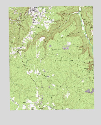
Spencer, TN USGS Topographic Map
Click on map above to begin viewing in our Map Viewer.

This topographic map contains these locations and features:
Feature Name Type Latitude Longitude GNIS ID View Map
Beaverdam BranchStreamN35.6965°W85.4766°1276720View Map
Benton BranchStreamN35.7170°W85.4472°1277030View Map
Bethlehem ChurchChurchN35.6265°W85.4555°1277168View Map
Cave HollowValleyN35.7083°W85.3801°1279933View Map
Commissioner District 4CivilN35.6266°W85.4934°2464094View Map
Commissioner District 5CivilN35.7180°W85.4772°2464500View Map
Denney CemeteryCemeteryN35.7412°W85.4658°1282336View Map
Dry ForkStreamN35.7412°W85.3952°1282963View Map
Gillentine (historical)Populated PlaceN35.6381°W85.4569°1312056View Map
Hale CemeteryCemeteryN35.7426°W85.4914°1286517View Map
Haston PointCapeN35.7301°W85.4039°1287099View Map
Hogue AirportAirportN35.6322°W85.3909°2675570View Map
Horsepen BranchStreamN35.6801°W85.3797°1288421View Map
Indian Camp BranchStreamN35.7151°W85.3869°1288936View Map
Lick BranchStreamN35.7262°W85.4822°1291176View Map
Lick CoveValleyN35.7311°W85.4855°1312069View Map
Little Whetstone BranchStreamN35.7006°W85.3875°1291709View Map
Lost CoveValleyN35.7345°W85.4842°1292070View Map
Miller CemeteryCemeteryN35.6251°W85.3991°1293917View Map
Molloy HollowValleyN35.7314°W85.4849°1294156View Map
Mount Pleasant BranchStreamN35.7148°W85.4408°1294748View Map
PhiferesPopulated PlaceN35.6653°W85.4458°1315703View Map
Pine CreekPopulated PlaceN35.6270°W85.4366°1315712View Map
Pine Creek School (historical)SchoolN35.6315°W85.4561°1320927View Map
Pine GrovePopulated PlaceN35.7001°W85.4855°1647587View Map
Pine Grove SchoolSchoolN35.7009°W85.4819°1297538View Map
Piney Church of ChristChurchN35.6278°W85.4386°1320928View Map
Piney Creek FallsFallsN35.6731°W85.3841°1297627View Map
Piney SchoolSchoolN35.6287°W85.4400°1297654View Map
Rigby Number One MineMineN35.6709°W85.4411°1651613View Map
Shockley CemeteryCemeteryN35.6345°W85.4766°1647588View Map
Shockley ChurchChurchN35.6342°W85.4769°1303598View Map
Shockleys Chapel School (historical)SchoolN35.6340°W85.4769°1320937View Map
SpencerPopulated PlaceN35.7473°W85.4666°1270985View Map
Spencer CemeteryCemeteryN35.7495°W85.4627°1320942View Map
Spencer Division (historical)CensusN35.7462°W85.4689°1648993View Map
Spencer Elementary SchoolSchoolN35.7453°W85.4625°1320943View Map
Spencer Fire and RescueBuildingN35.7311°W85.4542°2654860View Map
Spencer Post OfficePost OfficeN35.7482°W85.4668°1651618View Map
Town of SpencerCivilN35.7392°W85.4557°2407380View Map
Van Buren CountyCivilN35.6960°W85.4526°1648584View Map
Van Buren County CourthouseBuildingN35.7478°W85.4672°1320952View Map
Van Buren County Sheriff's OfficeBuildingN35.7483°W85.4672°2766022View Map
Welchland Division (historical)CensusN35.6262°W85.4830°1648994View Map
Whetstone CreekStreamN35.7078°W85.3802°1274279View Map

Note: Coordinates in the location and feature list above are referenced to NAD83 datum.


Copyright (C) 2008-2025 Ryan Niemi / Sunset Dynamics ... All Rights Reserved