TopoQuest Logo
Do you find TopoQuest useful?
Help keep TopoQuest running and adding new maps/features by donating!
Bitcoin:  19c7KJd3qBynnjoSw5npx9KScwjBe4ifkT
Litecoin:  LXs6TkuXGGXo1vDsWCkWVdjQX94eUKd6ui
Home View Maps Find Maps Find Places Resources & Links


Welchland, Tennessee Topographic Map

USGS Map Title: Welchland, TN
USGS Map MRC: 35085F5
DRG (GeoTIFF) Download: o35085f5.tif


Neighboring USGS Topographic Map Quads:


  Campaign, TN  
35085G6
 

  Doyle, TN  
35085G5
 

  Bald Knob, TN  
35085G4
 

  Cardwell Mountain, TN  
35085F6
 

  Welchland, TN  
35085F5
 

  Spencer, TN  
35085F4
 

  Irving College, TN  
35085E6
 

  Curtistown, TN  
35085E5
 

  Smartt Mountain, TN  
35085E4


Map MRC Location:

N36°
W86°
N36°
W85°
H8 H7 H6 H5 H4 H3 H2 H1
G8 G7 G6 G5 G4 G3 G2 G1
F8 F7 F6 F5 F4 F3 F2 F1
E8 E7 E6 E5 E4 E3 E2 E1
D8 D7 D6 D5 D4 D3 D2 D1
C8 C7 C6 C5 C4 C3 C2 C1
B8 B7 B6 B5 B4 B3 B2 B1
A8 A7 A6 A5 A4 A3 A2 A1
N35°
W86°
N35°
W85°

Welchland, TN USGS 1:24K Topographic Map Preview:
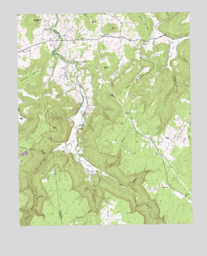
Welchland, TN USGS Topographic Map
Click on map above to begin viewing in our Map Viewer.

This topographic map contains these locations and features:
Feature Name Type Latitude Longitude GNIS ID View Map
Ace PointCapeN35.6601°W85.5983°1275437View Map
Baker MountainSummitN35.7059°W85.5453°1276186View Map
Barnett MountainSummitN35.7098°W85.6239°1276369View Map
Bee ForkStreamN35.6578°W85.5714°1305048View Map
Boyd Brothers LakeReservoirN35.6679°W85.6208°1302019View Map
Boyd Brothers Lake DamDamN35.6701°W85.6183°1302018View Map
Boyd CemeteryCemeteryN35.6823°W85.5797°1278103View Map
Boyd SpringSpringN35.6834°W85.5786°1278120View Map
Cane Ridge Church (historical)ChurchN35.7376°W85.5625°1320881View Map
Cane Ridge School (historical)SchoolN35.7376°W85.5625°1320882View Map
Caneridge (historical)Populated PlaceN35.7490°W85.5605°1312039View Map
Cedar GrovePopulated PlaceN35.7362°W85.5619°1312041View Map
Cedar Grove Community CenterBuildingN35.7367°W85.5625°1320883View Map
Cedar Grove Fire DepartmentBuildingN35.7381°W85.5623°2654618View Map
Cedar Grove SchoolSchoolN35.7367°W85.5622°1280060View Map
Chestnut Hollow BranchStreamN35.6673°W85.6047°1280396View Map
Crain Hill CemeteryCemeteryN35.7178°W85.5891°1320888View Map
Crain Hill ChurchChurchN35.7173°W85.5905°1306169View Map
Drake CemeteryCemeteryN35.7206°W85.5791°1282774View Map
Dyer GulchValleyN35.6729°W85.5887°1312054View Map
Dyer Gulch CreekStreamN35.6734°W85.5869°1283265View Map
Eureka ChurchChurchN35.7281°W85.6216°1283884View Map
Goodbar BridgeBridgeN35.7362°W85.5936°1320895View Map
GoodbarsPopulated PlaceN35.7409°W85.6014°1315131View Map
Grove PointCapeN35.7012°W85.5589°1286357View Map
HarmonyPopulated PlaceN35.7387°W85.5797°1647585View Map
Harmony ChurchChurchN35.7348°W85.5780°1286898View Map
Harmony School (historical)SchoolN35.7348°W85.5778°1320900View Map
High TopSummitN35.6820°W85.5986°1287724View Map
Highland ChurchChurchN35.6901°W85.5444°1287744View Map
Hillis (historical)Populated PlaceN35.7287°W85.6222°1645046View Map
Hillis CemeteryCemeteryN35.6687°W85.5933°1287834View Map
Keener MountainSummitN35.7403°W85.5311°1289962View Map
Laurel CoveValleyN35.7320°W85.5116°1290719View Map
Laurel Cove (historical)Populated PlaceN35.7340°W85.5111°1312067View Map
LaurelburgPopulated PlaceN35.7217°W85.5805°1315362View Map
Laurelburg BridgeBridgeN35.7217°W85.5883°1320911View Map
Little MountainSummitN35.7417°W85.5575°1291578View Map
Long CemeteryCemeteryN35.7345°W85.5419°1320916View Map
Long ChurchChurchN35.7337°W85.5425°1291928View Map
Long Fork CreekStreamN35.7320°W85.5144°1291942View Map
Long MountainSummitN35.6742°W85.6150°1291986View Map
McGregor CemeteryCemeteryN35.6640°W85.6239°1293326View Map
Mitchell HollowValleyN35.7279°W85.5512°1294108View Map
Moulder MountainSummitN35.7181°W85.5628°1294534View Map
Mount Elim ChurchChurchN35.7315°W85.5341°1294609View Map
Narrow CoveValleyN35.6553°W85.5722°1651609View Map
New Rocky CemeteryCemeteryN35.7315°W85.5980°1320563View Map
Norton SpringSpringN35.6970°W85.5783°1295989View Map
Pine BranchStreamN35.6562°W85.5653°1297516View Map
RiverviewPopulated PlaceN35.6903°W85.5780°1315814View Map
Rocky BranchStreamN35.6462°W85.5466°1299855View Map
Rocky Branch MineMineN35.6565°W85.5314°1320932View Map
Rocky River Volunteer Fire DepartmentBuildingN35.6560°W85.5737°2654617View Map
Russell MountainSummitN35.7445°W85.5714°1300342View Map
Sopha (historical)Populated PlaceN35.6653°W85.5214°1312096View Map
Sycamore BranchStreamN35.6356°W85.5705°1271999View Map
Turkeyscratch MountainSummitN35.7456°W85.6125°1273047View Map
WelchlandPopulated PlaceN35.6478°W85.5166°1274082View Map
Welchland Baptist ChurchChurchN35.6423°W85.5053°1320955View Map
Welchland SchoolSchoolN35.6423°W85.5053°1274083View Map
White HillPopulated PlaceN35.6551°W85.5719°1274369View Map
White Hill CemeteryCemeteryN35.6564°W85.5750°1320956View Map
White Hill School (historical)SchoolN35.6565°W85.5736°1320957View Map

Note: Coordinates in the location and feature list above are referenced to NAD83 datum.


Copyright (C) 2008-2025 Ryan Niemi / Sunset Dynamics ... All Rights Reserved